Argentina: El Chaltén
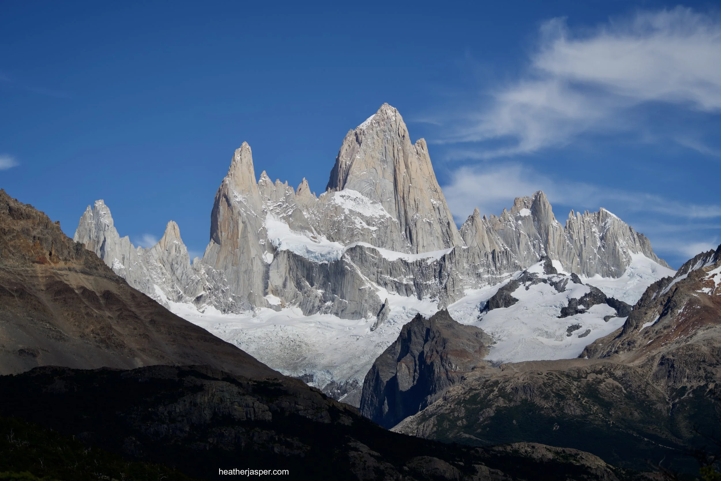
You can’t beat the views of Fitz Roy from the trails around El Chaltén.
I updated the Rough Guide to Argentina and am so happy how it turned out! Get 30% off the Rough Guide to Argentina with my author code AUTHOR0018 in their online store.
Patagonia is a vast region, spanning two countries, with thousands of lakes and glaciers. I visited only the area around the towns of El Calafate and El Chaltén. I chose this spot for several reasons. First, on the map it looked like it had more glaciers than other areas. Second, Ushuaia and Bariloche seemed like they were already too well known. Third, flights to El Calafate were affordable.
Check out my articles about El Chaltén in Fodor’s Travel, Wander With Wonder, Thrifty Nomads and Pedacitos!
The other reason to go to El Chaltén is the the numerous hiking trails that leave directly from town. On this trip I was traveling by bus and plane, but not renting a car (for both environmental and budgetary reasons). The airport is in El Calafate, which Matador Network rated as the third best hiking town in the world. However, I do disagree with the rating. El Chaltén is much better for hiking than El Calafate, and it’s only a two hour bus ride away!
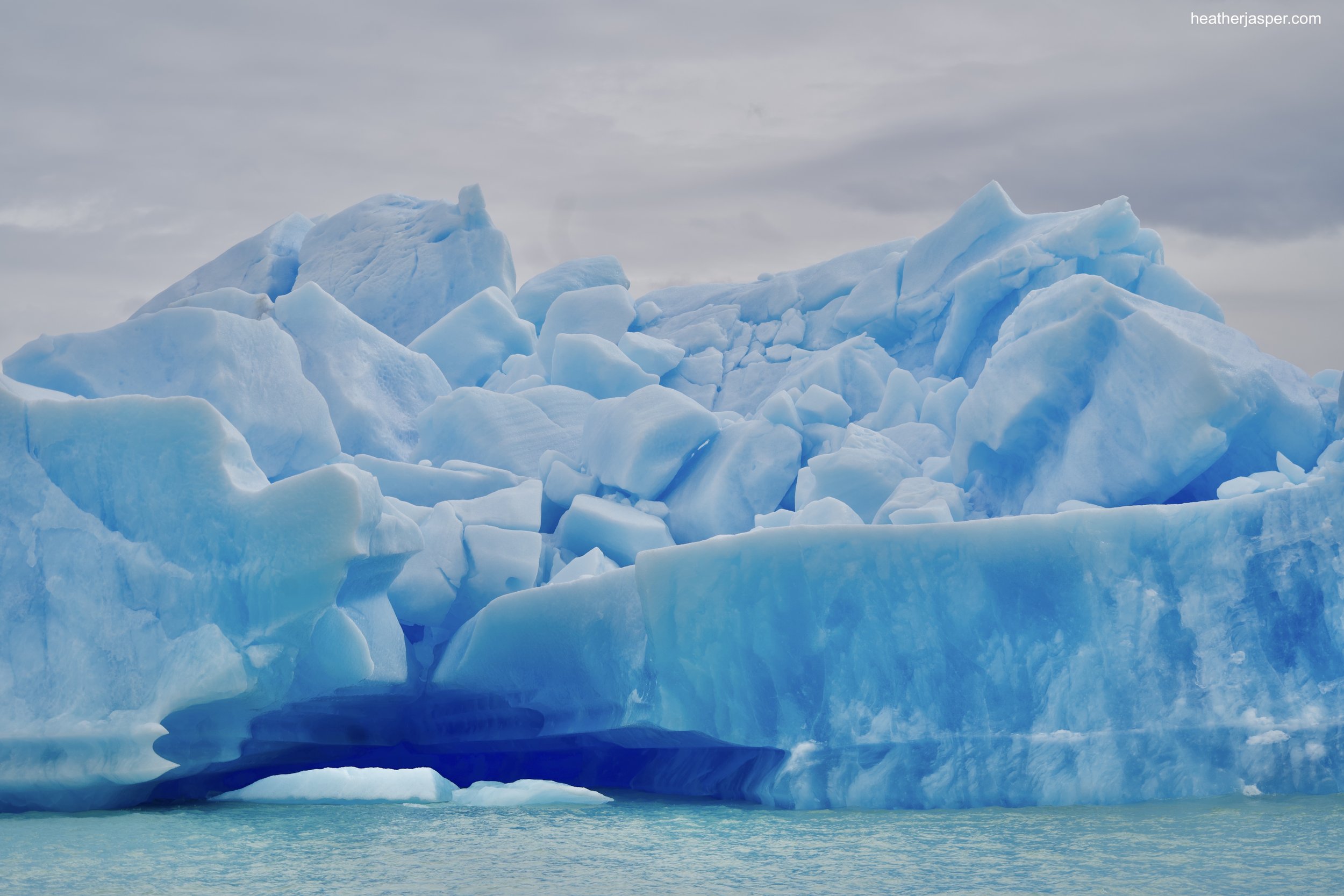
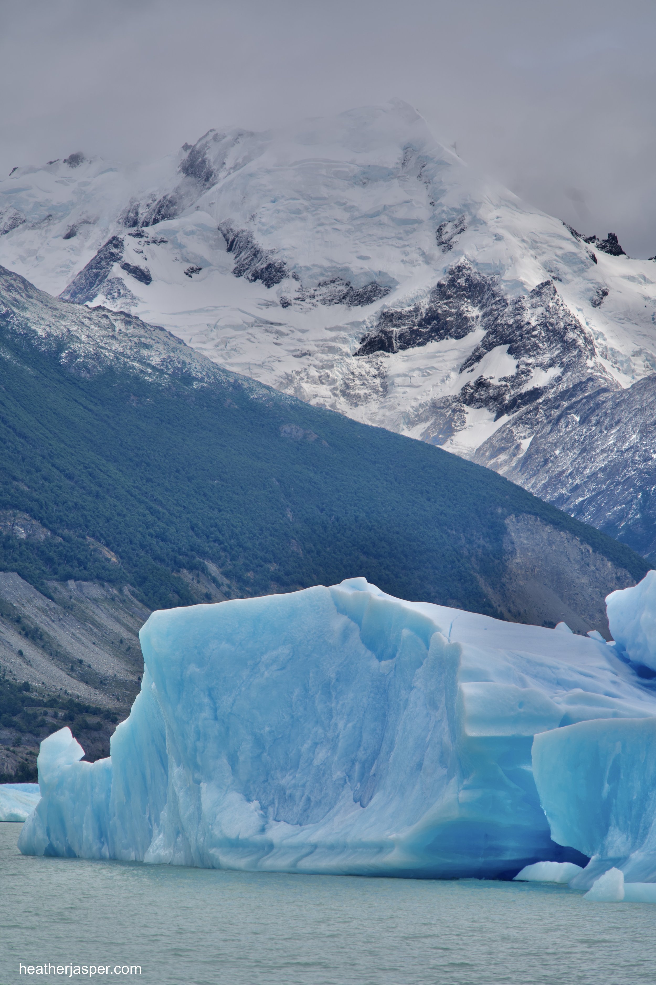
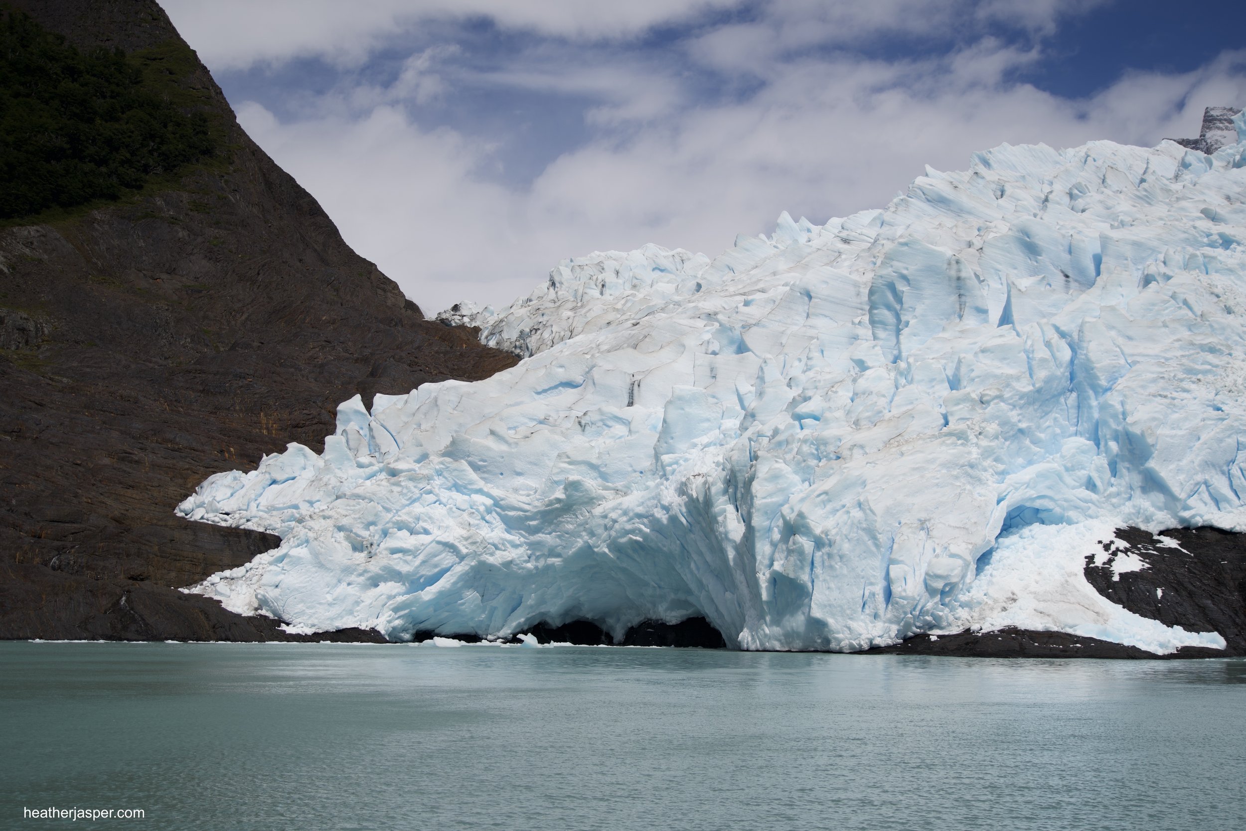
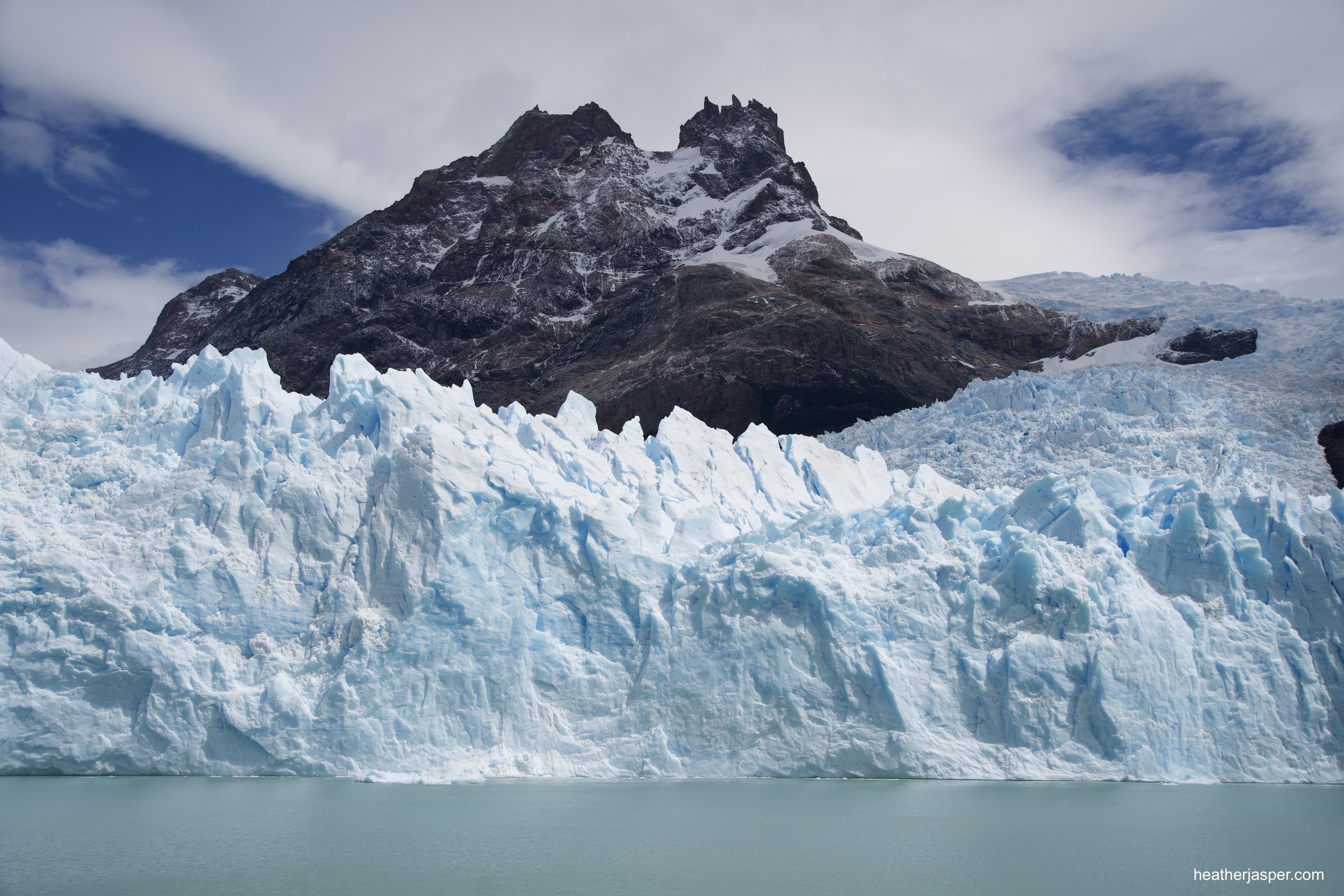
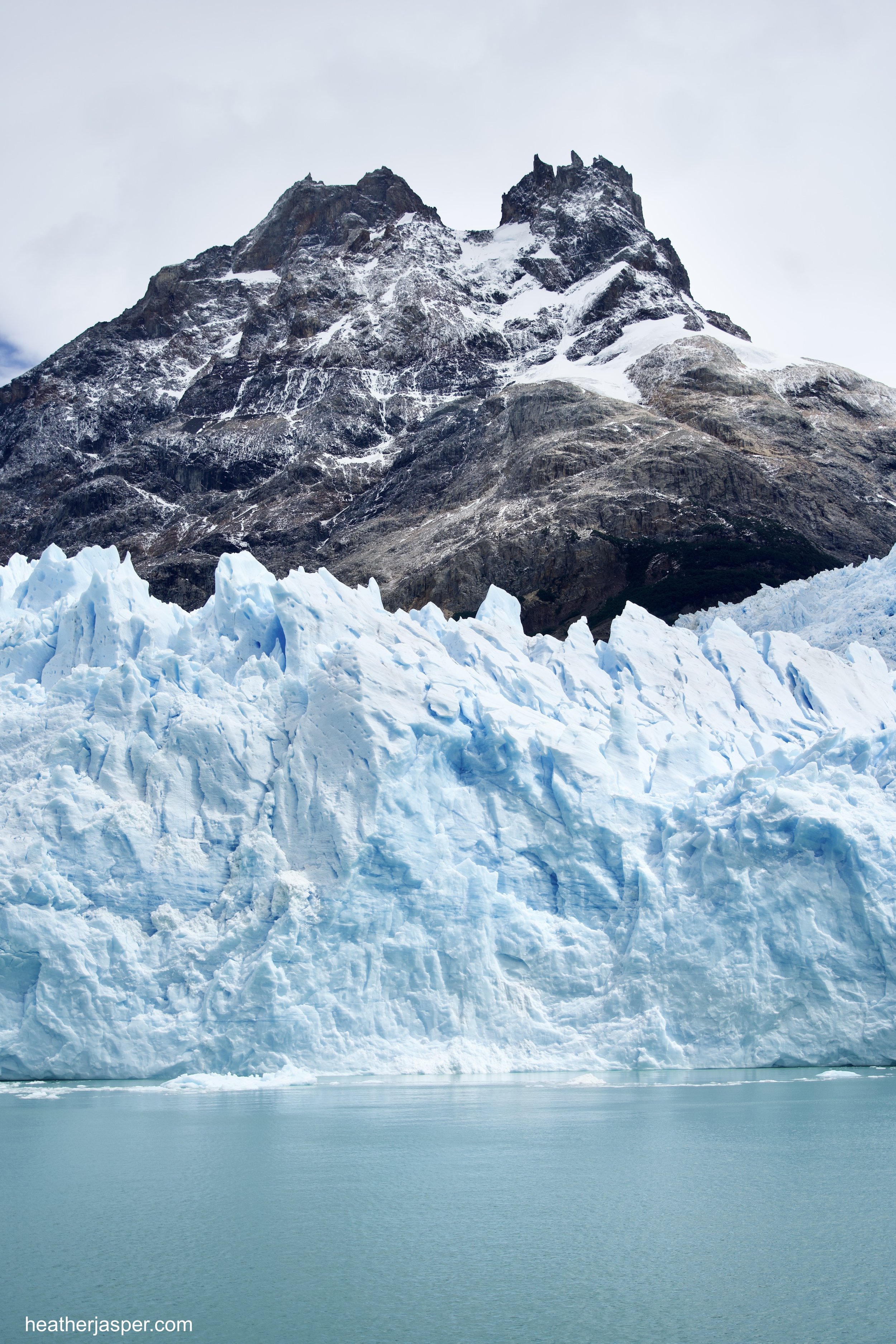
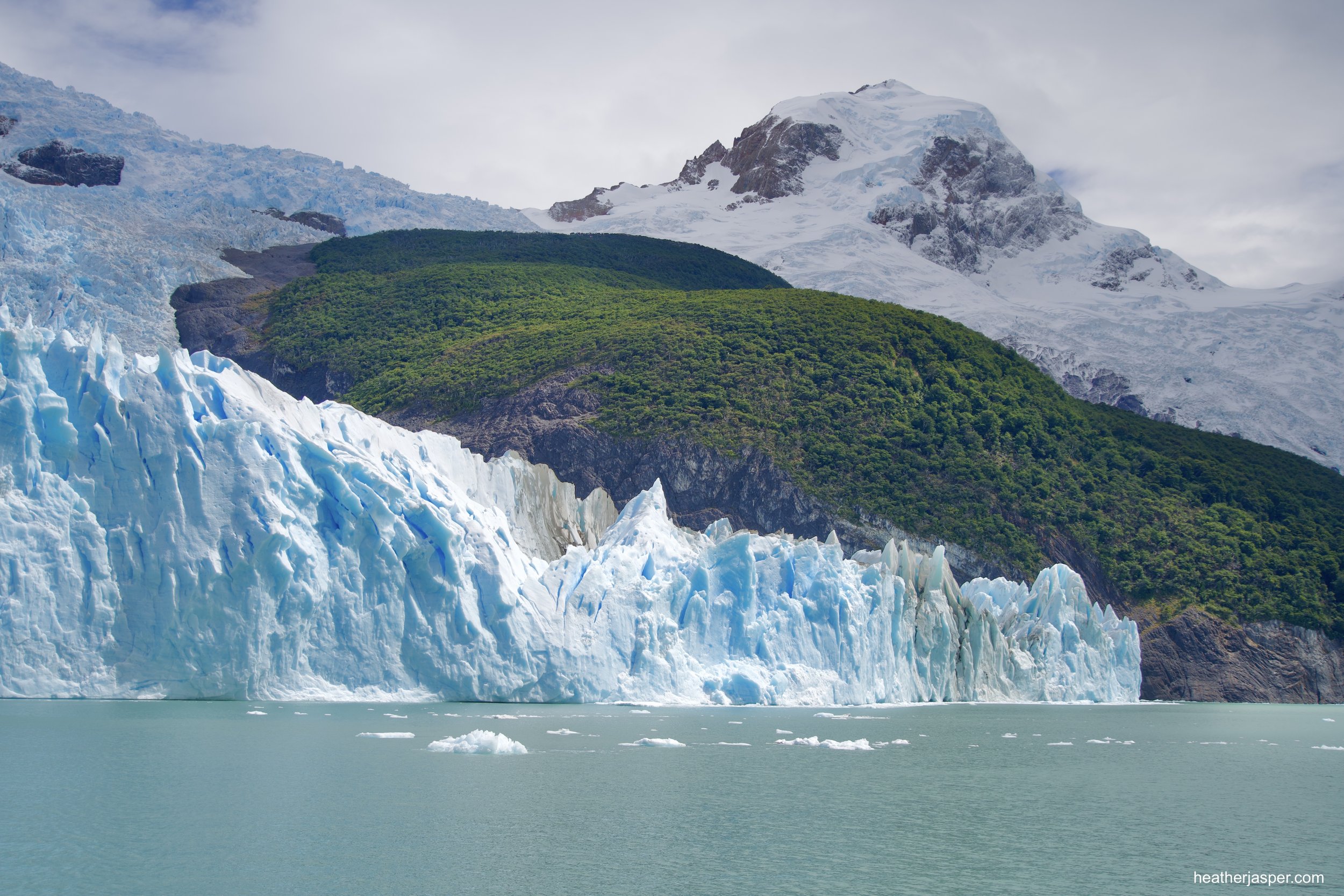
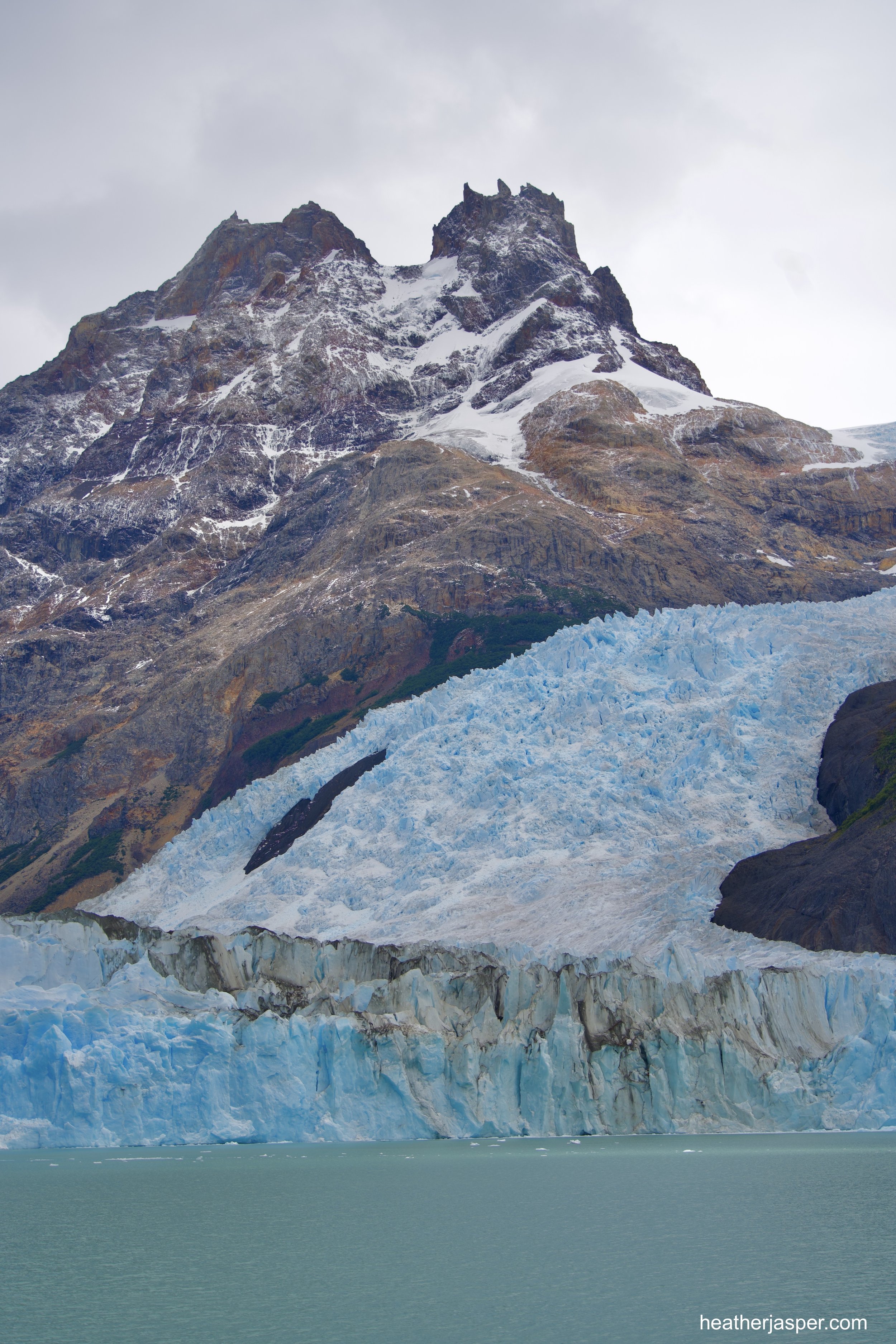
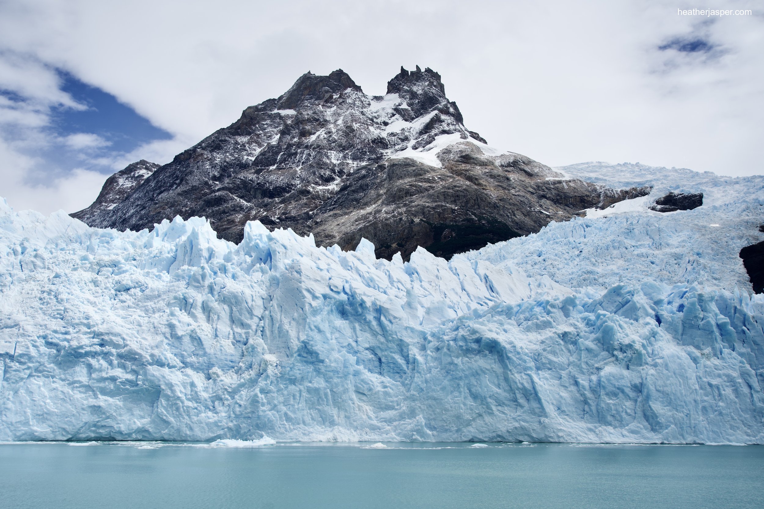
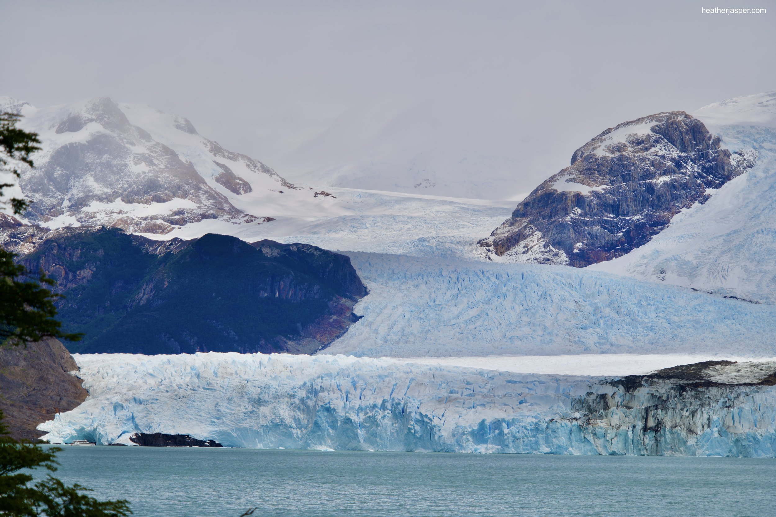
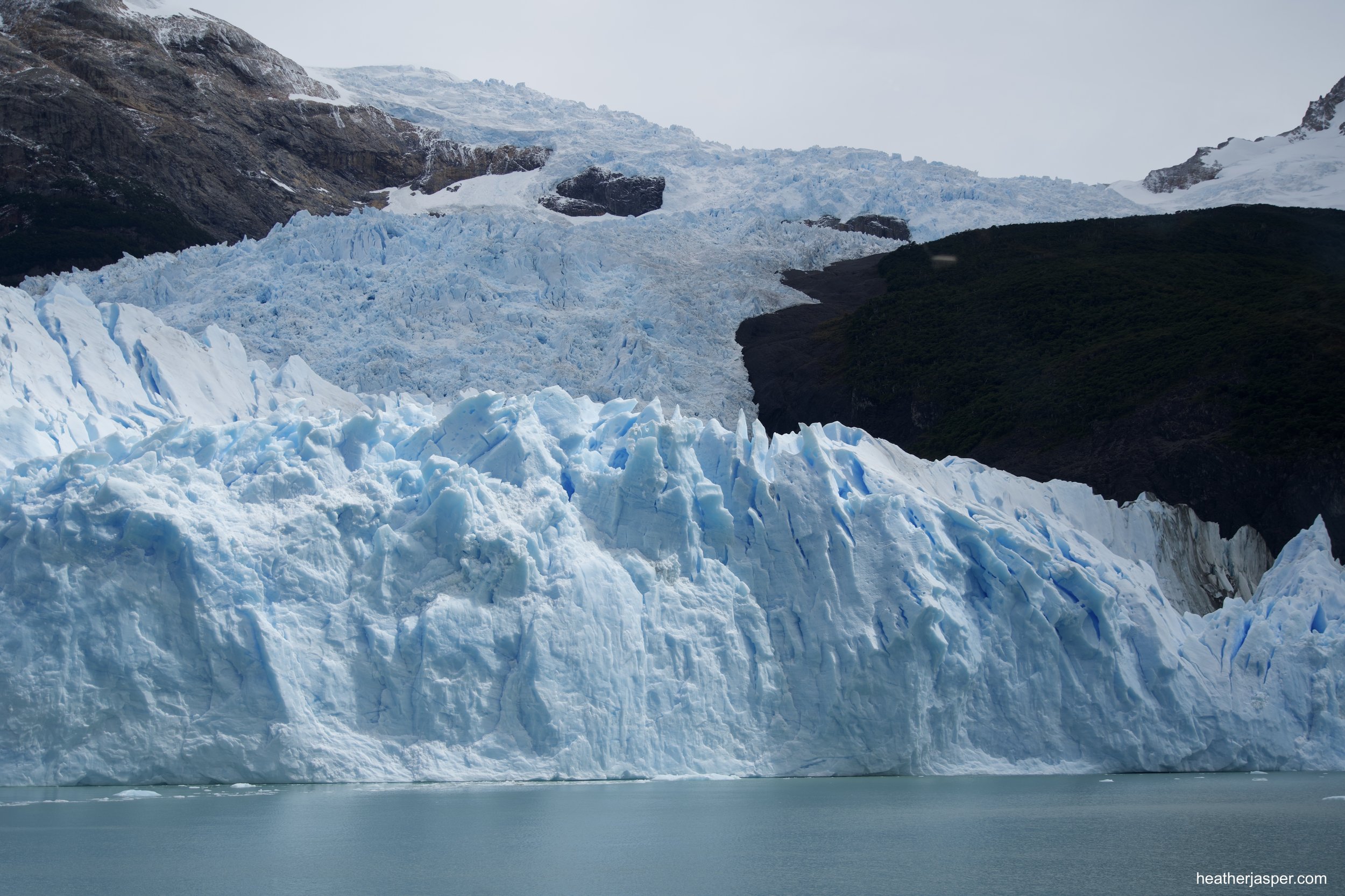
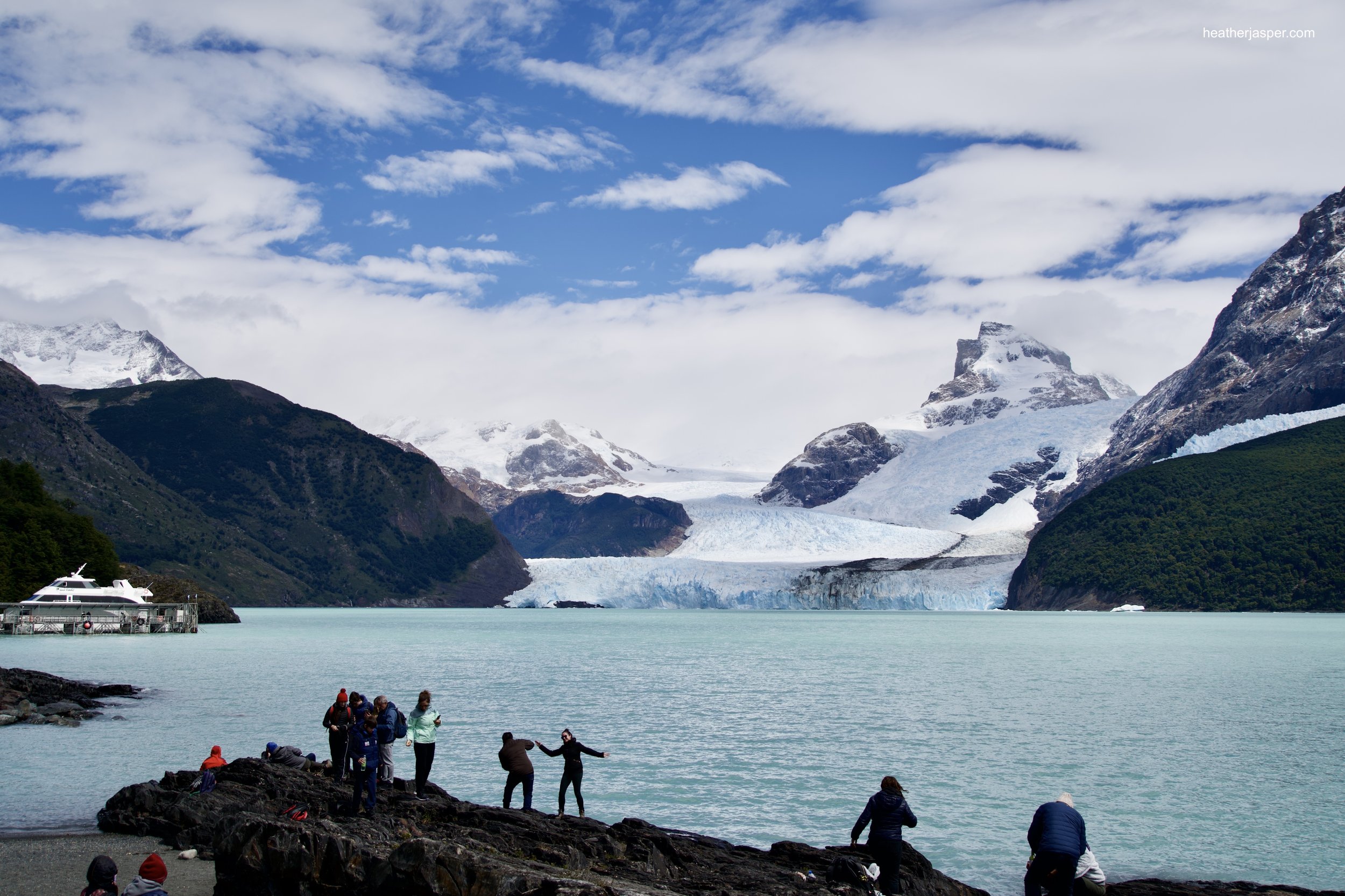
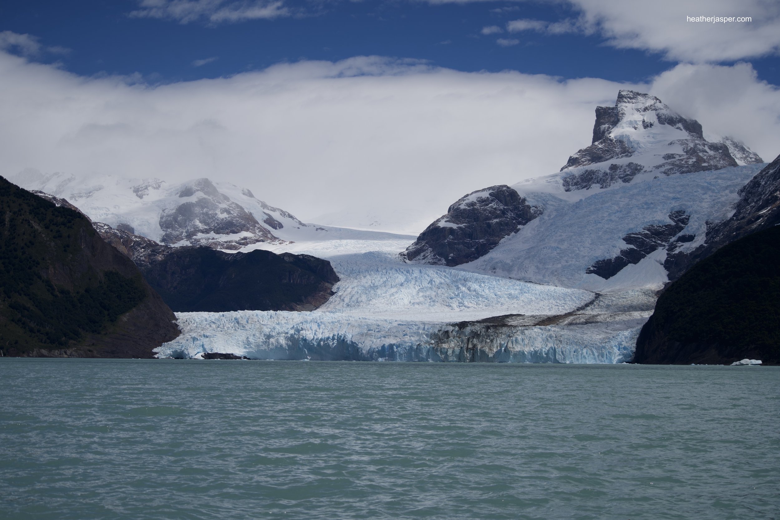
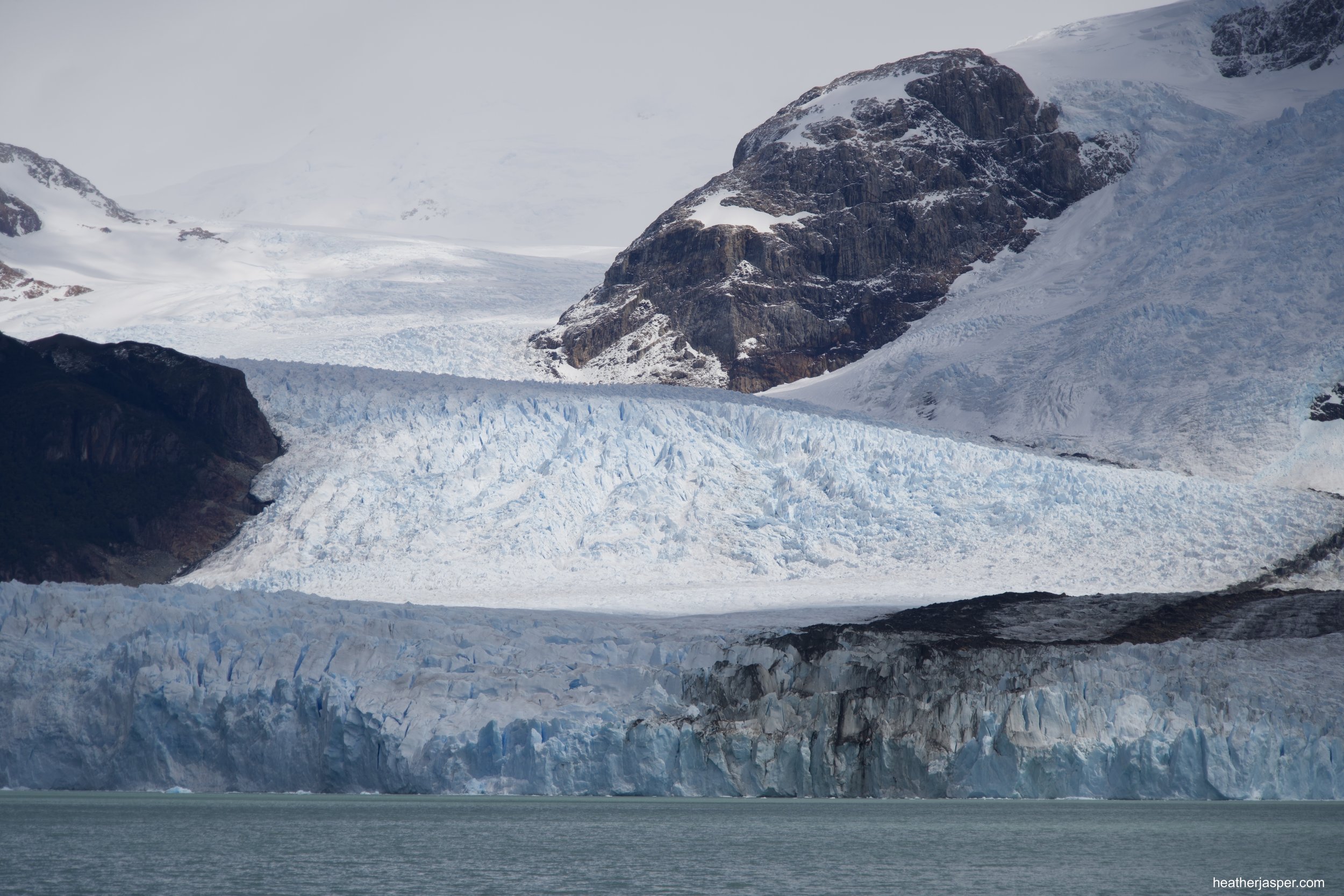
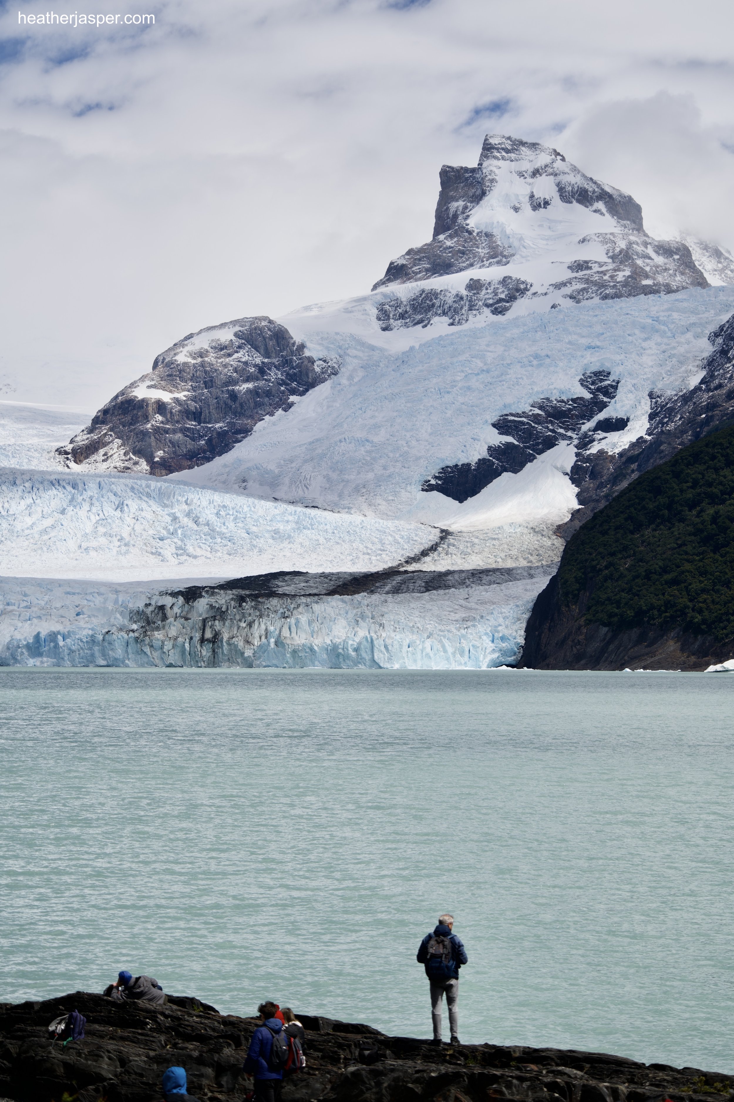
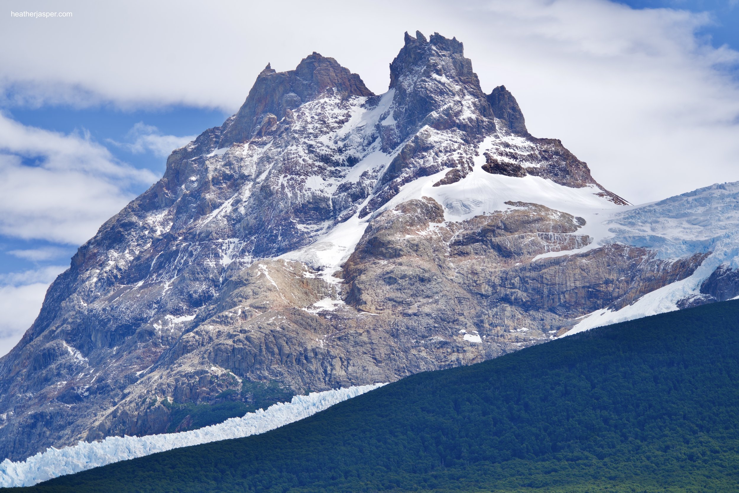
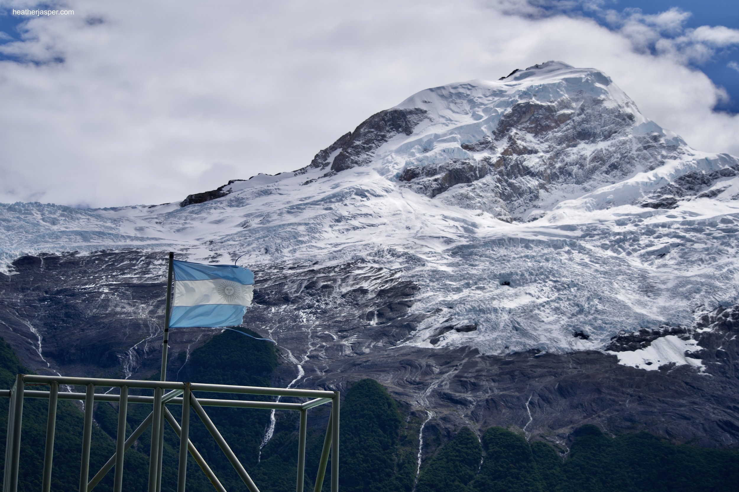
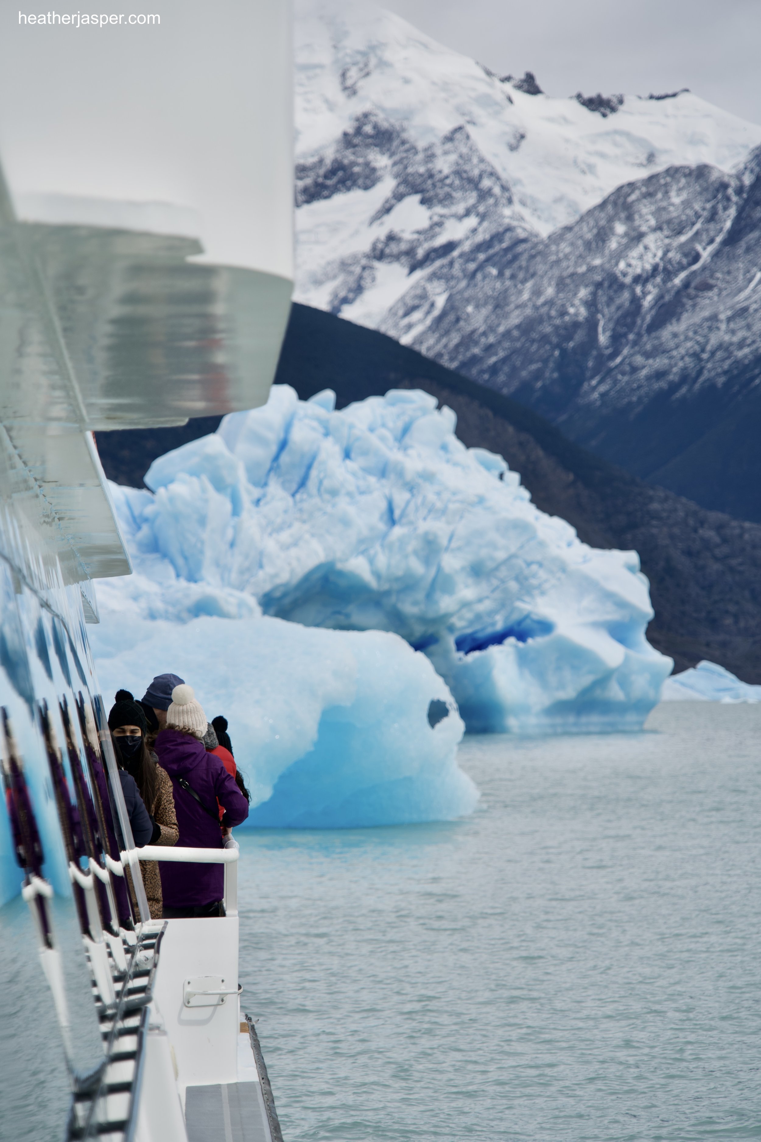
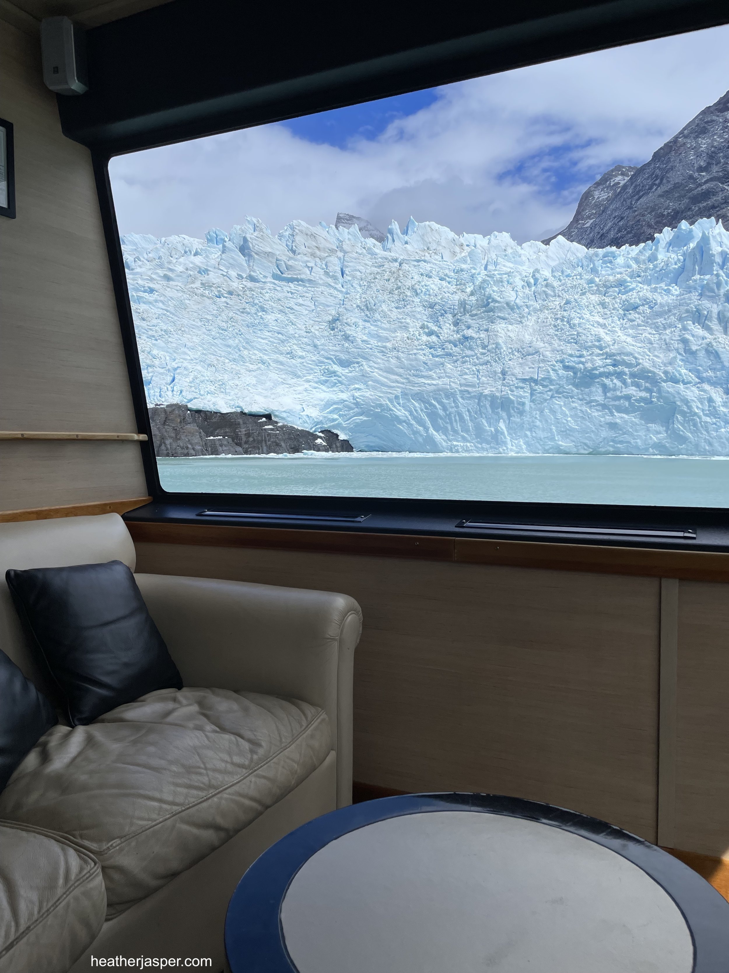
The only day I had scheduled for El Calafate, I signed up with Latina Azul for a full day boat ride around to visit several glaciers. Below are just a few of the many beautiful photos I shot of the glaciers.
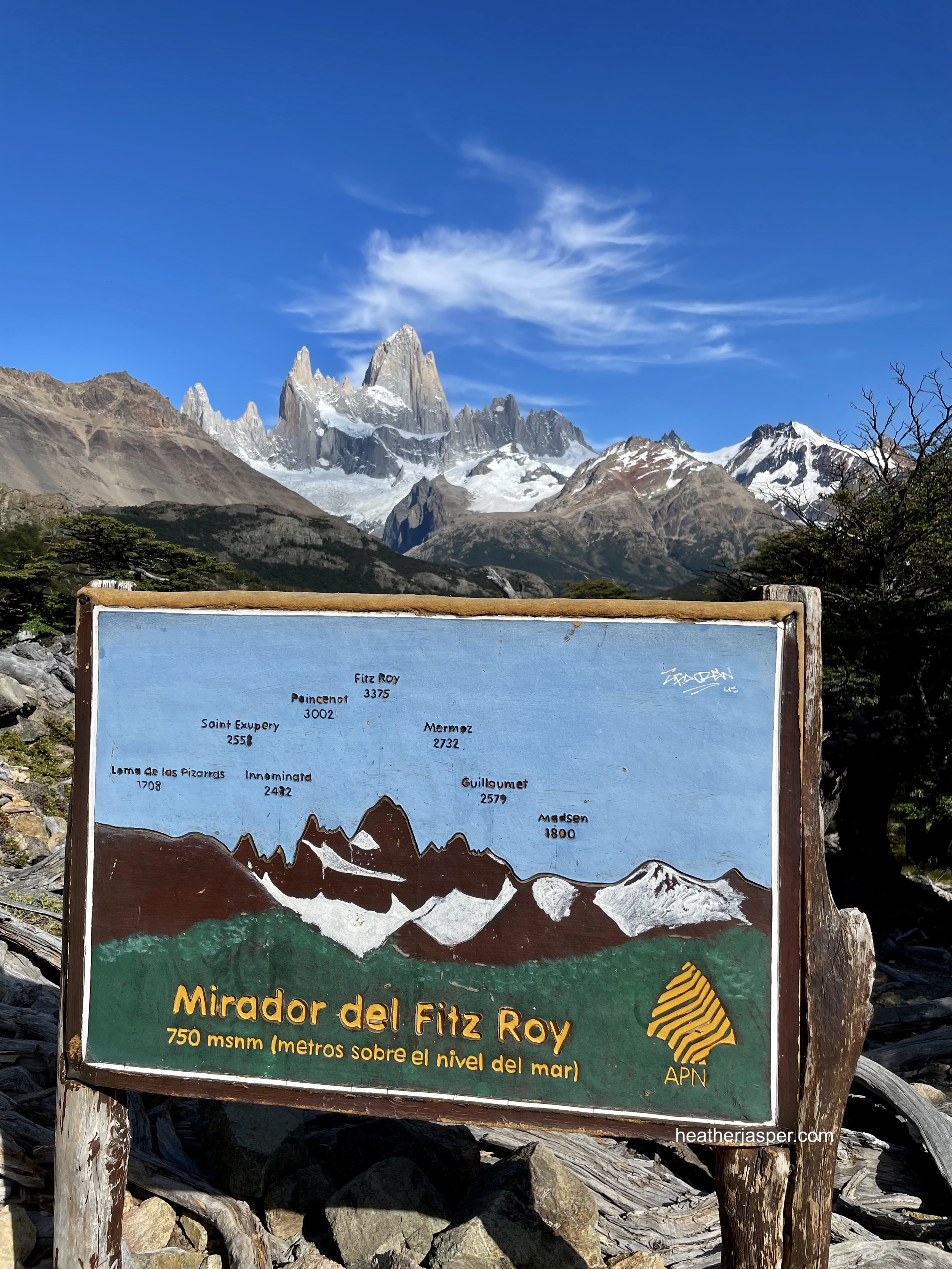
El Chaltén, Patagonia
Your first stop in El Chaltén should be at the park ranger station, where you can get all the information you need about hikes in the area. There is also an interpretive garden of native plants, each labeled with common and scientific names and other information. At the ranger station you can also learn about the wildlife common in the area and the best places to spot them. The most popular is the huemul, a small deer endemic to the area. Unfortunately, there aren’t many left and I didn’t see one during my week there. However, I did spot several wild hares, foxes and lots of birds. The other important piece of information I got was that you can drink the water just about anywhere near the glaciers. On every trail I found springs to fill my water bottle and even drank directly from a few glacial streams. Below are the trail maps for the hikes I went on.
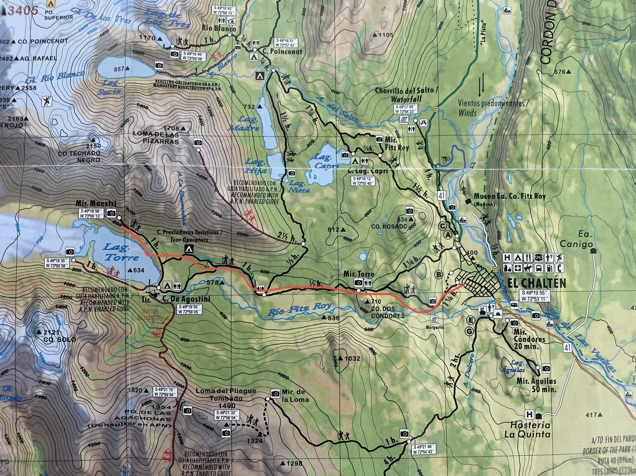
Laguna Torre
This trail had a couple steep bits, but was mostly a gentle uphill stroll. When you get close to the lake, I turned right to walk by the camping area for curiosity, but the trail isn’t as well marked as if you go directly to the lake. Either way, I do recommend hiking up to Mirador Maestri. The last bit is loose scree with a lot of exposure, so go slowly and carefully. The time estimates on the map are fairly accurate.

Laguna de Los Tres y Laguna Sucia
This hike was more challenging than Laguna Torre, partly because it’s longer and partly because the last hour is a steep uphill on loose glacial moraine. However, it is absolutely worth the effort. On the map there is a separate trail for Laguna Sucia (which is a sparkling turquoise, not dirty at all). I hiked up to Laguna de Los Tres, which has a spectacular view down to Laguna Sucia. There are springs that bubble up out of the sand on the shores of Laguna de Los Tres, which was the sweetest water I’ve ever tasted.

Lago y Río Eléctrico
This requires a short drive (or hitchhike) to the trailhead on Río Eléctrico. The trail itself is a gentle uphill, following the river. Most of the hike is through a forest, where you should stop to listen for woodpeckers. The Magellanic Woodpecker is one of the largest in the world and it’s quite common in the area. Check my photography page for photos of the woodpecker family I saw. The trail ends at a refuge, where you can stay or buy food. From the refuge, another trail goes across glacial moraine to the lake, which is absolutely worth the extra hour! Be aware that this is private land, owned by a collective that does not charge a fee to access the trails.

Laguna Huemul
If you want a rest day between longer hikes, go to Laguna Huemul. It’s more than an hour drive from El Chaltén, but if you don’t want to hitchhike, there are several shuttle services to get you to the trailhead. Be aware that this is on private land. There is a $600 peso fee charged at the trailhead. That came to $3 USD when I was there. There is also a lodge with a restaurant and places to eat if you brought your own food. I also recommend walking to the lake, where you have the option to take a boat across and hike along the far side.
Full story about El Chaltén coming soon!
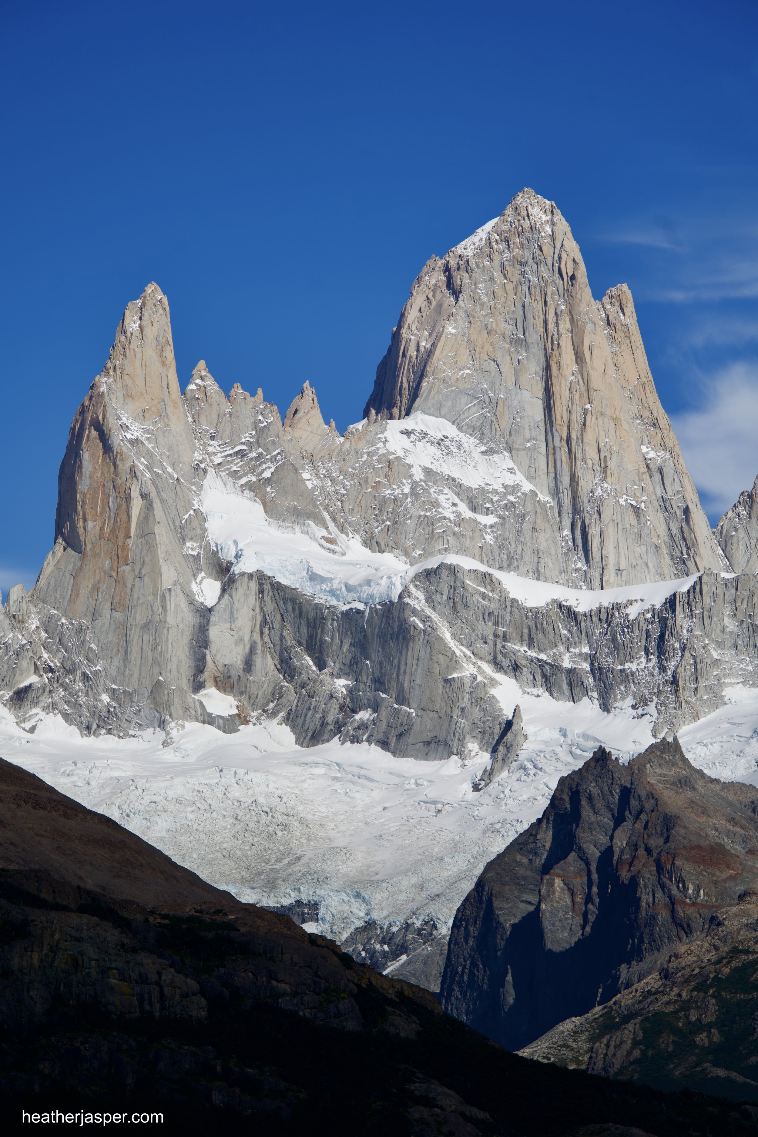
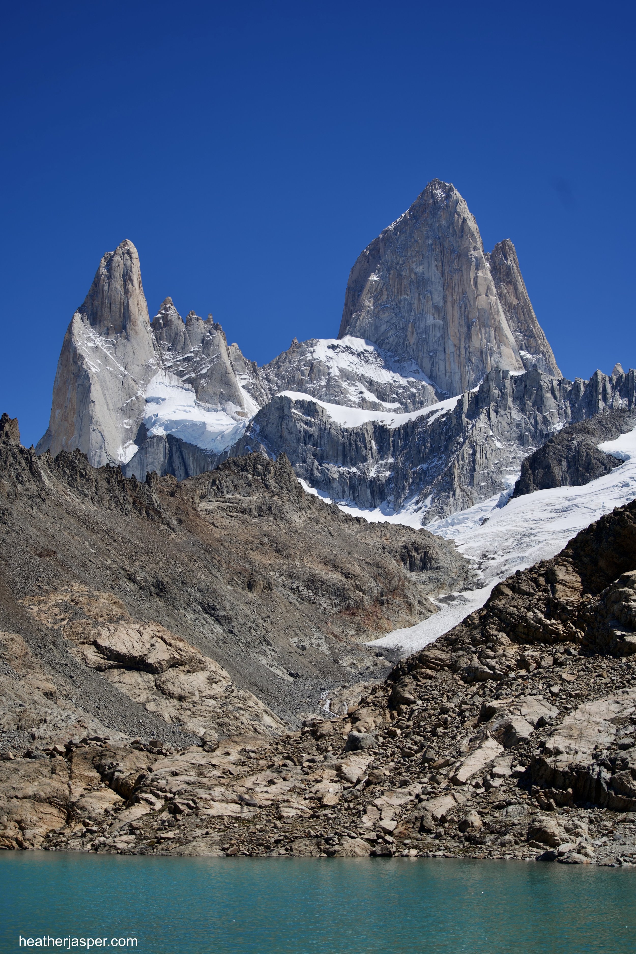
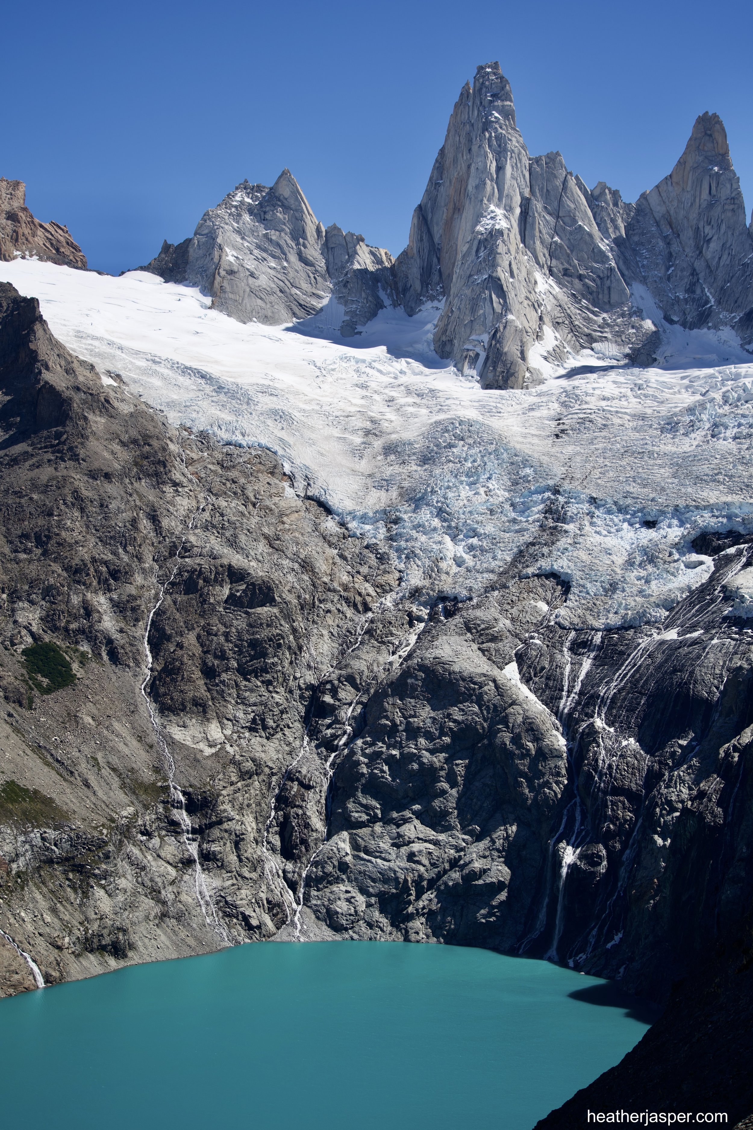
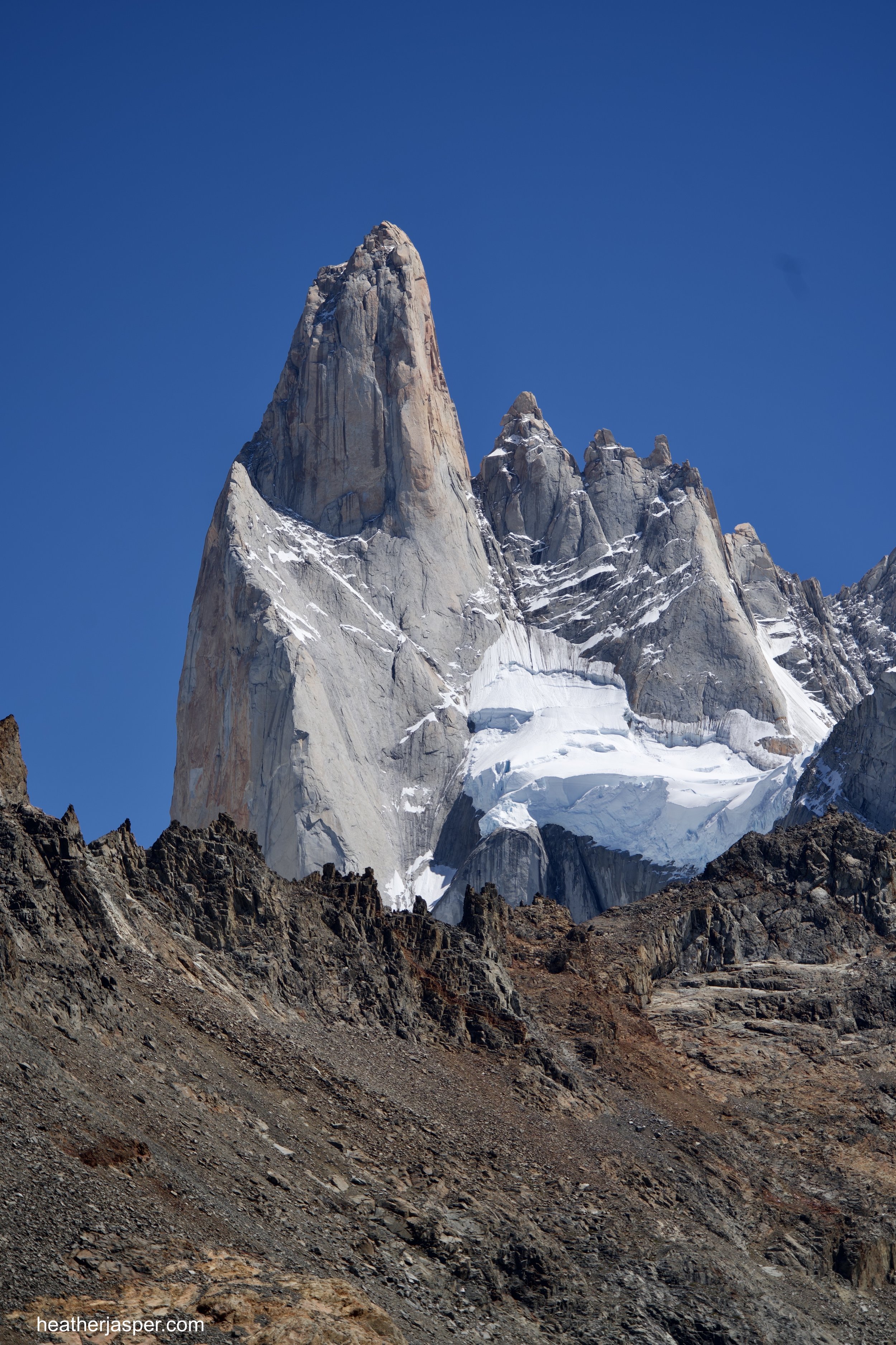
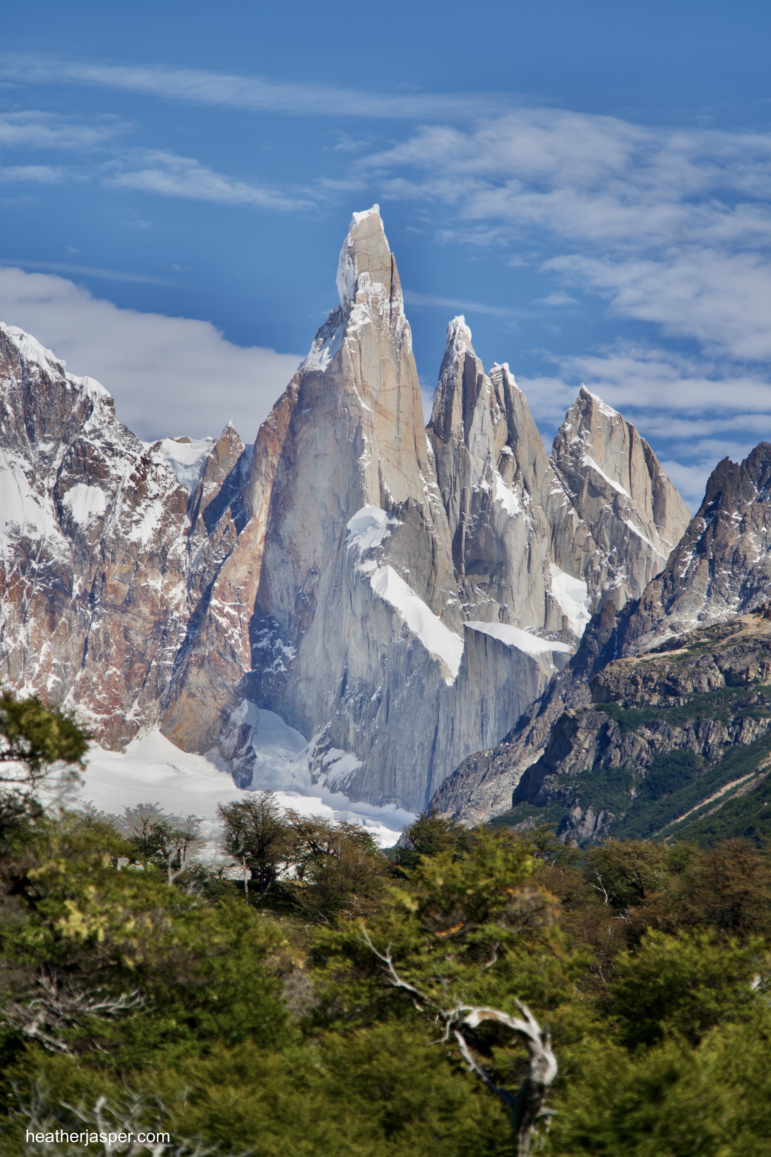
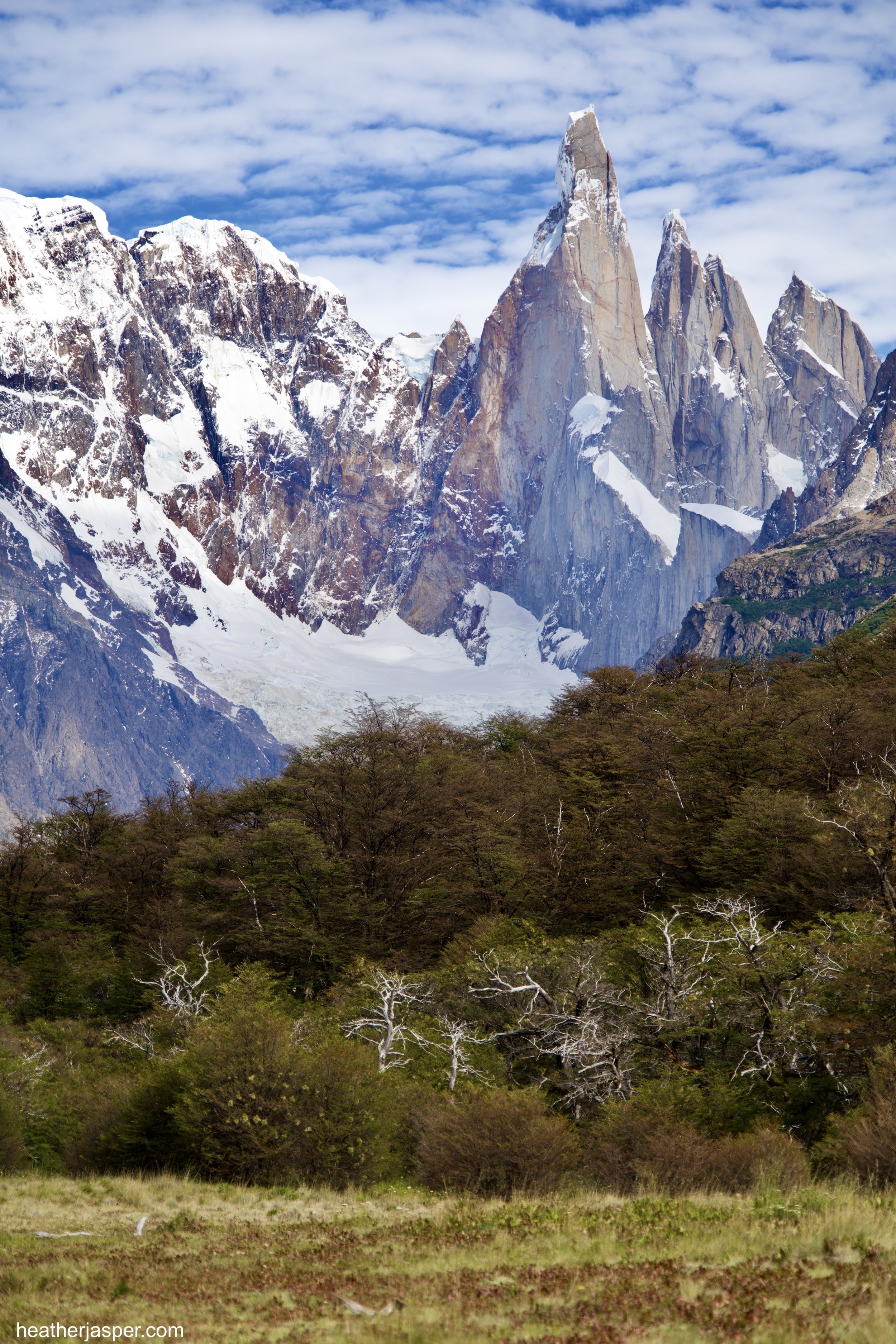
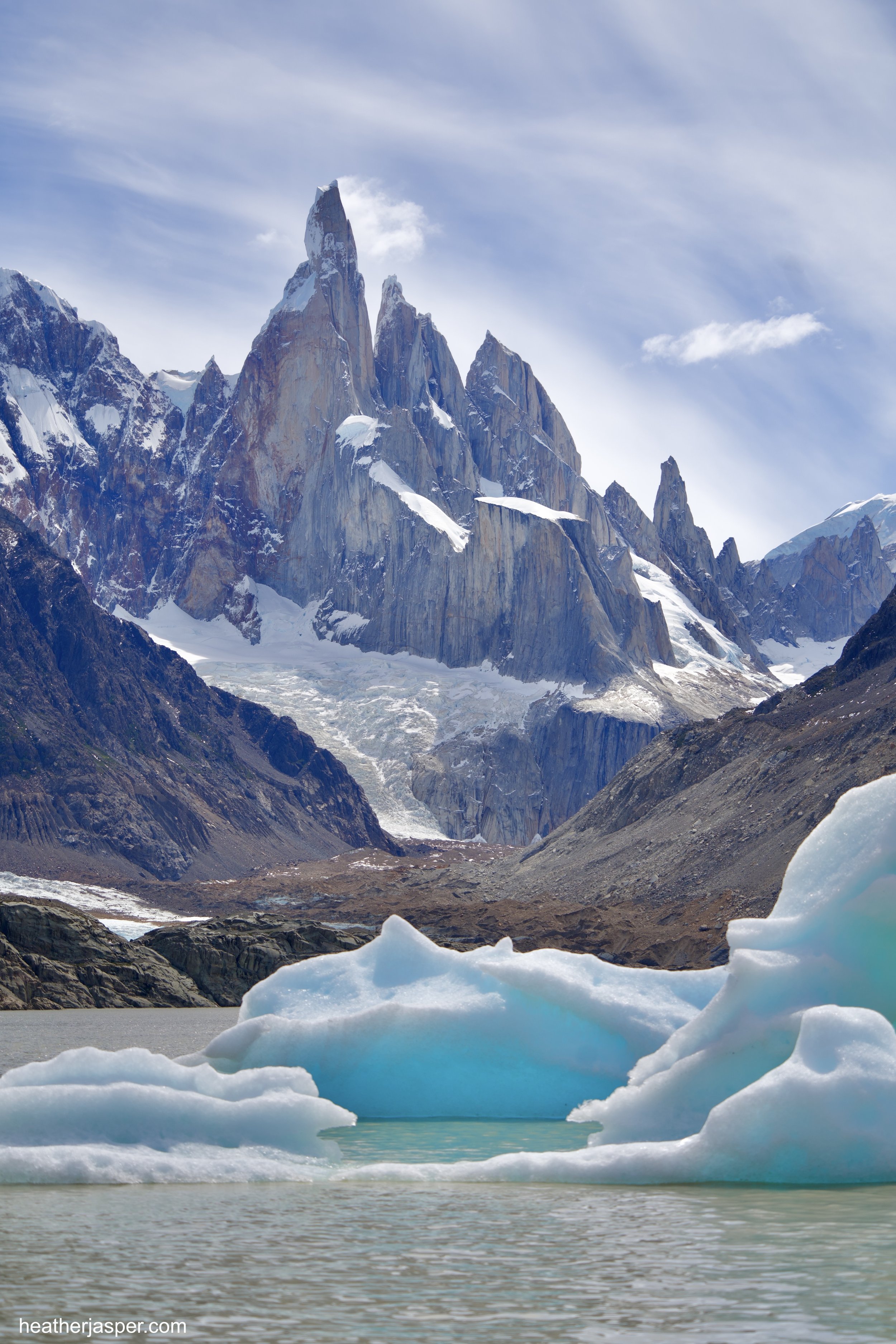
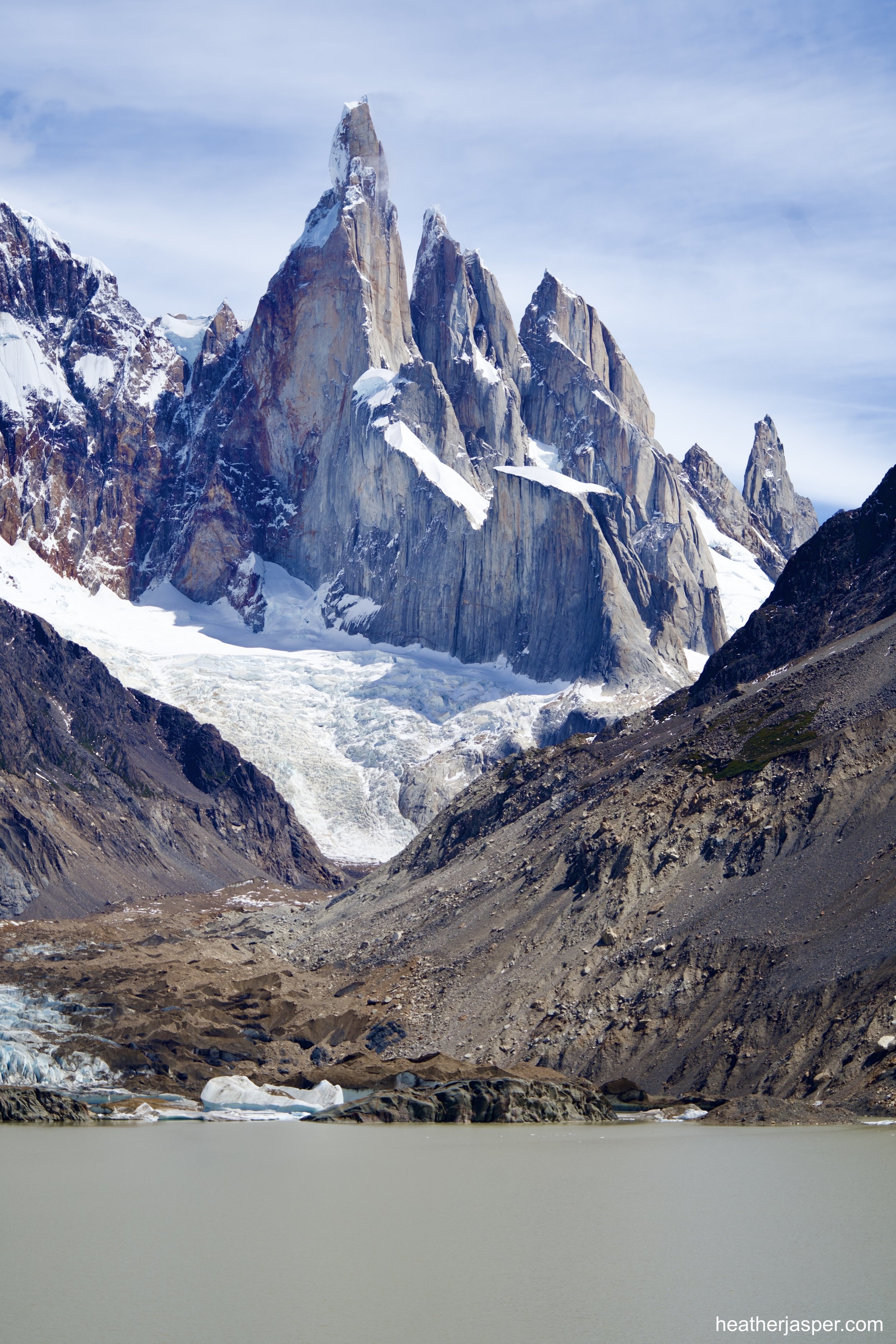
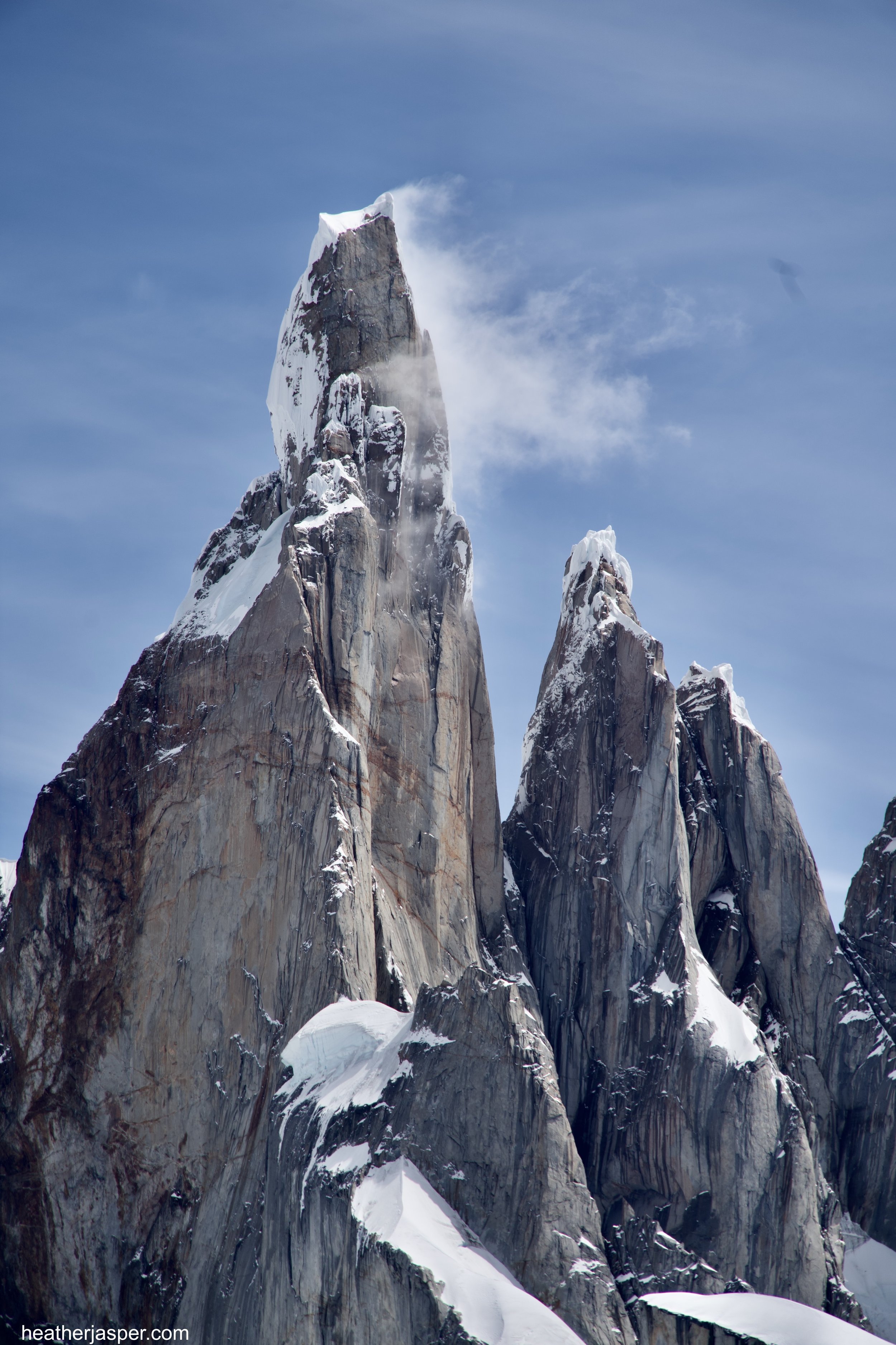
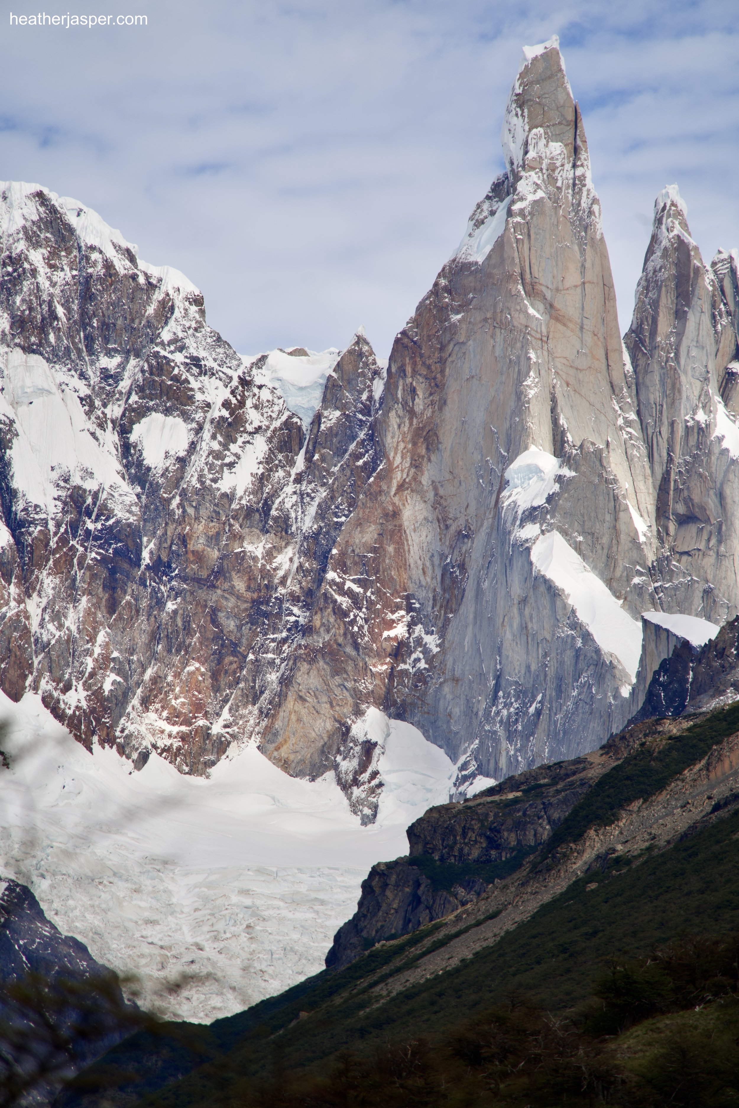
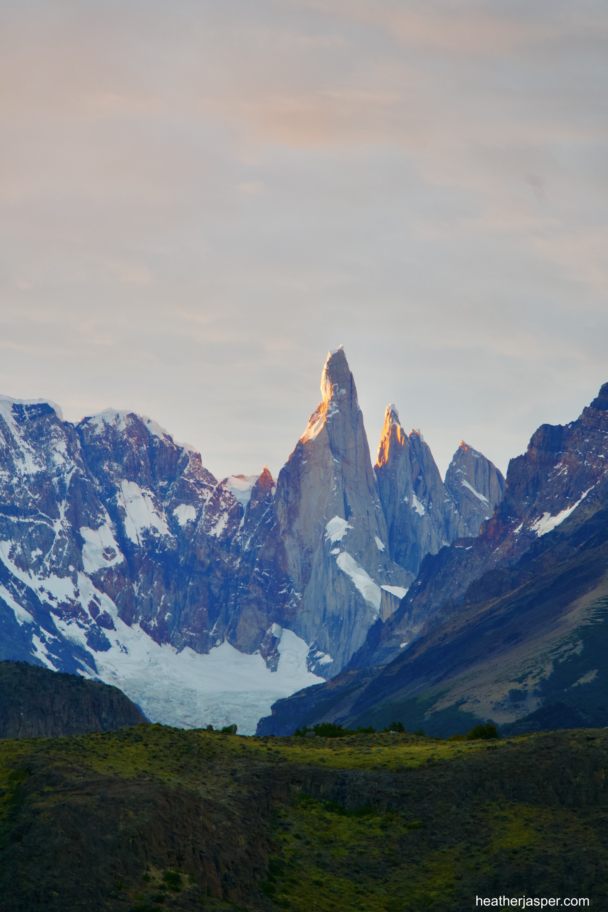
The Fitz Roy and Poincenot peaks are so striking that I couldn’t help taking dozens of photos: in the morning, in the evening, with clouds, with a clear blue sky, with the sunset, from the east, from the south … you get the idea. I would have spent a lot more time taking pictures of them, if I didn’t also have glaciers and lakes and icebergs to capture my attention. Below are just a few of my favorites of Fitz Roy and Poincenot.