
Inti Punku
It’s hard, but Inti Punku is definitely worth the effort.

Inti Punku means Sun Door or Sun Gate in Quechua, and that’s about all that’s left of this Inca building.
The most difficult day hike in the Sacred Valley gives you the most spectacular views.
The Sacred Valley deserves its name as a valley that’s full of sacred Inca and pre-Inca sites. Inti Punku overlooks one of the most important: Ollantaytambo. The town itself was a sacred place and today has an estimated forty archeological sites, with even more sites surrounding the ancient town. Check out my blog about the Ollantaytambo archeological site.
I highly recommend spending a couple days in Ollantaytambo, especially if you’ve decided to not go to Machu Picchu. (I know more people skipping Machu Picchu this year than ever before).
Most major archeological sites are close to the valley floor, where the Inca almost never built. Most Inca towns and other constructions are up above the valley floor, both protecting them from seasonal floods and leaving more space for planting.
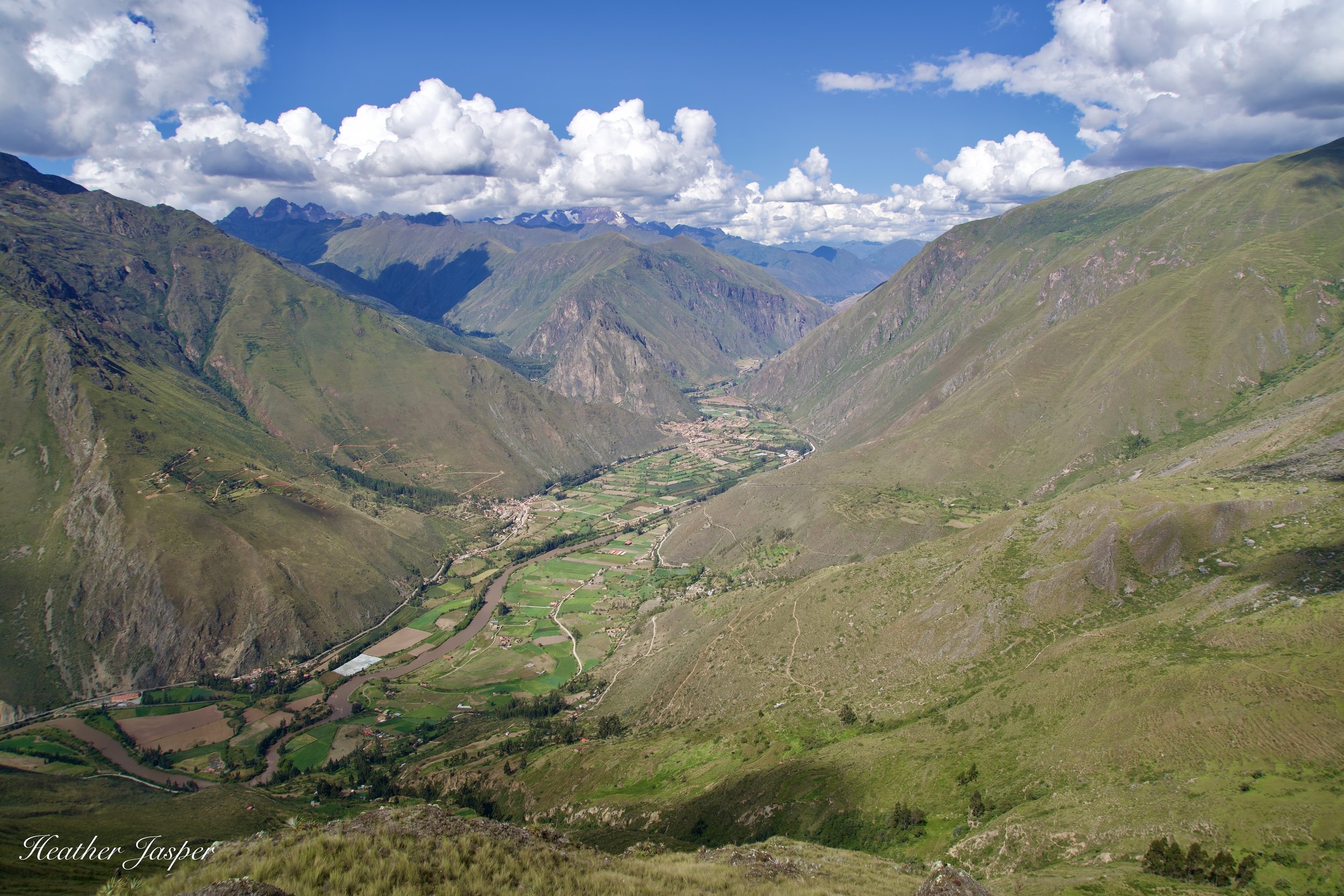
The view down to Ollantaytambo from Inti Punku is my favorite view of the Sacred Valley.
One of the Inca’s main sources of power was their control of food. As the saying goes, the best way to a person’s heart is through their stomach. If crops failed in one part of the Inca’s territory, called Tahuantinsuyu, the Inca sent dried corn, potatoes and other staples from an area that had a good harvest. Controlling who planted what, and how much was stored for emergencies, was an important part of how the Inca controlled so much of South America.
Built so high above the valley, Inti Punku seems more likely to have been an observatory and a place for ceremonies. According to archeologist Óscar Montúfar, when archeologists did a formal dig at the site, they found that the whole area had been looted. Not only were there no artifacts to find, but the layers of dirt had been so disturbed that it was impossible to glean any information about how the site was used.

Starting near Cachiccata
If you start from Cachiccata, the trail is steep right from the beginning and you get a great view of the valley pretty quickly.
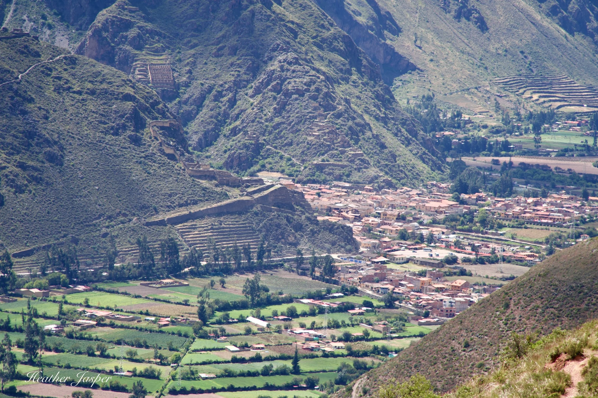
The Ollantaytambo ramp
The obvious ramp that goes up to the Ollantaytambo archeological site is where they dragged the giant stones still standing at the top of the site. Read about the site on this blog.
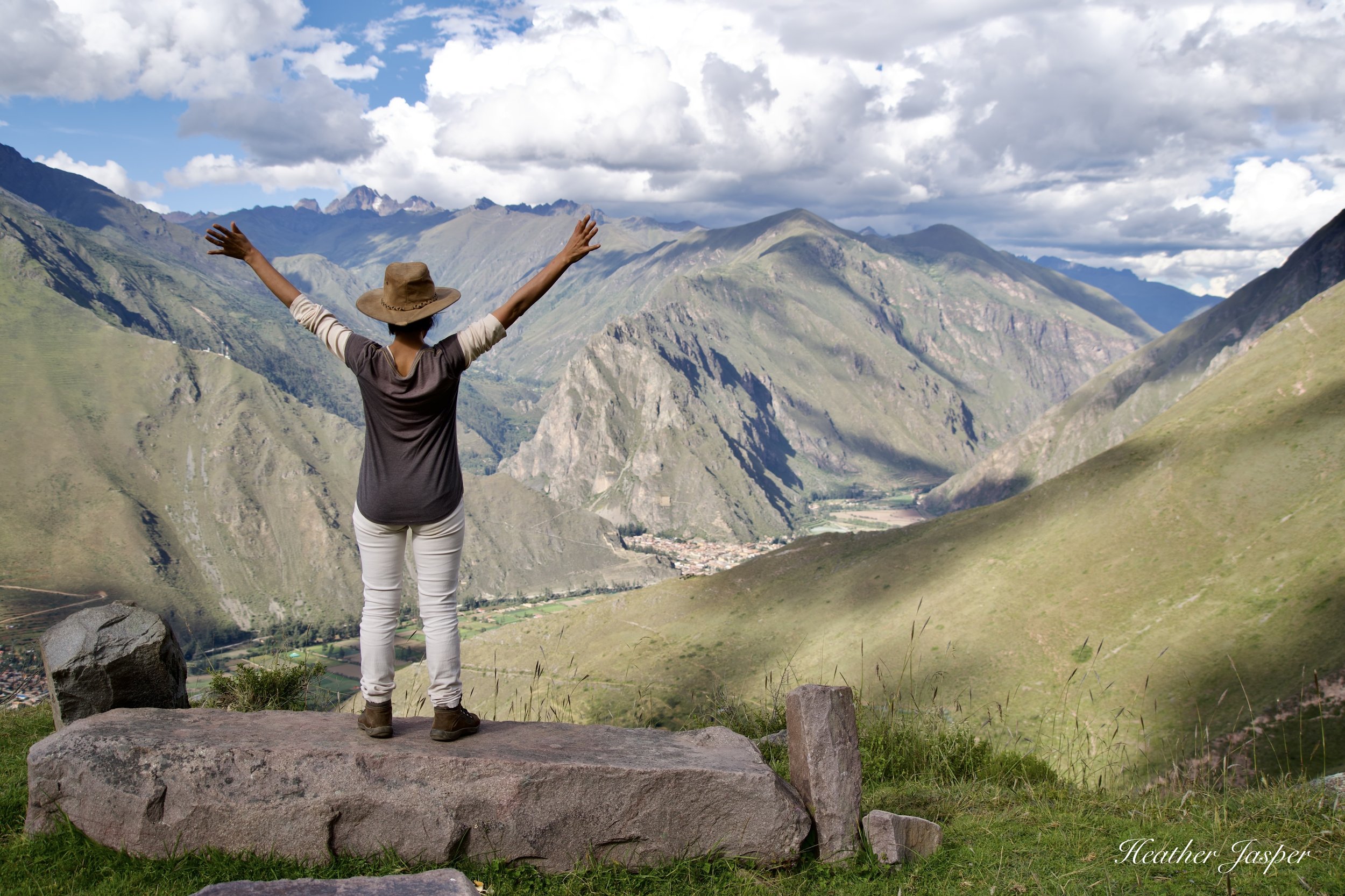
I loved the view from any point along the trail. This is only about halfway up.
Inti Punku’s spectacular views
What you can see from Inti Punku is the glacier-capped mountains that line the north side of the Sacred Valley, with Wakay Willka seemingly close enough to touch. As with many places in Peru, there are overlapping names of Spanish, Inca and pre-Inca origin. Also, Quechua names usually have more than one correct spelling. Wakay, or waqay, are tears in Quechua and willka or wilka means sacred. This is likely in reference to the importance of the glacial melt from the peak’s glaciers, which irrigated fields and crops around Ollantaytambo.
Most words written with w are just as often written with hua. The letters c, k, and q are often equally interchangeable. Huacay Huilca is just as correct as Wakay Willka and the two words written together as one is equally correct. The European alphabet doesn’t do a great job of expressing Quechua sounds, so you shouldn’t get too hung up on spelling.
Quechua is a very poetic language, so it makes sense they would call glacial melt “tears.”
The Spanish name for the peak is Verónica, perhaps in reference to Saint Veronica, who gave Jesus a cloth to wipe his face. Spanish place names are often loosely related to the original Quechua names, so perhaps the idea of tears made them think of the saint.

Chullpa burial site
Chullpas, round burial sites, were common in the north, but many of the people that the Inca conscripted to build Ollantaytambo were from what is now northern Peru.

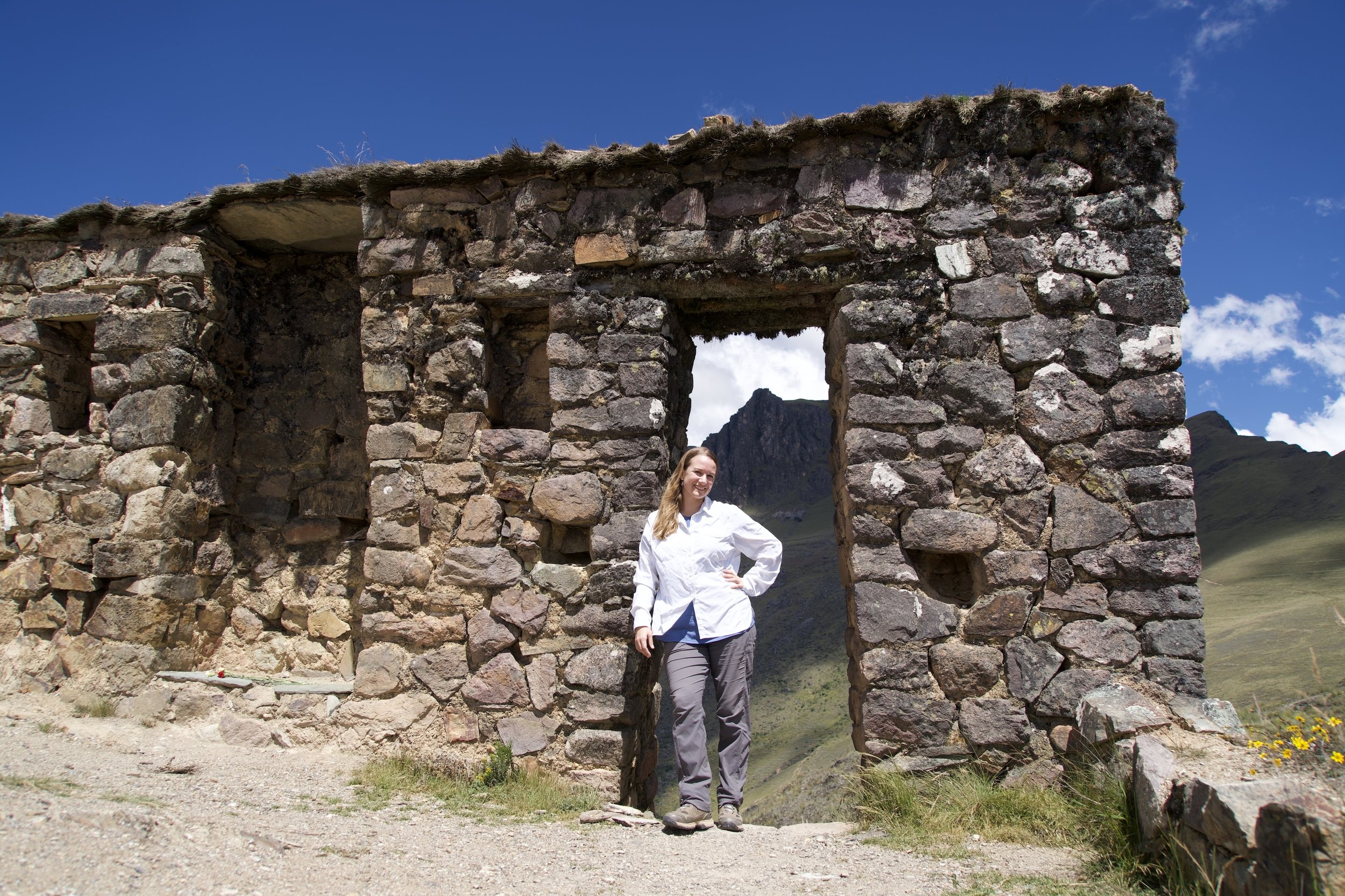
Choquetakarpu
These are the only buildings along the trail, and were possibly an administrative center for managing the nearby quarry.
I recommend starting early in the morning because there is no shade, and the equatorial sun is very strong at this altitude. Take a good hat and sunscreen!
Take plenty of water, because there are no water sources along the way. If you ever have knee pain on steep trails, definitely take hiking poles with you. You’ll be happy to have them, especially for the way back down. Many trails in the Sacred Valley go past communities, where you can buy food. However, nobody lives along this trail so make sure you bring enough snacks to get through a long day.

Apachetas
Apachetas are small stacks of rocks, which Peruvians still make to show respect for the mountains and as places to leave offerings like coca leaves and flowers.

Spanish mill stone
The Spanish used the same quarry that the Inca had used, making things like this giant mill stone for grinding corn or wheat.
Check the elevation
The elevation gain is what makes this hike so hard. It’s 3,870 feet (1,180m), from Ollantaytambo at 9,160 feet (2,792m) up to 13,035 (3,972).
Most people start in Ollantaytambo, at a spot called the Inca Bridge. It’s about 10.2 miles (16.4km) round trip. When I hiked this, our van took us to Cachiccata and we hiked only 8.6 miles round trip (13.8km). However, we had the same elevation gain and next time I’ll start at the Inca Bridge. The beginning of the Cachiccata trail was just too steep.

Trail signs
The trail is very easy to follow, though it does need more signs. The project is underway and I’ll update this blog when I find they have better signs on the trail.

Óscar Montúfar Latorre
I did this hike with Inkari Centro Cultural which organizes professional development for guides with experts like archeologist Óscar Montúfar.

Tour Guides
Hiking with guides like Elisa, I get to learn from the experts and hear what it’s like to be a guide.
Two trails to choose from
The trail from the Inca Bridge is still very steep towards the end, but the beginning is more gradual than the Cachiccata trail. Also, the Inca Bridge trail goes by the quarry, which you miss if you hike up the shorter trail.
Next time I also plan on camping at Choquetakarpu. It’s relatively close, but down off the ridge so it shouldn’t be too windy. The wind really howls up there. However, the challenge with camping is bringing enough water for two days. I would only take water for drinking and not plan to cook, in order to minimize weight.
Some of the families who live in Cachiccata are starting to rent horses for the hike. If you want to ride a horse most of the way or hire somebody to carry camping gear up on horses, you need to start at the community. They can’t run horses on the trail from the Inca Bridge.
Unfortunately, I don’t have any contacts with the people who rent horses. However, most tour agencies in Cusco can arrange this hike for you and get you a horse.


Rainy season vs. Dry season
During the rainy season the peaks you can see from Inti Punku are often covered with clouds, but the valley is green. If you hike in the dry season, you can usually see the chain of glacier topped Andean peaks, but the hills are brown with dry grass.
Just one wall at the top
The top is very windy and since there’s just one wall left, there isn’t anywhere to hide from the wind.

How to get there?
All the dotted red lines are trails. They’re easy enough to follow and since there are no trees, you can always see ahead where each trail leads.