
Ushuaia Hikes
I updated the Rough Guide to Argentina and am so happy how it turned out! Get 30% off the Rough Guide to Argentina with my author code AUTHOR0018 in their online store.
Ushuaia has fantastic hiking opportunities! Here’s my guide to your options along the coast and in the mountains.


Alarkén Nature Reserve
The easiest hikes with fantastic views leave from Arakur Resort. There are three trails, all clearly marked and easy to follow. They are public trails on the Cerro Alarkén Nature Reserve that you can access even if you’re not staying at the hotel. If you have a car, just drive up to the hotel. You can also go in a taxi or the Alarkén shuttle which leaves on the hour from Ramos Generales Restaurant.
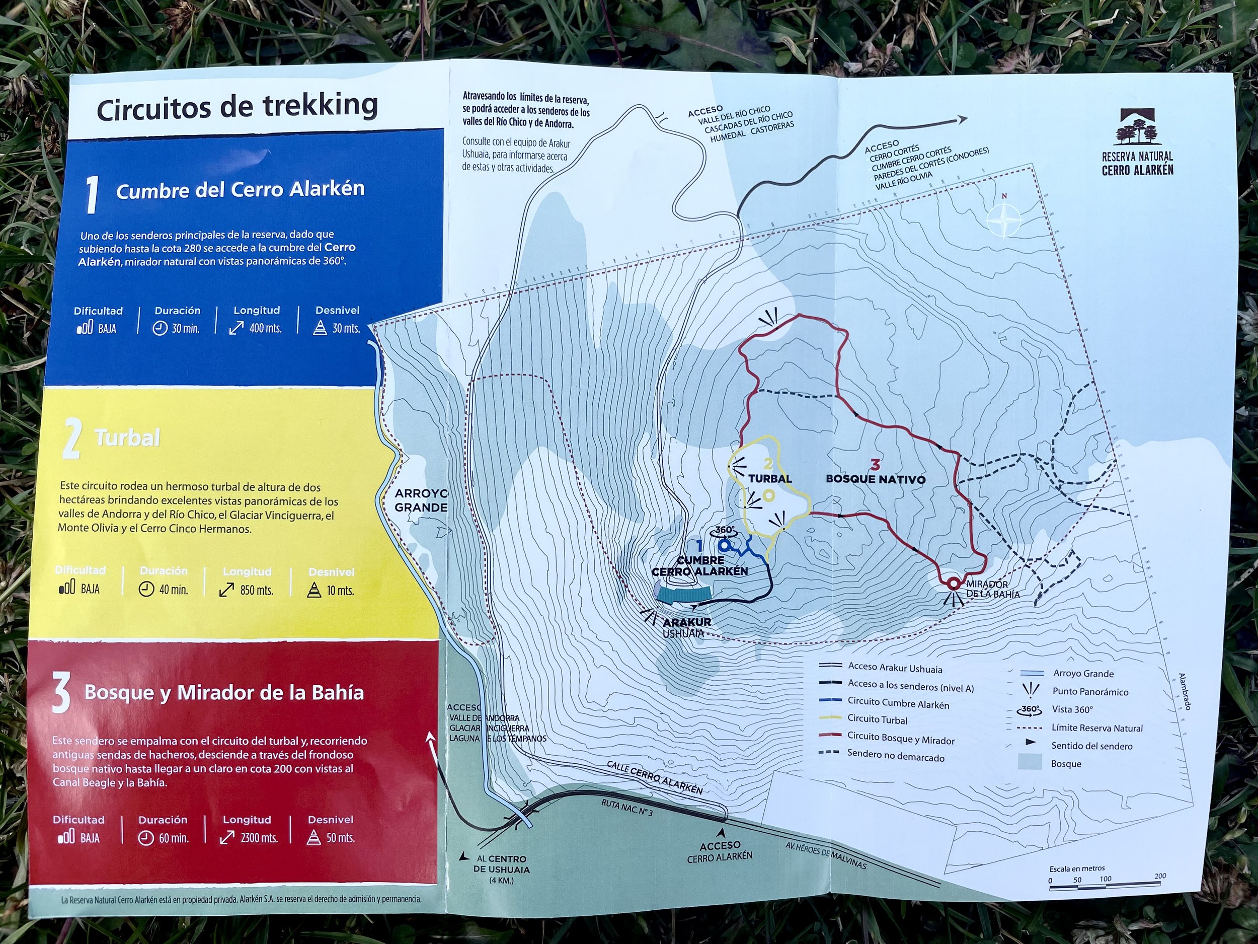
Cerro Alarkén Trail Map
Even if you don’t want a long walk, I highly recommend the viewpoint on the blue trail and checking out the peat bog on the yellow trail. Peat is an important part of Tierra del Fuego’s ecosystem and an important carbon sink.
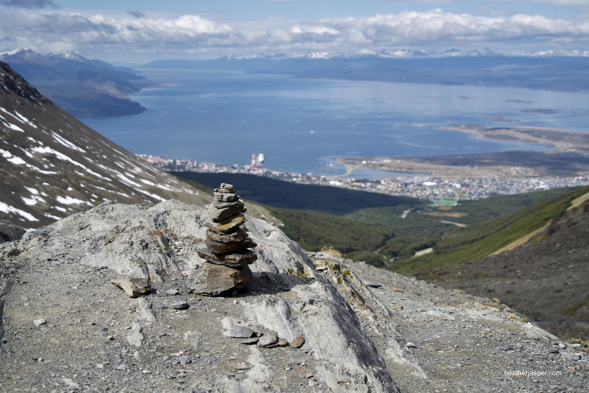
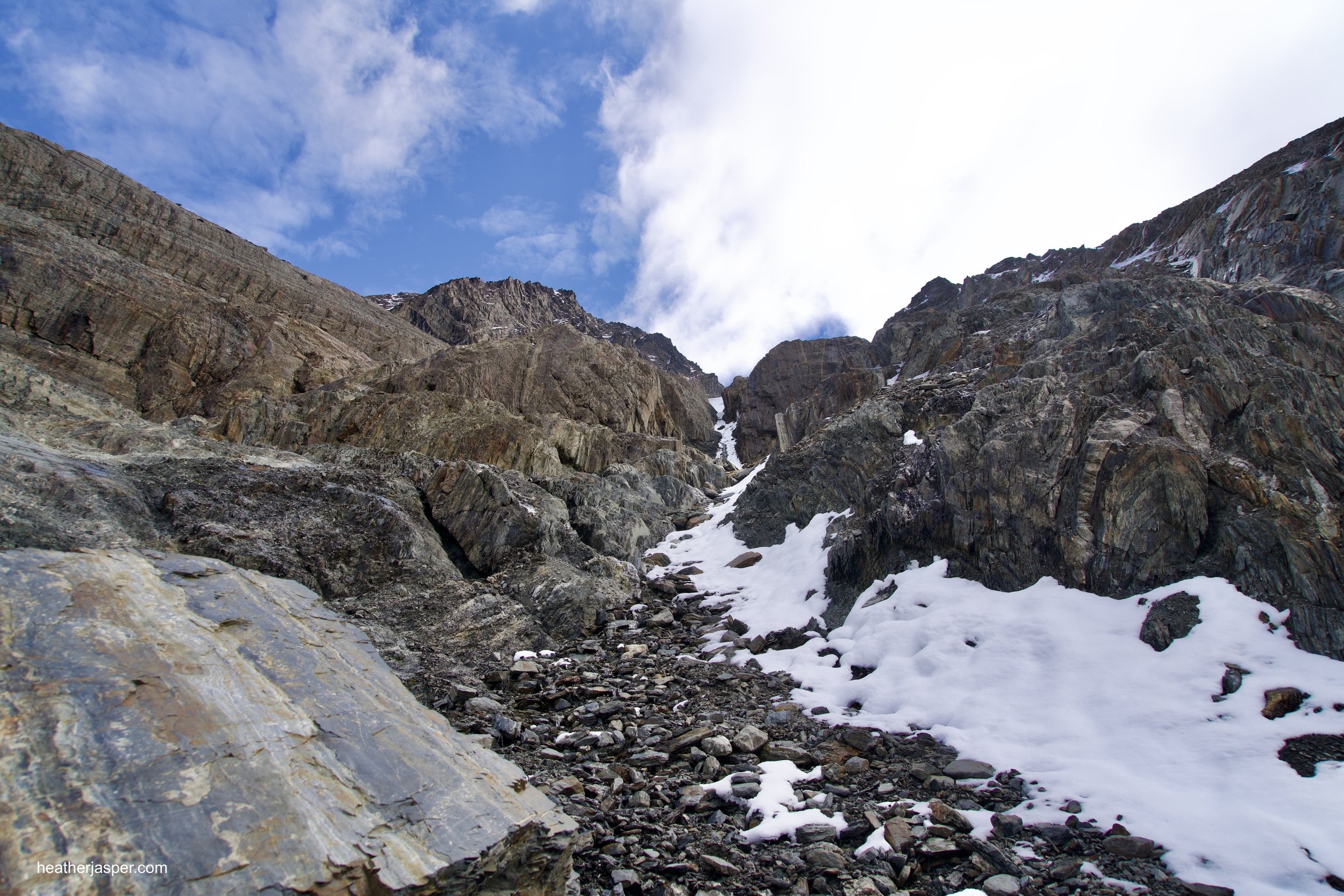
Martial Glacier
Martial Glacier is a harder trail than Cerro Alarkén, but has even better views. There are several ways to do this trail. The long version starts in town near Altos Ushuaia Hotel & Restaurant. On the right side of the road, there is a trail that heads uphill through the forest. It’s very clearly marked with yellow signs and yellow paint on some trees. It took me about an hour walking slowly and taking lots of photos to get from the trailhead to the ski resort.
You can also drive or take a taxi up to the ski resort. At the parking lot there is the famous Cabaña de Té tea house and a the restaurant Refugio de Montaña which serves hot drinks, (including mulled wine), and hearty dishes like burgers and stews.
From the ski resort, you walk up a ski run to a wide viewpoint which is where most people stop. From there, the trail is much narrower and there are a lot of loose rocks. I recommend having good hiking boots if you want to continue past the viewpoint. I loved the hike but was disappointed to find that the trail doesn’t actually take you up to the glacier. It ends at a cliff that you could climb if you had climbing shoes and ropes. I was hiking solo without any climbing gear, so I didn’t actually get to see the glacier.


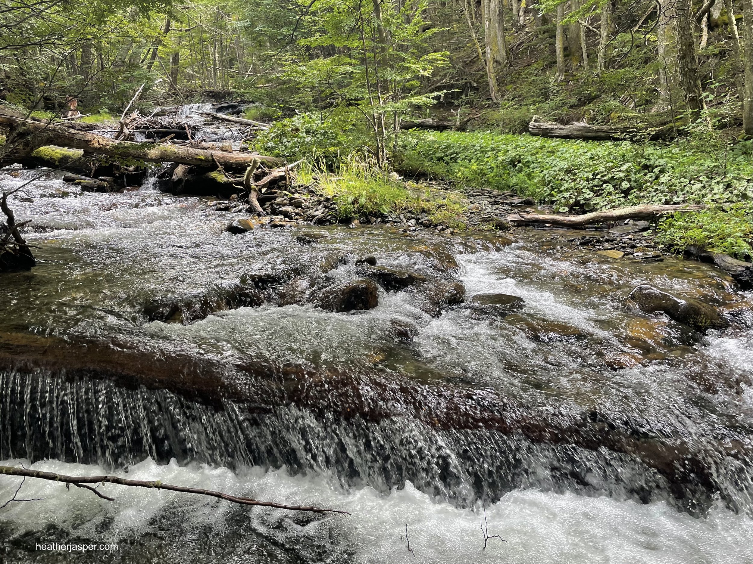
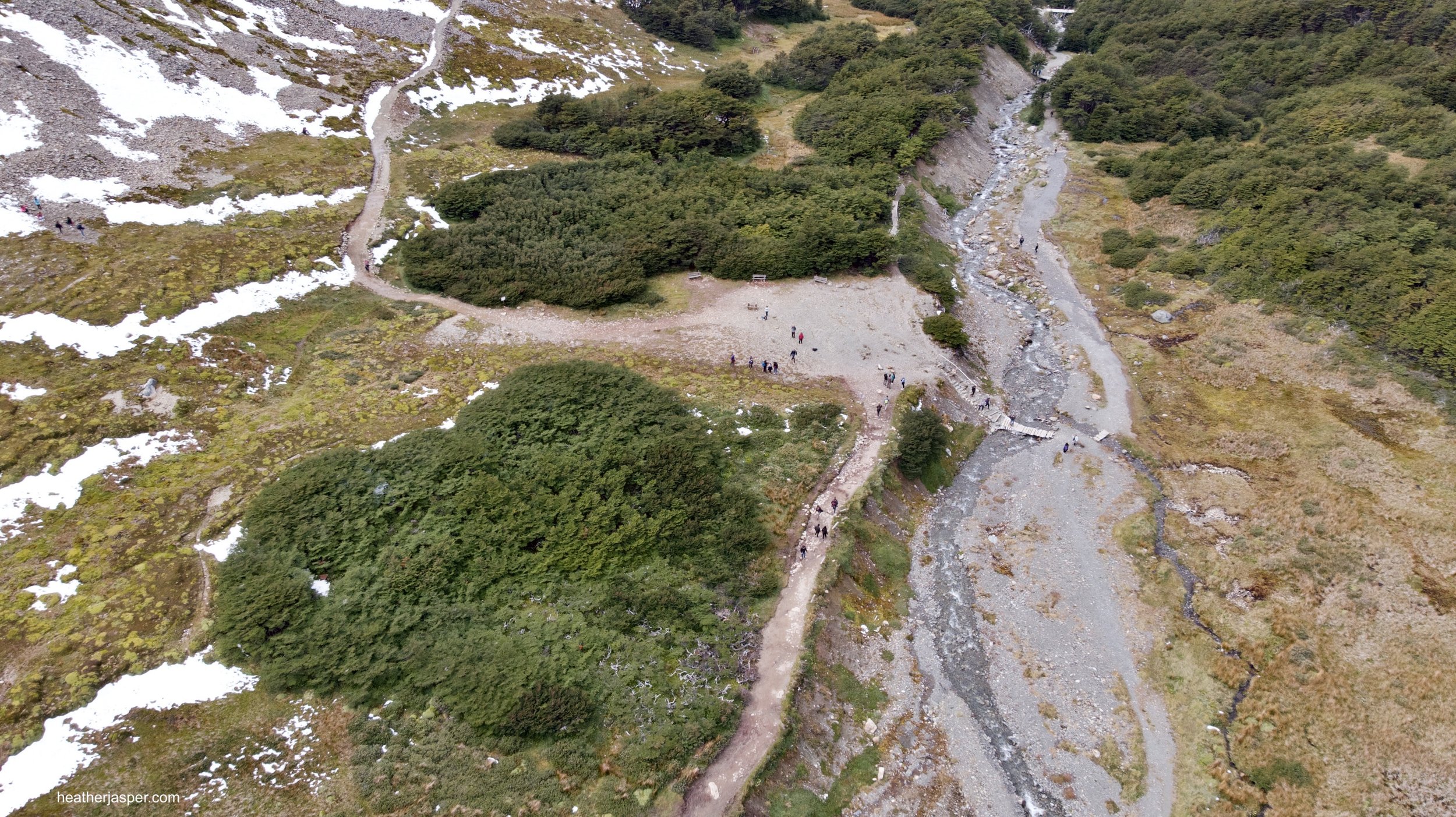
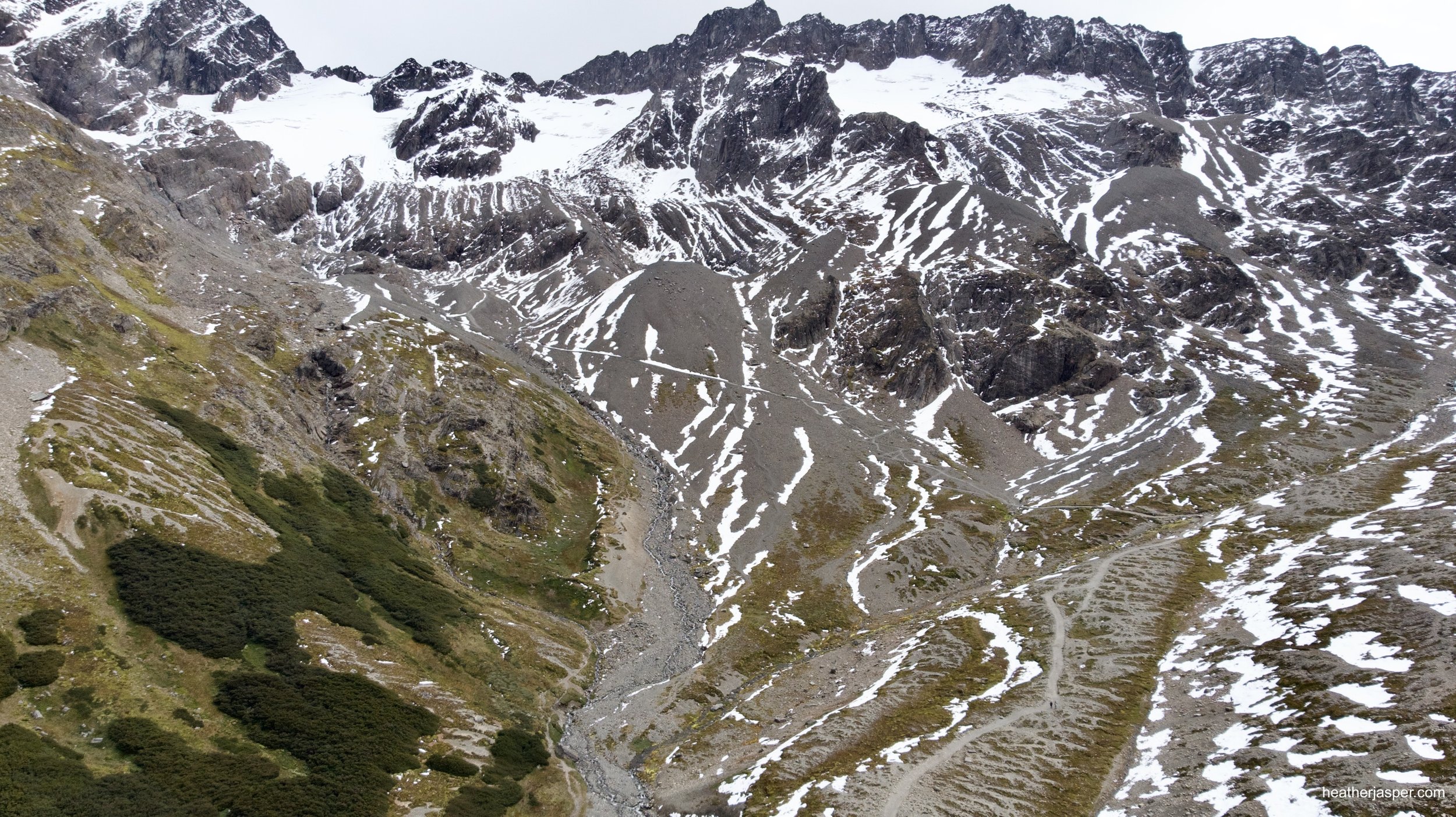
Follow the stream to Martial Glacier
The trail from the edge of town leads from Ushuaia up to the Martial Glacier ski resort. Many people drive up to the ski resort and walk from there but if you have time I recommend taking the trail that follows this stream up to the resort.

Martial Glacier Hike
This was a really fun hike and I loved the view from the top. The trail was in great shape and easy to follow when I was there but I expect when there’s fresh snow the top section would be harder to follow. I recommend going on a day when there isn’t much wind or fresh snow.
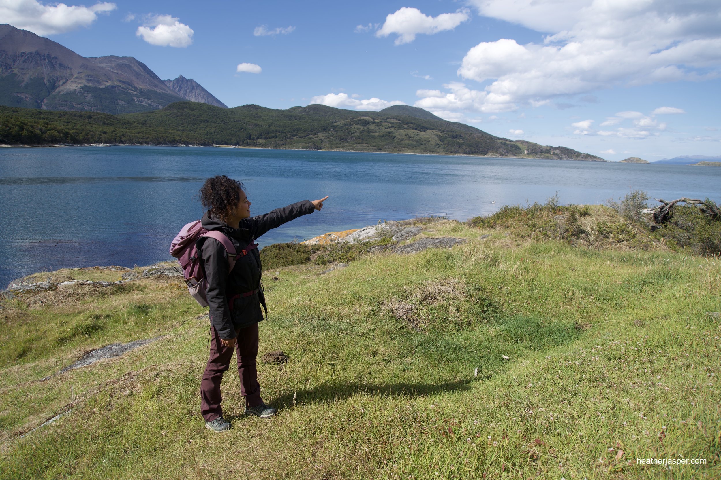
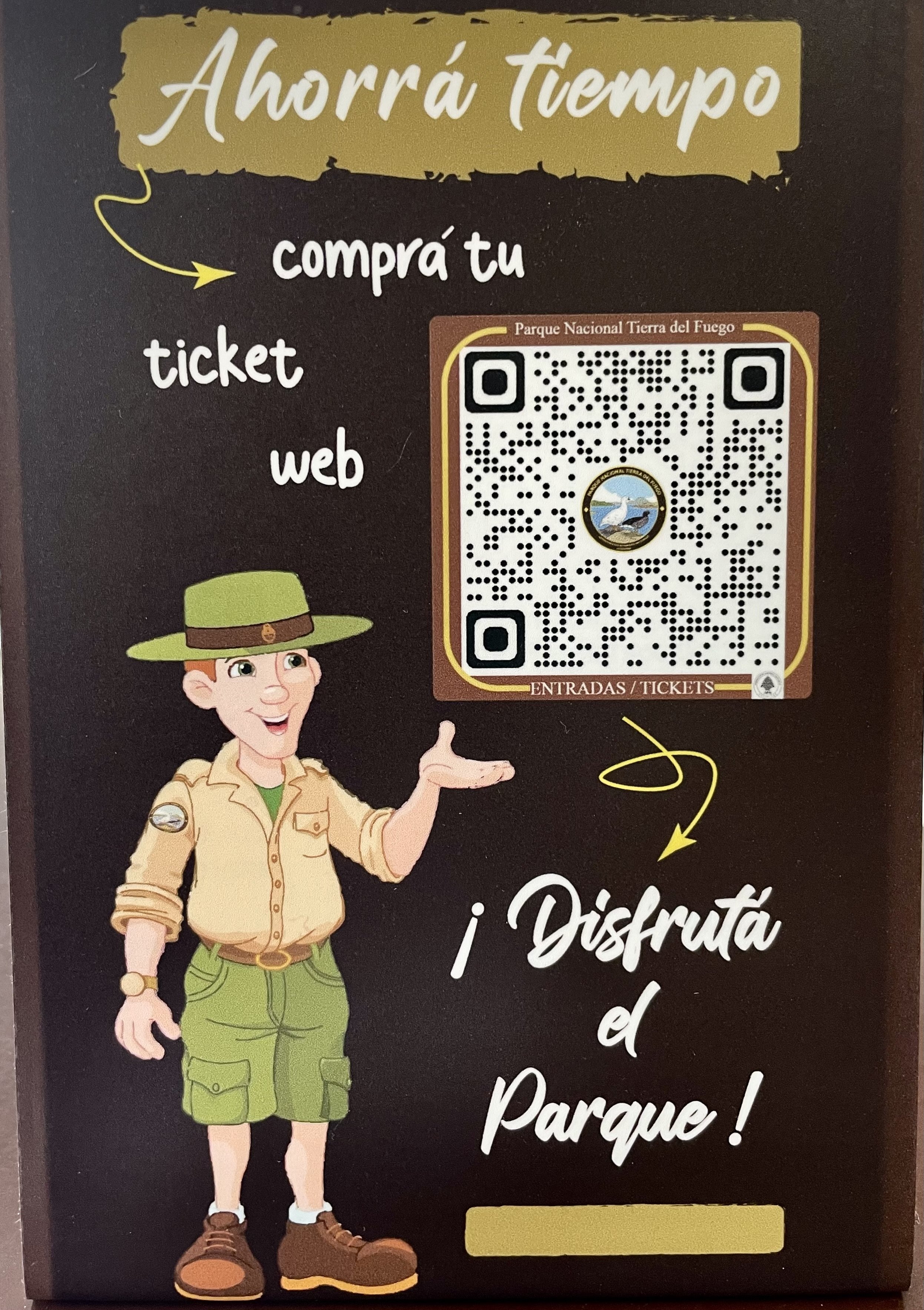
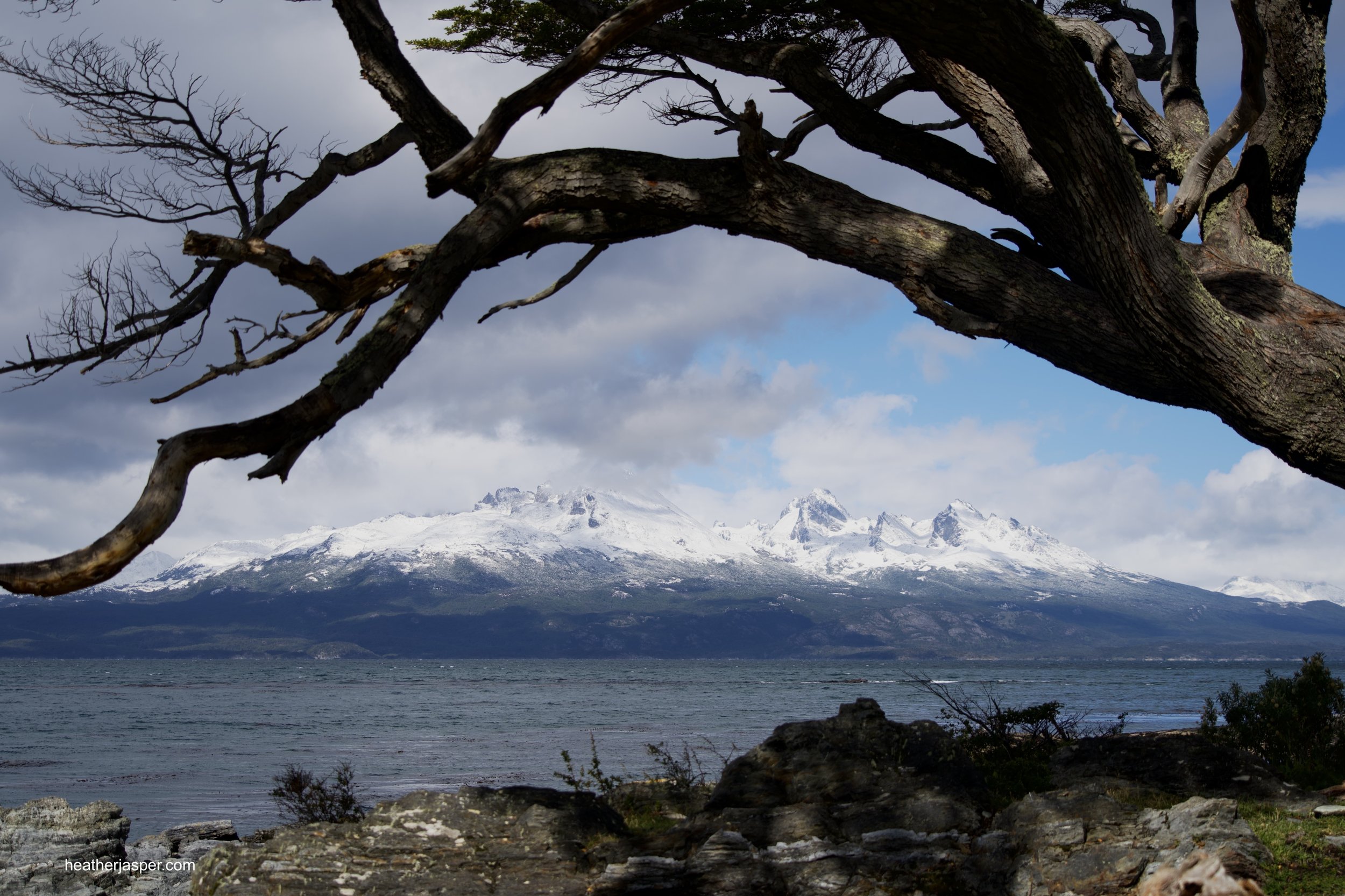
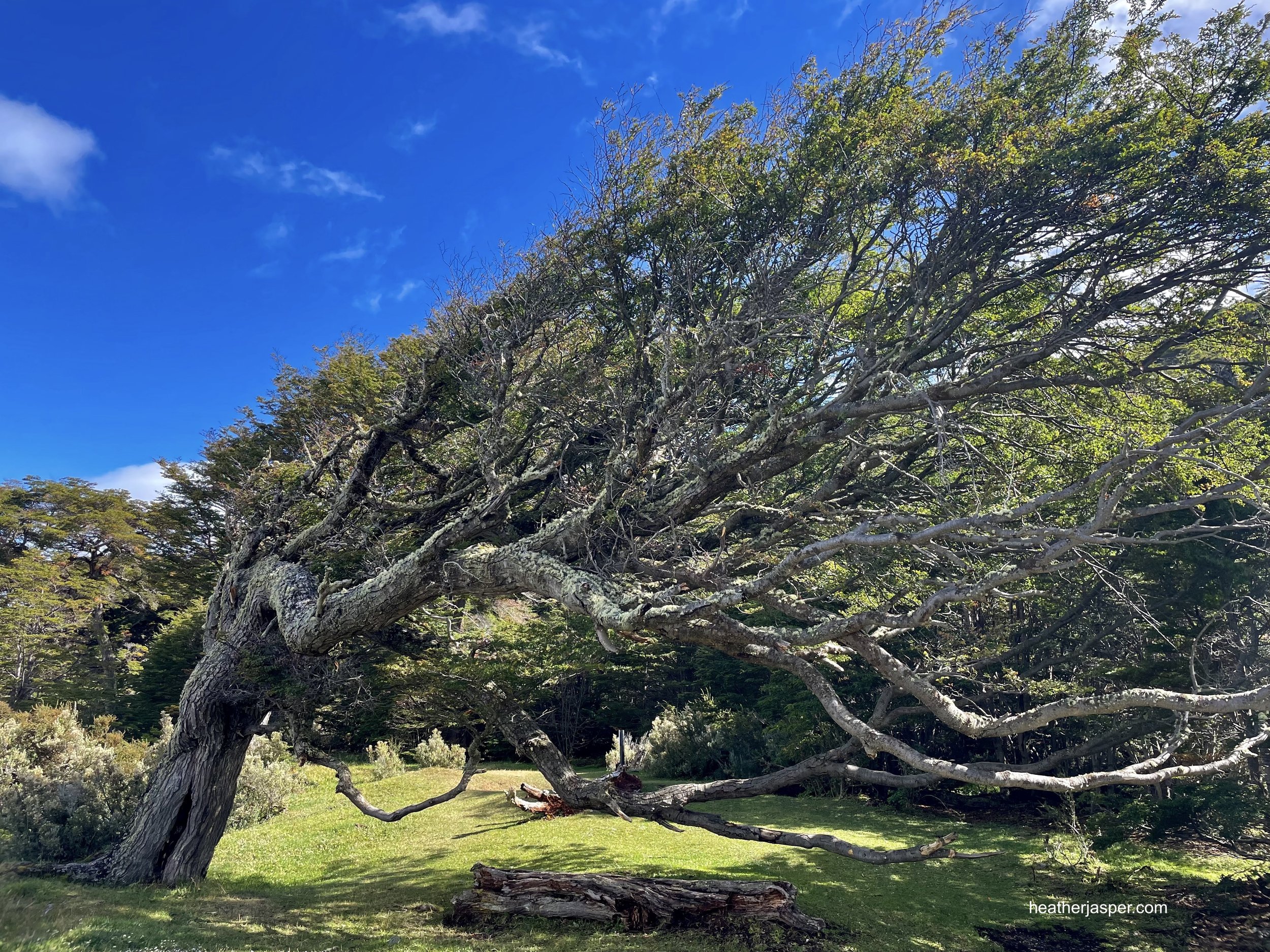
Tierra del Fuego National Park
If you have more than one day in Ushuaia, schedule a full day for the national park. The park entrance has an interpretive center with a great exhibit that explains the regions glaciers, past and present. This is the best place to learn about the geology of Tierra del Fuego.
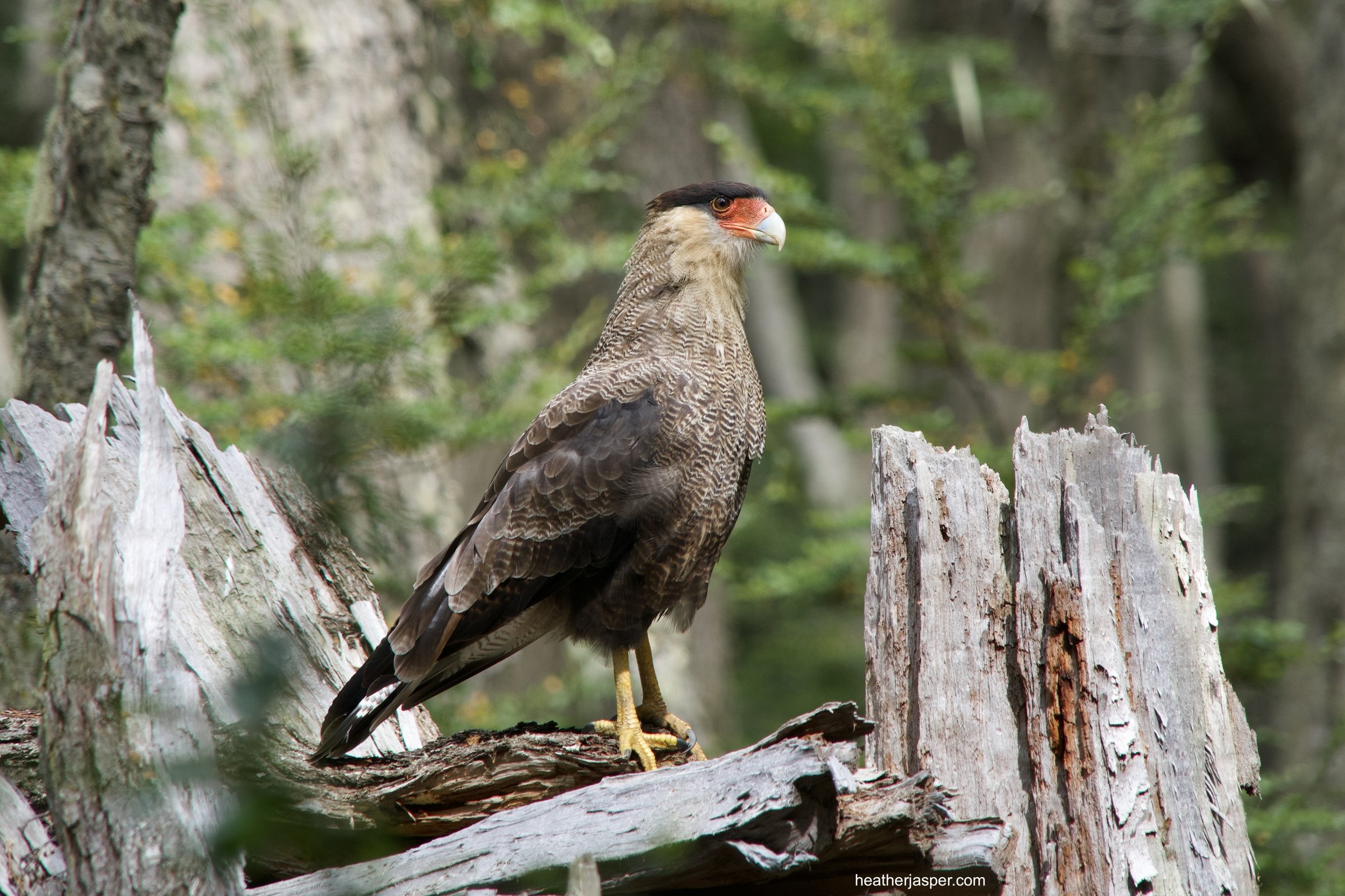
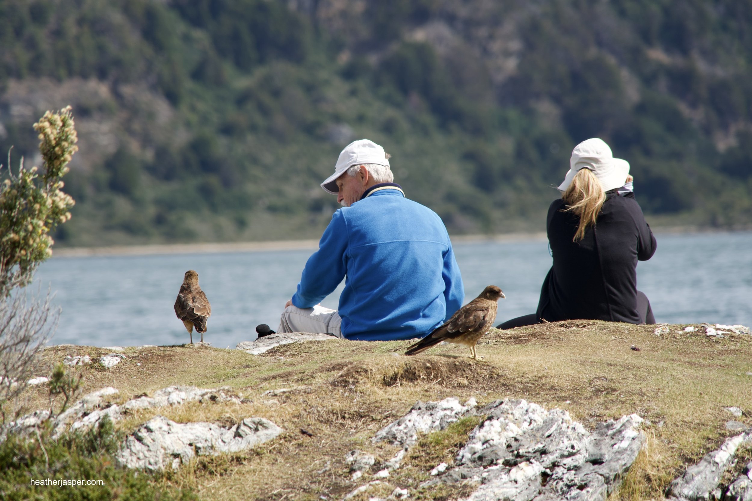
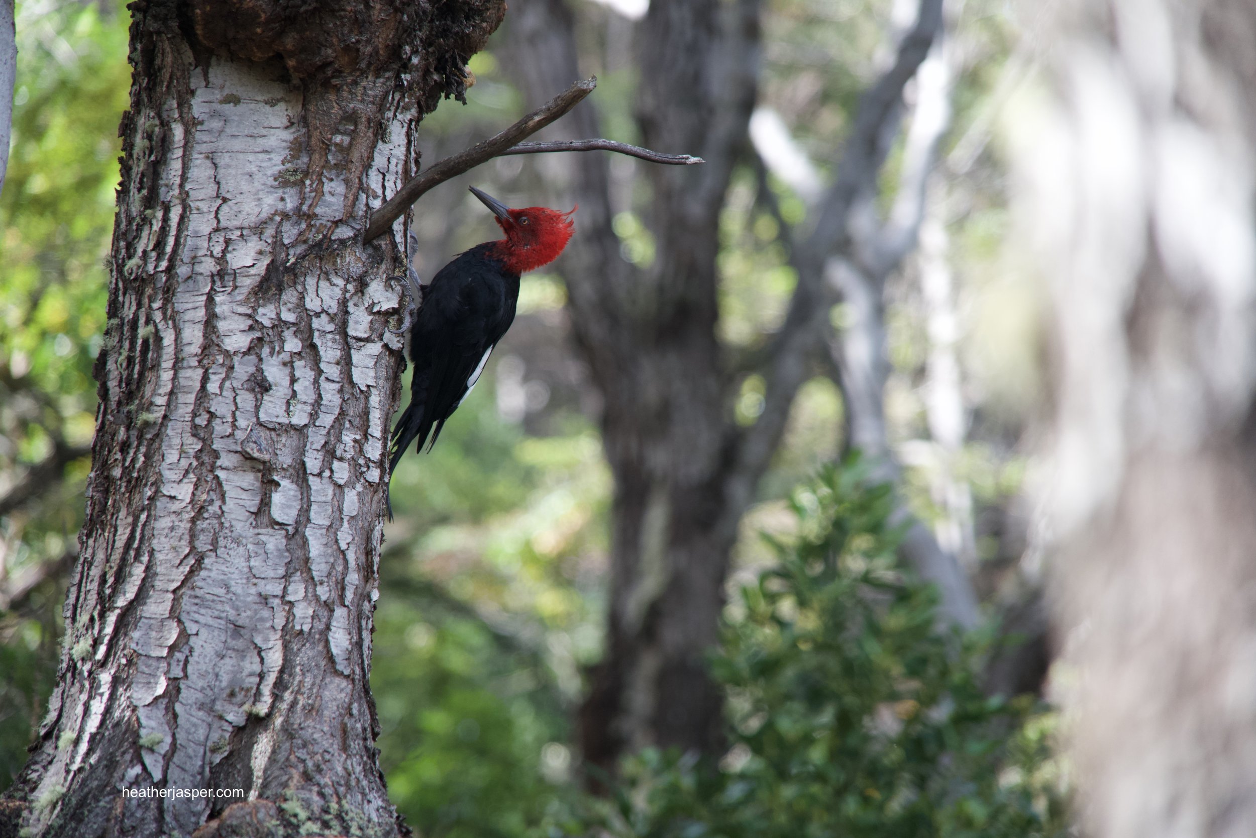
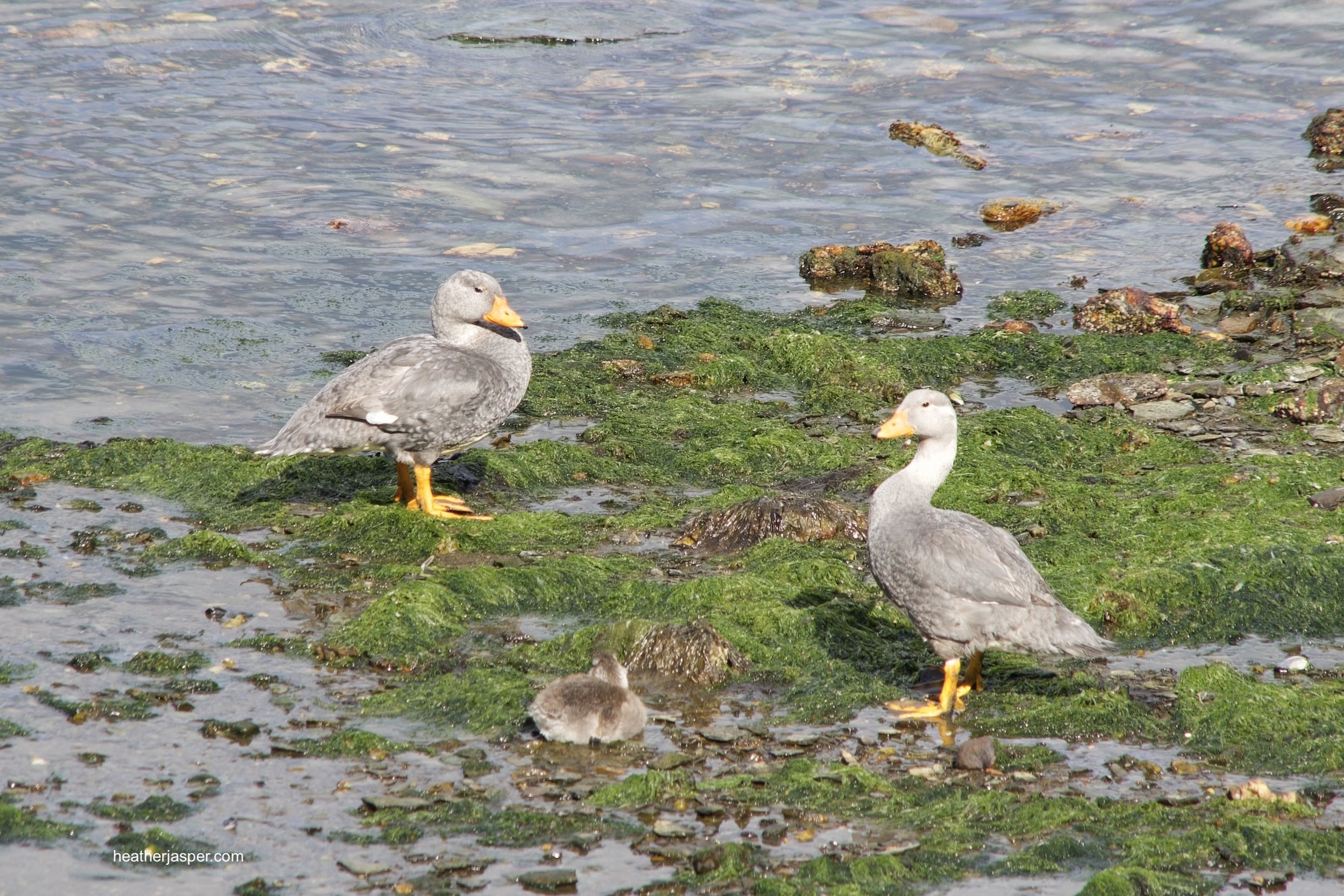
I saw lots of birds in the forest and on the water. In the photos, the birds are Crested Caracara, Chimango (which are clearly not afraid of people), Magellanic Woodpecker, and a pair of Vapor Ducks with a duckling. I also saw king fishers, petrels, albatrosses, cormorants and lots of small birds in the forest that were too fast for me to identify.
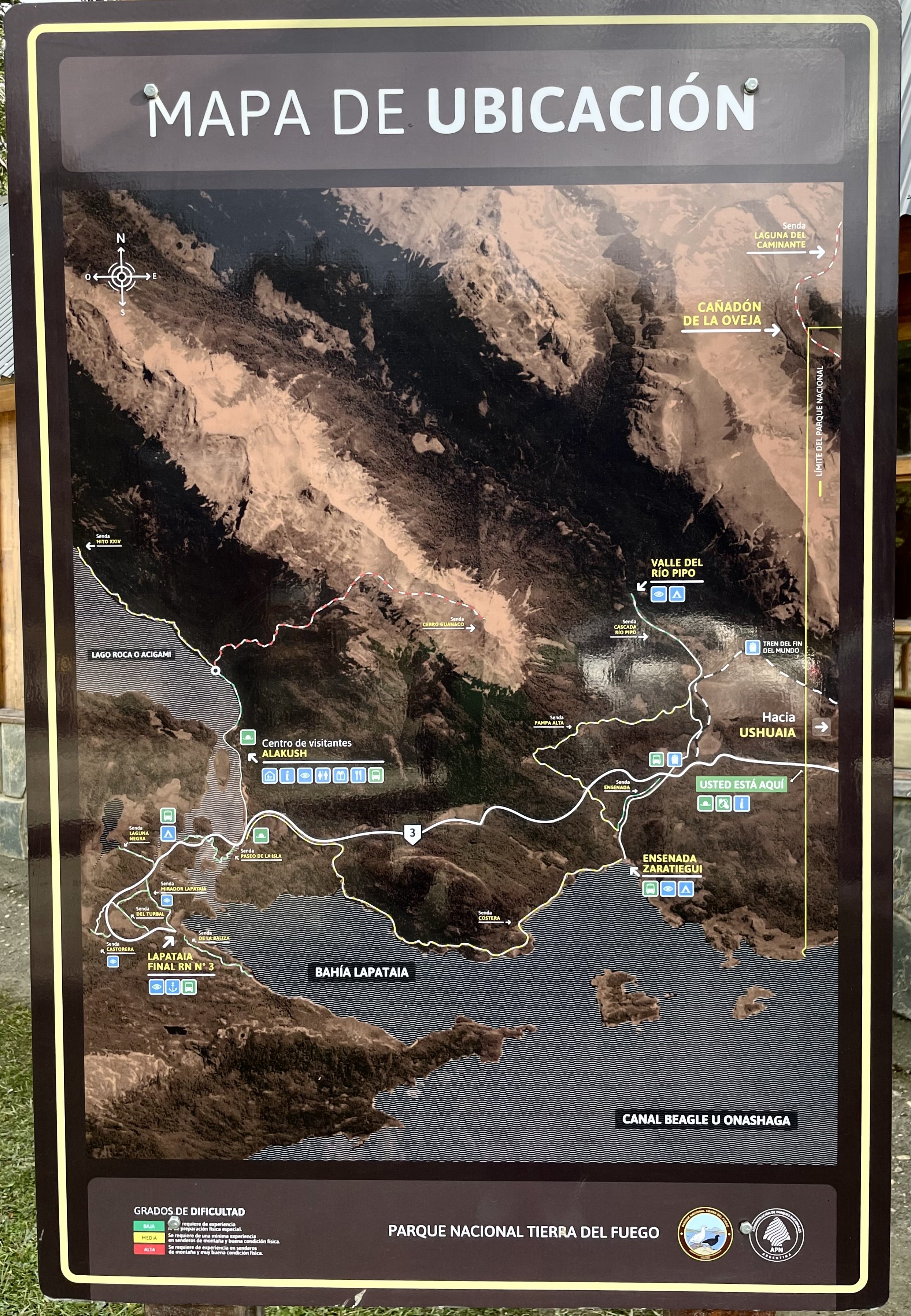
Tierra del Fuego National Park
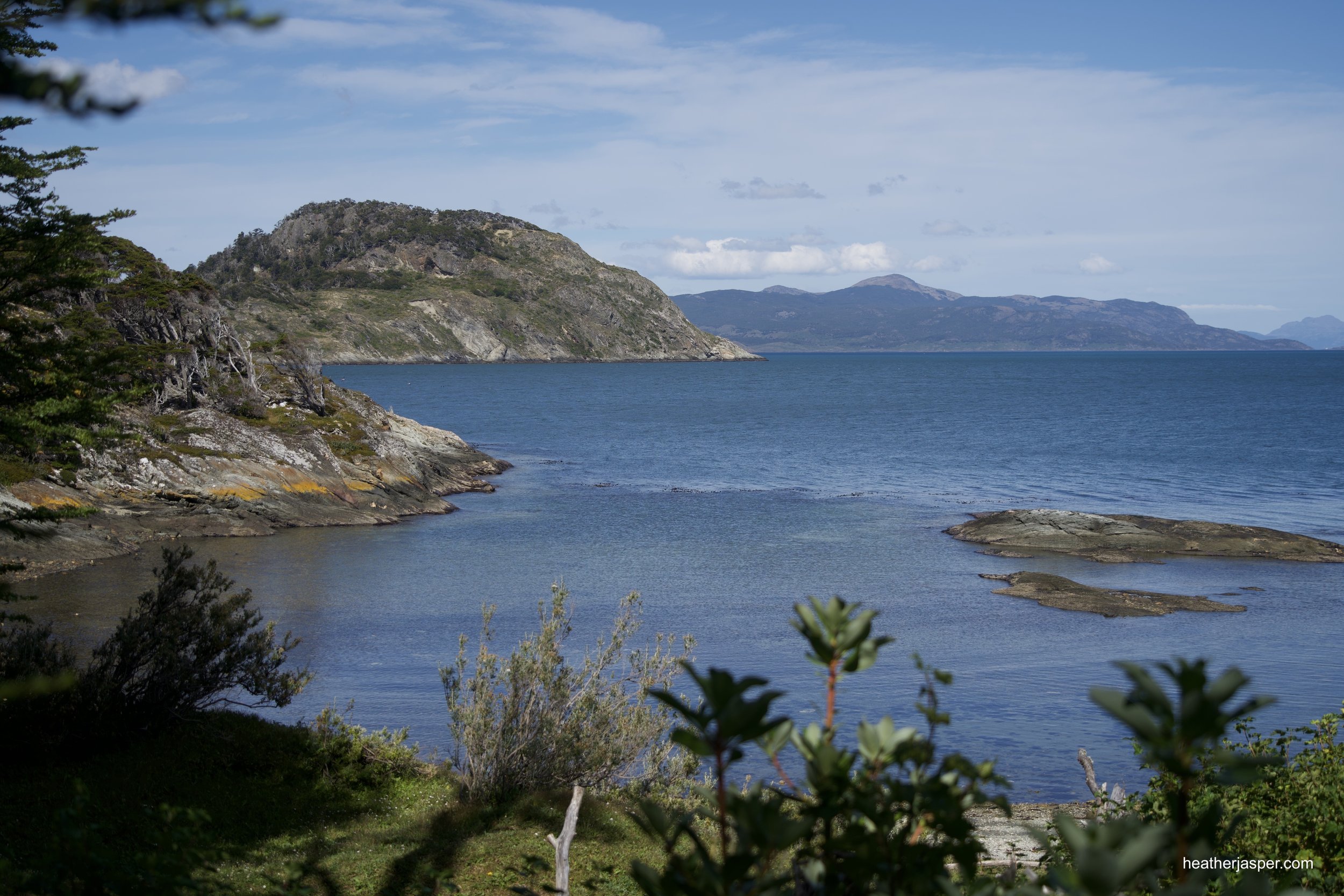
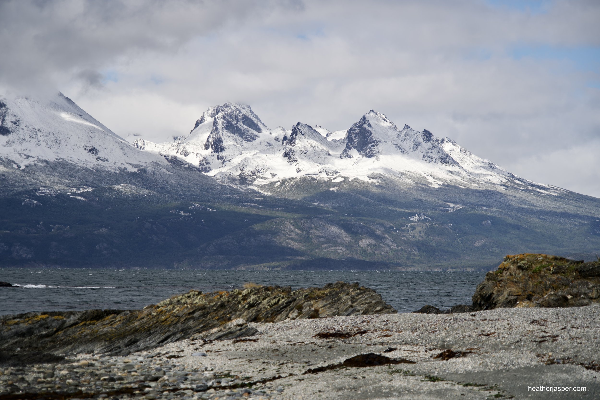
The park is on the coast west of Ushuaia and has several great hiking trails along the water. You can camp in the park, including on the small islands between Lago Roca and the Beagle Channel. Lago Roca was named Acigami by the native Yamana people and the Beagle Channel was called Onashaga. The name Beagle comes from the first voyage of the Beagle, the trip before Charles Darwin sailed on the ship.

Laguna Esmeralda is famous for its milky turquoise waters, the result of glacial sediments.
Laguna Esmeralda
Laguna Esmeralda is one of the most popular hikes near Ushuaia. Only an 11 mile (18km) drive from town, the trail head is easy to find. Roundtrip, the hike is about 5.5 miles (9km) and goes through forest and past red peat bogs.

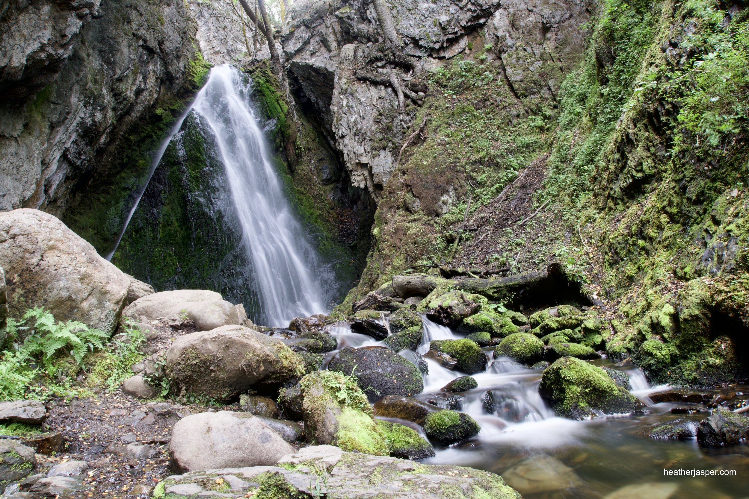
Lasifashaj Waterfall
This is a 45-minute hike on a relatively flat trail. Start at the main road to Puerto Almanza, where there’s a parking lot.
El Duende Waterfall
The Dwarf Waterfall is an easy 10 minute hike from a restaurant in Puerto Almanza.
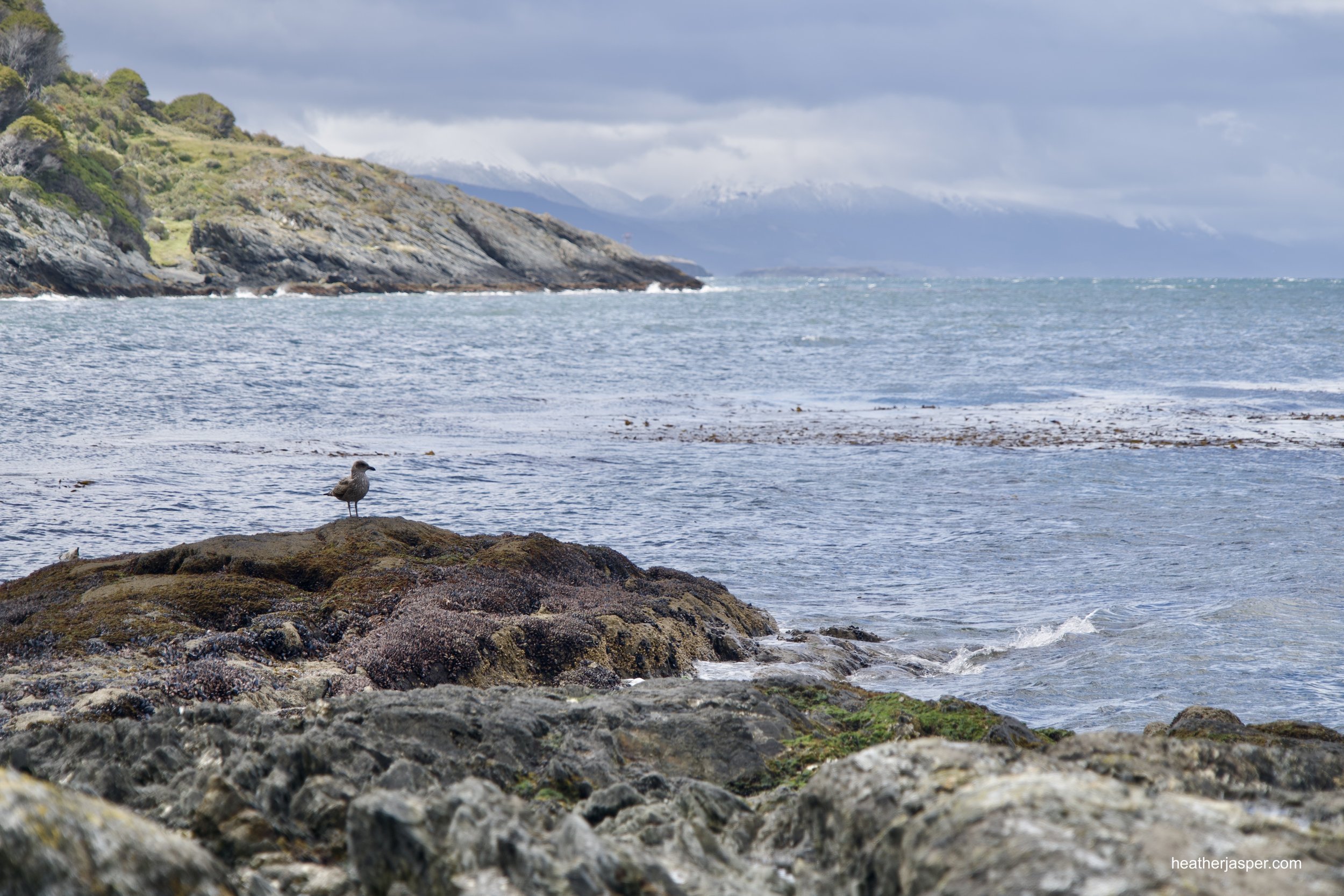
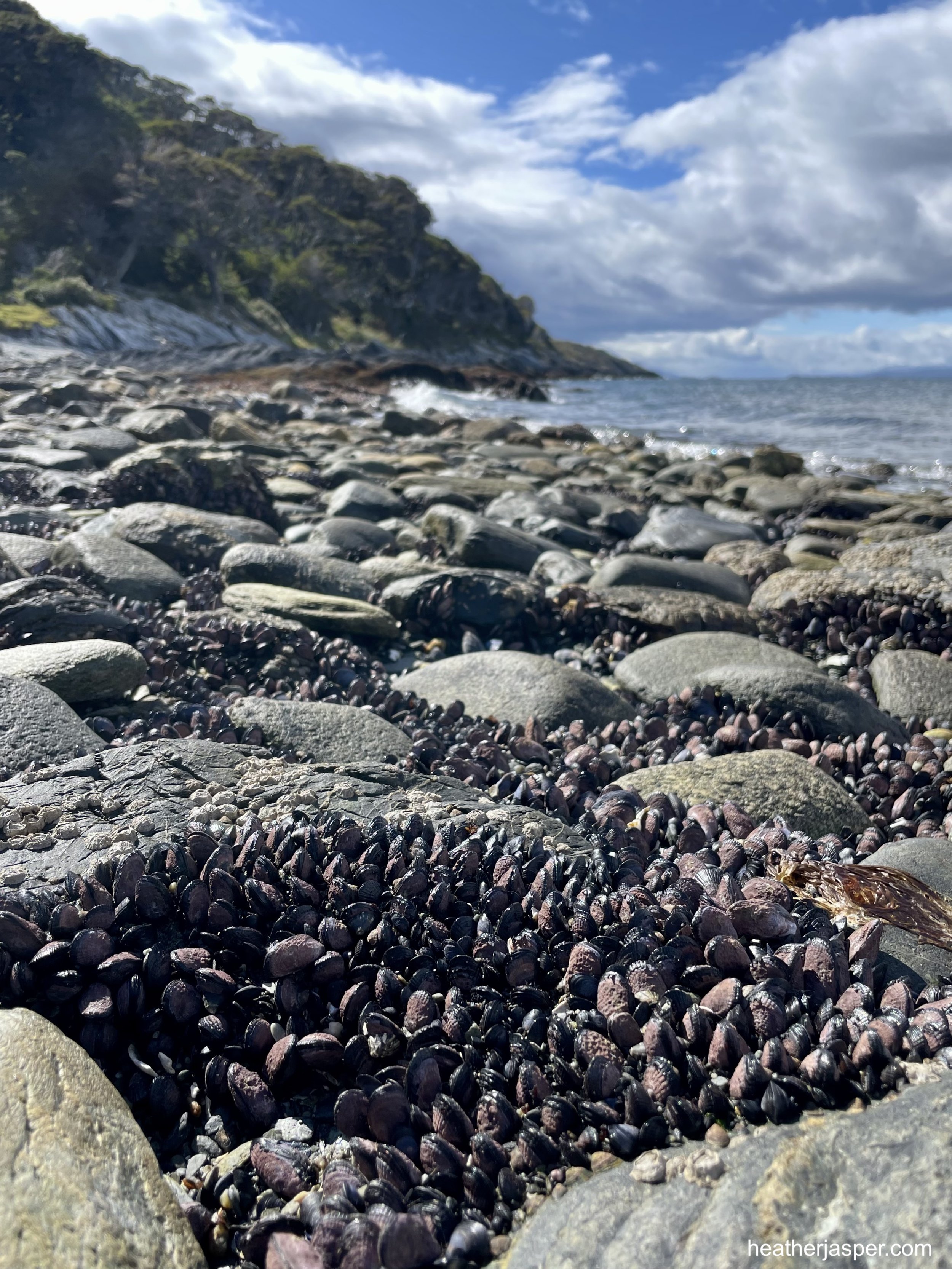
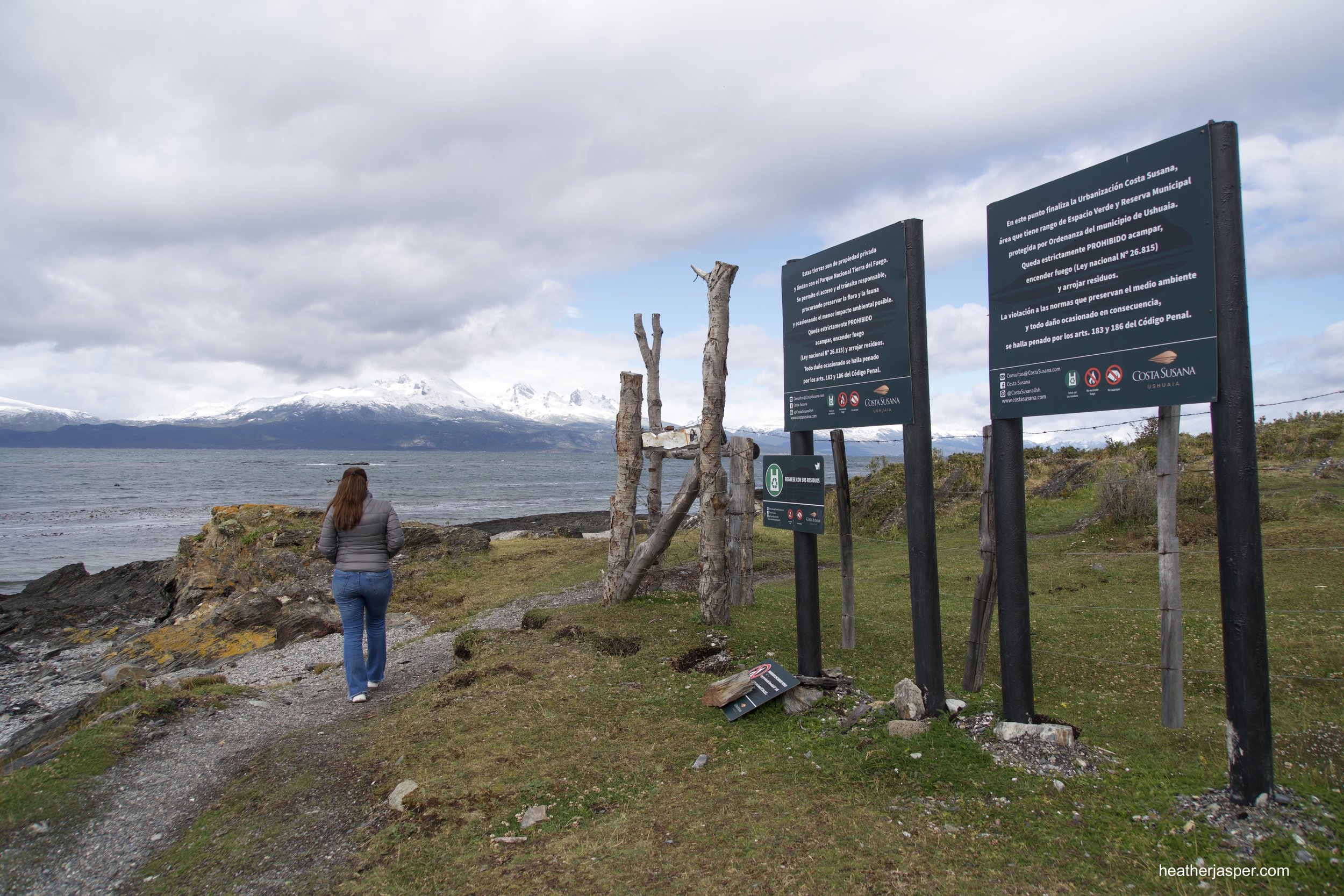
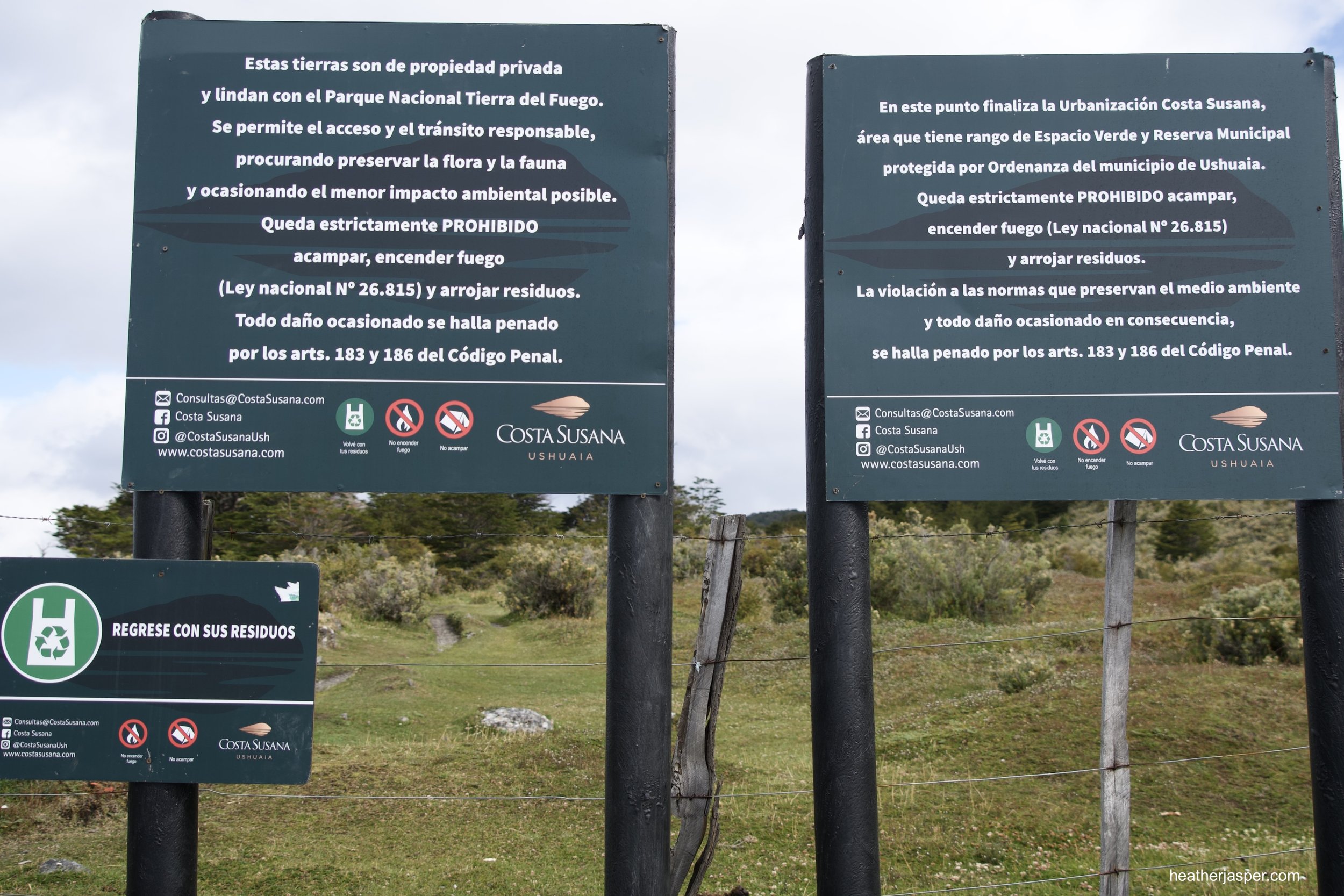
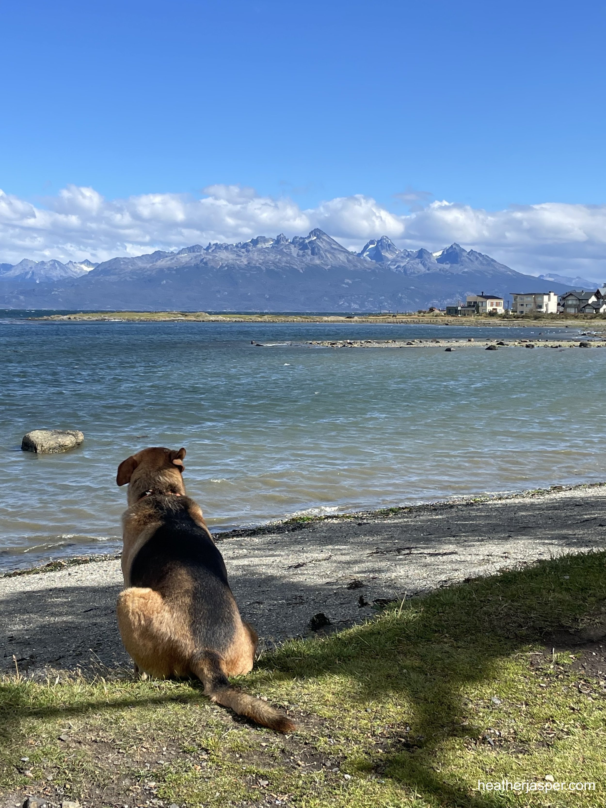
The Beagle Channel Coastal Trails
I love walking on the beach, even when there’s no sand or sun and the coast west of Ushuaia is perfect for walking. Rocky beaches have the advantage of more places for wildlife to hide among the rocks. There are several access points from the west side of town down to the coast, which is all public land. I recommend timing your walk with low tide so you can see what animals are trapped in the tide pools when the sea retreats. If you follow the Pipo River down to where it meets the Beagle Channel, you’ll be on a stretch of coast called Yámanas, after the native people of the area. West of that is an area of private land called Costa Susana which borders the national park. There are public access trails through Costa Susana to get you around areas where cliffs meet the coast and there isn’t a beach to walk on.

Río Pipo
There are several places along Río Pipo (Pipo River) where trail lead from the road through undeveloped areas. The trails aren’t on Google maps, but if you follow Río Pipo from anywhere in town, you’ll find trails and small parks.