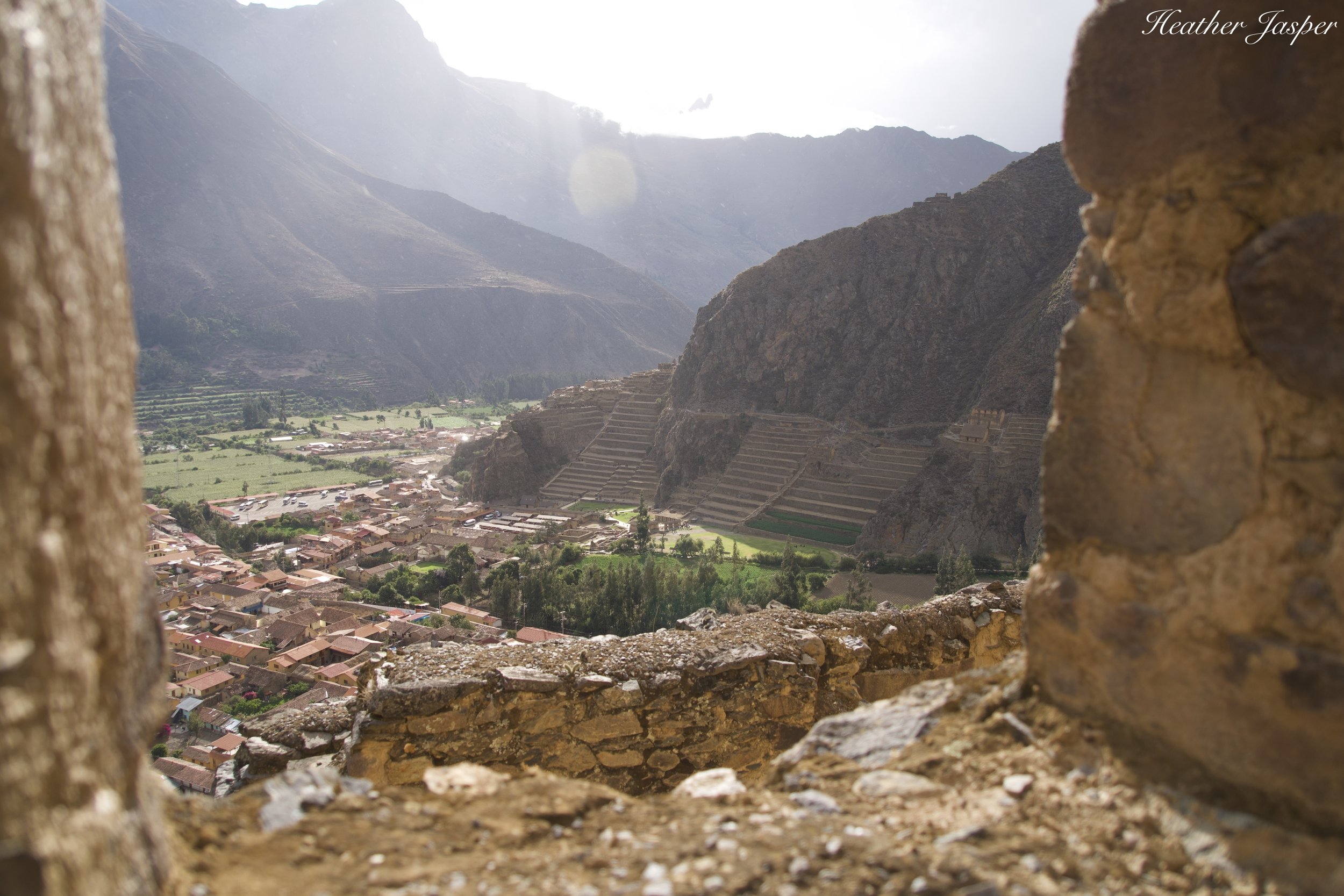
Pinkuylluna
You’ve heard of Ollantaytambo, but have you heard of Pinkuylluna?
Directly across from the Ollantaytambo Inca ruins is Pinkuylluna, a free Inca site and hike that you can do in an hour.
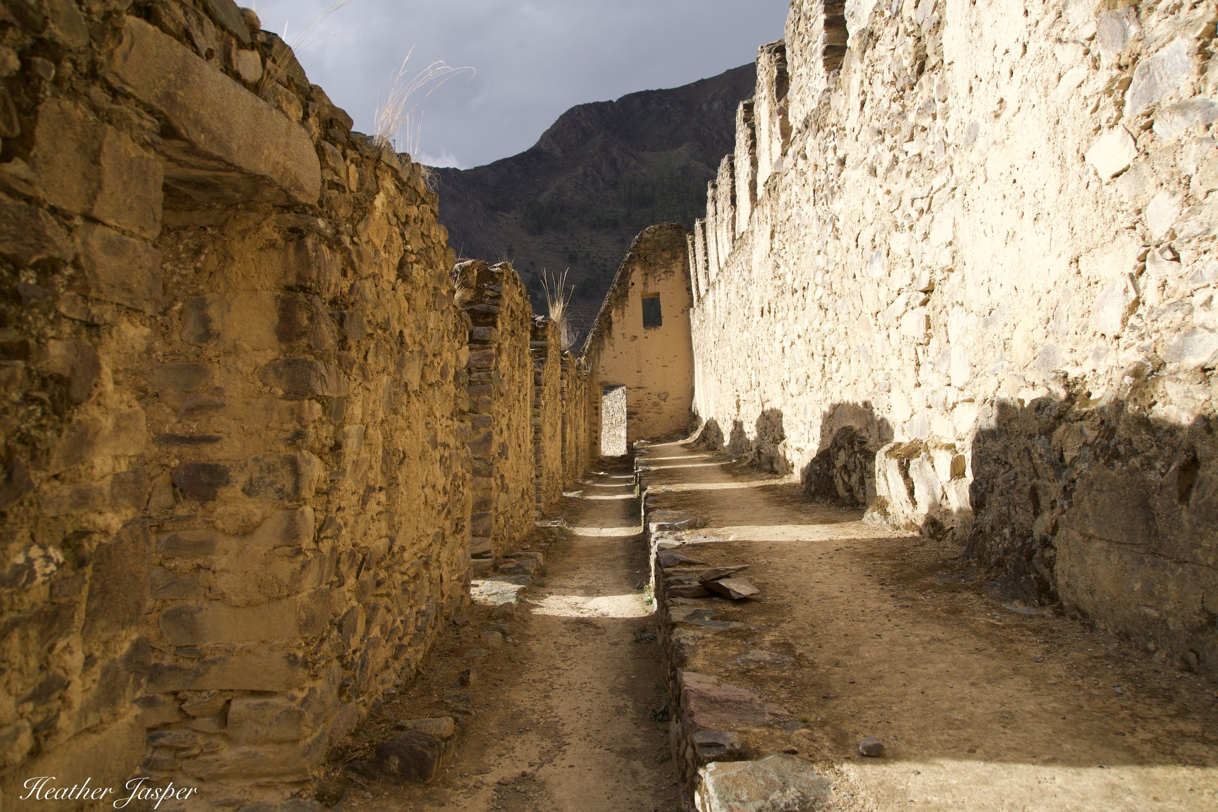
Wind howls through the narrow passageways at Pinkuylluna, creating a natural cooling system for storage.
The Pinkuylluna Inca Archeological Site
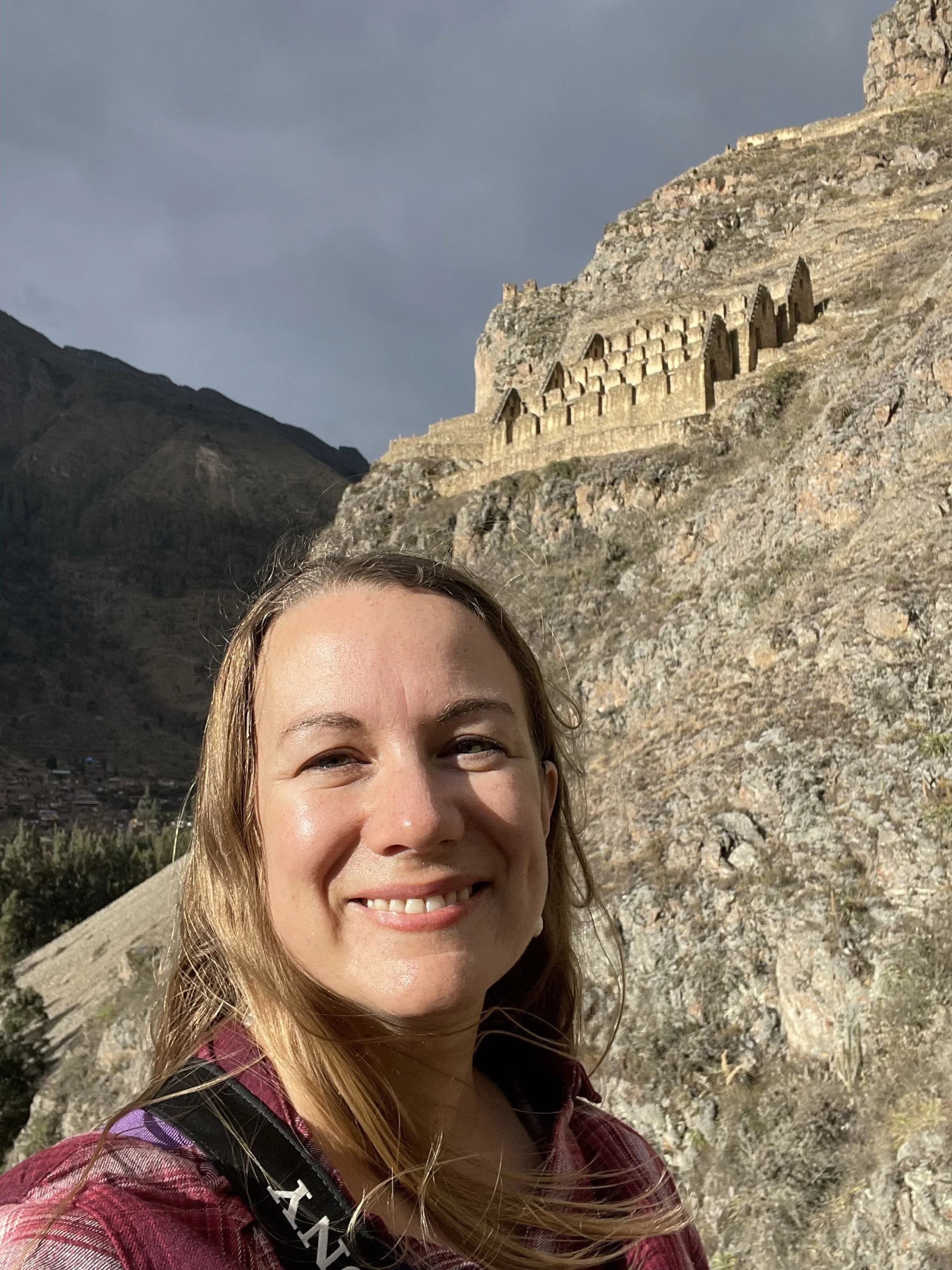
Pinkuylluna (pronounced peen-cuy-you-na) is high on a steep hillside facing Ollantaytambo. You can’t miss it! I recommend taking two hours, so you can explore the site and have plenty of time for photos. It’s also my favorite picnic spot in Ollantaytambo.
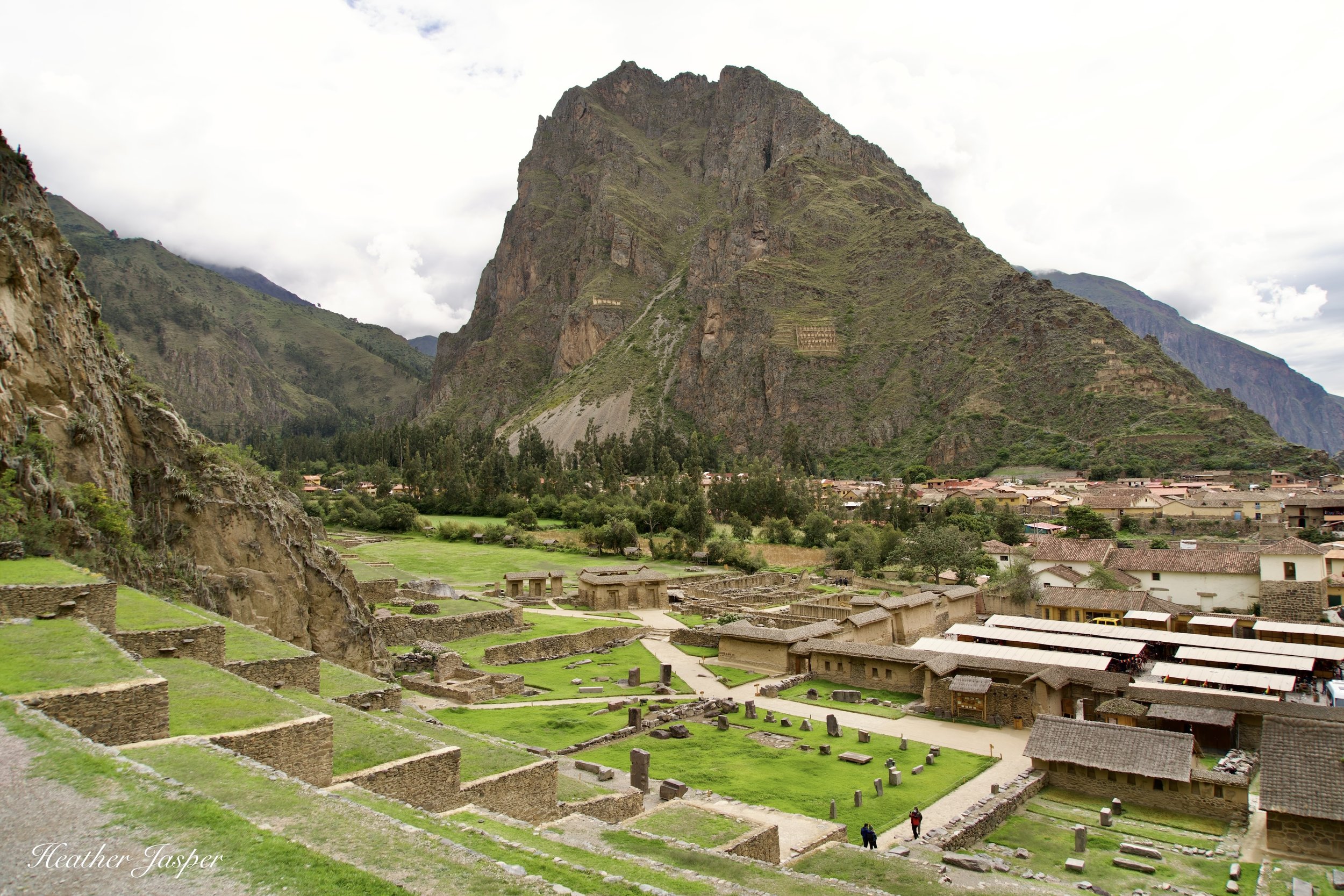
From the main Ollantaytambo Inca archeological site, look across town and you’ll see Pinkuylluna on the opposite hillside.
Called Ccolcas in Quechua & Graneros in Spanish
The structures were once storage for dried food and other goods. The word for storage buildings in Quechua is ccolca, which is sometimes also spelled qolqa. They’re built on a very windy hillside and designed so that wind blows across the back wall and through spaces underneath the storage area, which created a natural cooling system. They haven’t been used in over 500 years and what’s left is the walls, as the roofs made from straw and wood disintegrated centuries ago.
You can still see remnants of the yellow clay that once lined the walls inside and out.
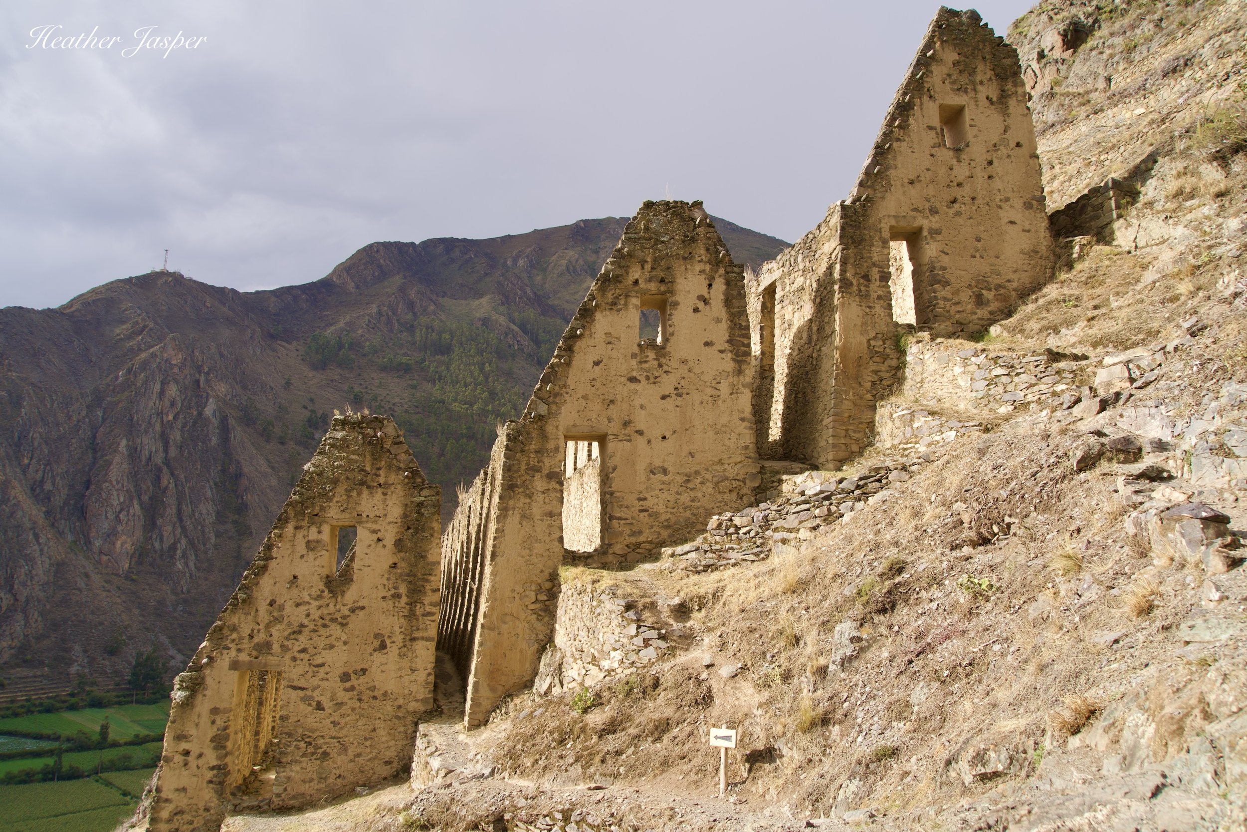
The walls are stone, and you can still see the yellow clay that sealed the inside walls, keeping out moisture and insects. The three rows of the main structure are tall buildings, made so people can walk inside. The lower structures are squarer and squatter, with small holes in the bottom wall. They’re designed so a person standing on a rock ledge above can pour grain through an opening in the roof. The hole in the bottom wall is about 30cm/10in. in diameter, just the right size to remove a plug and have grain pour out into a waiting basket.
The structures in the foreground are the square grain storage bins, with the town below and Ollantaytambo ruins behind.
So far, historians haven’t found any drawings that show how these storerooms were used, so what I’m writing is the best theory that archeologists have come up with for now. Research is ongoing and if I find better information, I’ll update this blog.
Wind howls through the narrow space between the three rows of storage, sometimes producing low musical notes.
The name Pinkuylluna is Quechua
The name means “the place where the pinkuyllu plays.” The pinkuyllu (pronounced peen-cuy-you) is a kind of Inca flute. It’s possible that people used to climb up to the site to play flutes, but more likely it’s a poetic name for a windy spot. The way that wind howls through the narrow spaces between the buildings both cools them and sometimes sounds like a flute.
The windows on the left let in light so people walking on the path could see the food stacked against the back wall, which was cooled by the wind on the uphill side.
Plan two or three days for Ollantaytambo
Ollantaytambo is my favorite town in the Sacred Valley and was selected as one of the best places in the world to go in 2023 by Condé Nast. Since then, the town has continued to improve accessibility for travelers, including upgrading the trail to Pinkuylluna with more handrails and widening some sections of the trail.
Read my Ollantaytambo blog to learn more about the main archeological site there.
There is another row of storage if you keep hiking past the main part of Pinkuylluna, but the trail is more treacherous and the handrails aren’t as good as the main trail.
Pinkuylluna is a quick hike
This is my favorite place to go if I have a spare hour or two in Ollantaytambo. There are great views of town, the main Ollantaytambo archeological site and even Inti Punku from the trail, so you don’t even have to hike all the way to the top to enjoy the trail.
How to get there?
The trail up to Pinkuylluna starts in town, about 120 meters/400 feet from the corner of Ollantaytambo’s plaza that has an ATM. (There’s still only one ATM in town, so this is a better reference than you might think). The trail starts on Calle Lares, between Calle 1 and Calle 2. (Calle means street in Spanish).
Rules for Pinkuylluna
They’re pretty standard rules: no climbing on walls, no camping, no fires, no alcohol, no drones, no graffiti, no pets and no leaving trash.
Open 7:30 to 4:30
The last entrance is at 4:30 but at around 4pm, the caretaker hikes from the entrance up to the ruins to start clearing people out. You don’t really have to rush, as the gates aren’t locked until around 5pm.
Pinkuylluna is my favorite place to take photos of Ollantaytambo.


