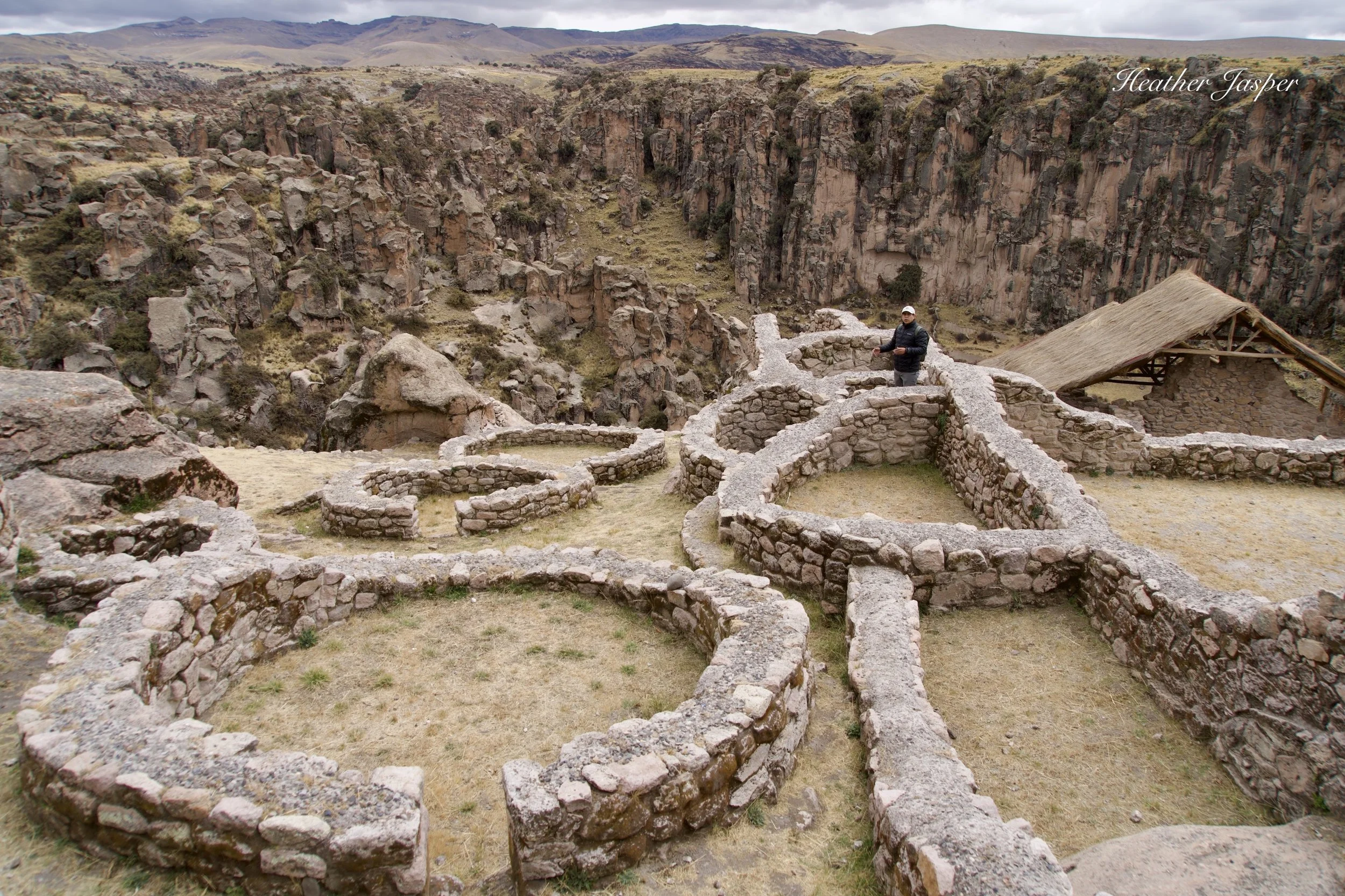
Archeologist Emerson Pereyra Pacheco shows which structures were tombs and which were homes.
First, how do I know about Taqrachullo?
I visited Taqrachullo on August 23 with archeologist Emerson Pereyra Pacheco and historian Lilia Vargas León. The visit was organized by Inkari to train tour guides who want to lead tours to Taqrachullo. I also read the article by Alejandro Muñoz published in National Geographic UK in June.
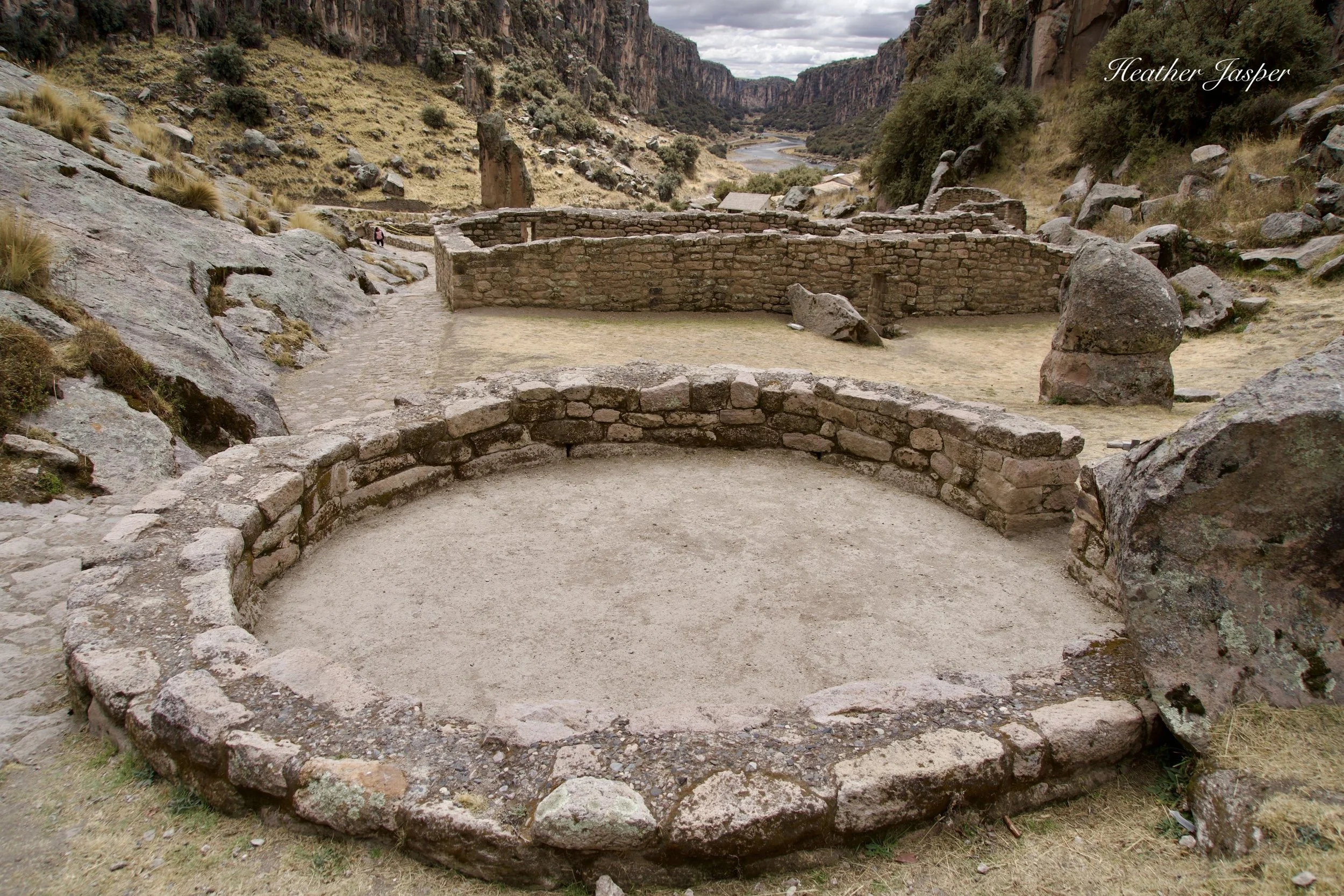
These structures are below the llaqta, near the entrance that leads up to the city on the top of the mesa.
What is Taqrachullo?
Taqrachullo is an archeological site that used to be a giant city on a mesa at the confluence of three spectacular canyons. The surrounding puna plains make the location extremely windy, especially on top. Archeologists believe that the buildings are round, in part so the wind didn’t have any flat walls to batter.
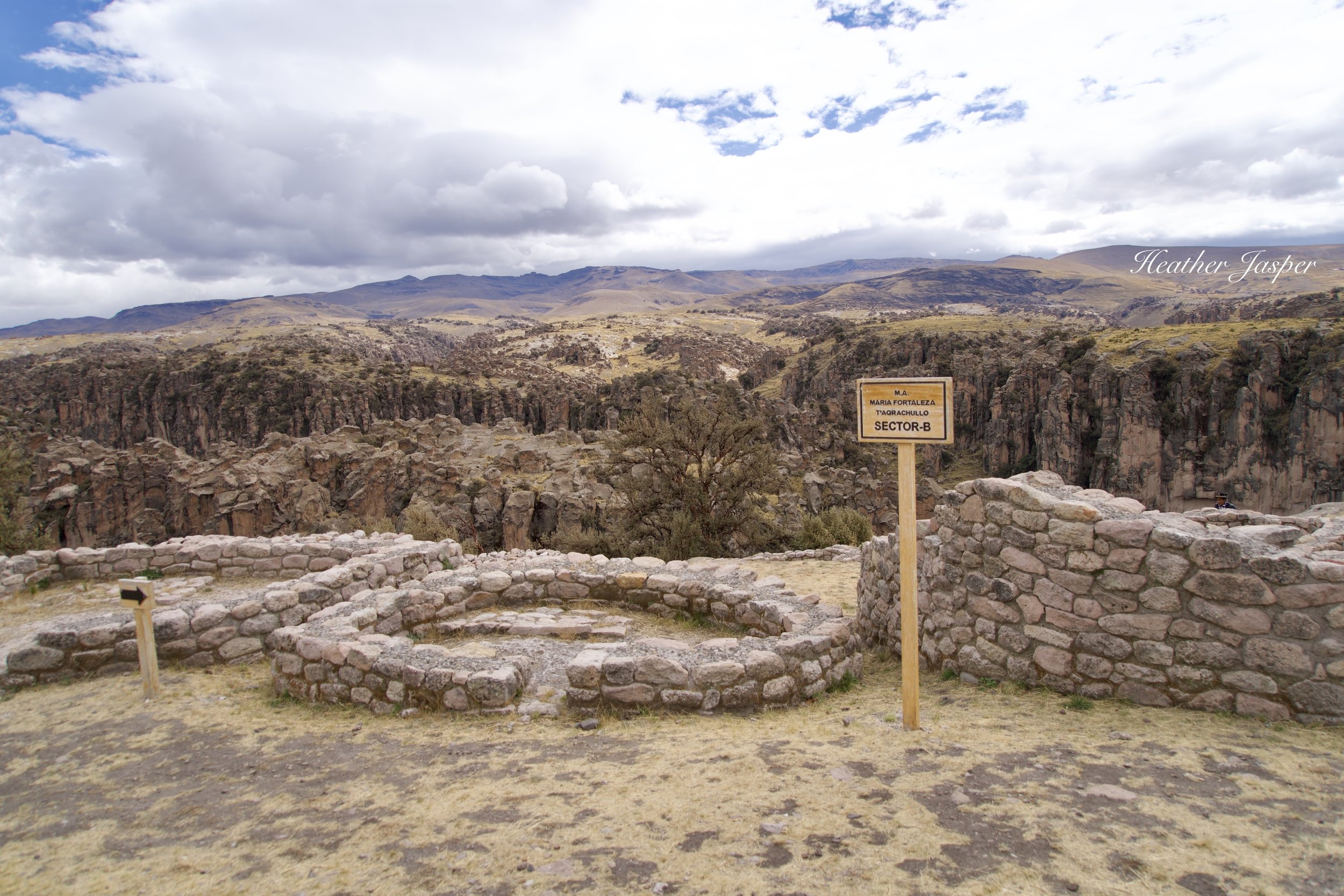
The Taqrachullo llaqta is divided into sectors, though you have to pay attention at the entrance for what is in each sector because there are no printed brochures or maps.
The Taqrachullo llaqta about 16 hectares (40 acres), including the central part of the city, called the llaqta, and outlying “suburbs” of the city. It’s about the size of the Machu Picchu llaqta, though Machu Picchu Historic Sanctuary is many times larger than the entirety of Taqrachullo. (Llaqta, pronounced yack-ta, is the Quechua word for town).
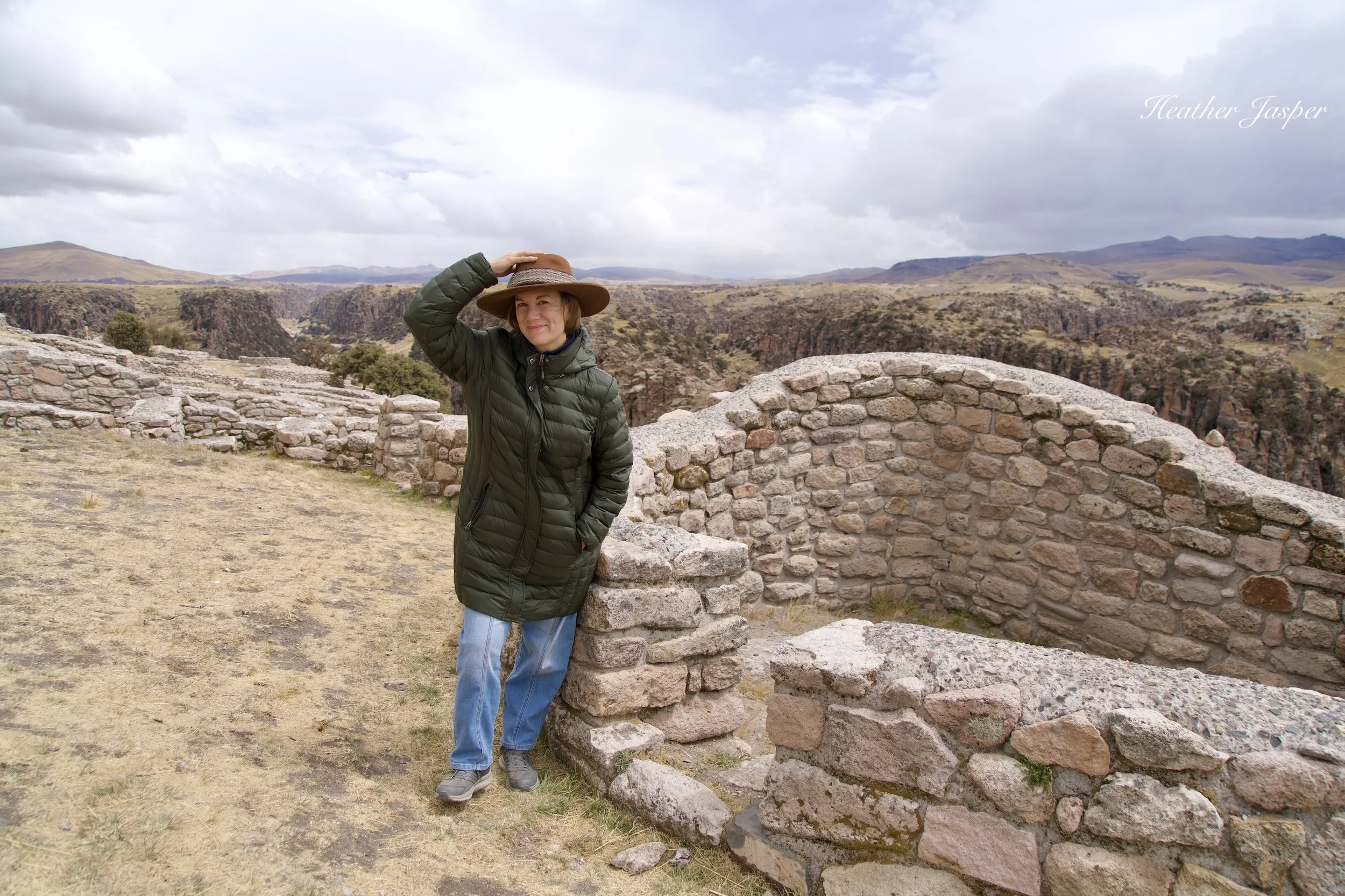
I could see why the Spanish didn’t stay. It was cold and so windy my hat was blown off several times.
In recent history it was called María Fortaleza, a name given by the Spanish. They recognized Taqrachullo as a very important place and habitually built churches, chapels or giant crosses on such places. It must have been impractical or impossible to build at the site because no colonial structures have been found. Apparently, all they left was a Catholic name to mark their territory.
Before it was called María Fortaleza, people called the place Ancocagua – not to be confused with Mt. Aconcagua in Argentina. Ancocagua was mentioned by two Spanish chroniclers, as I explain below.
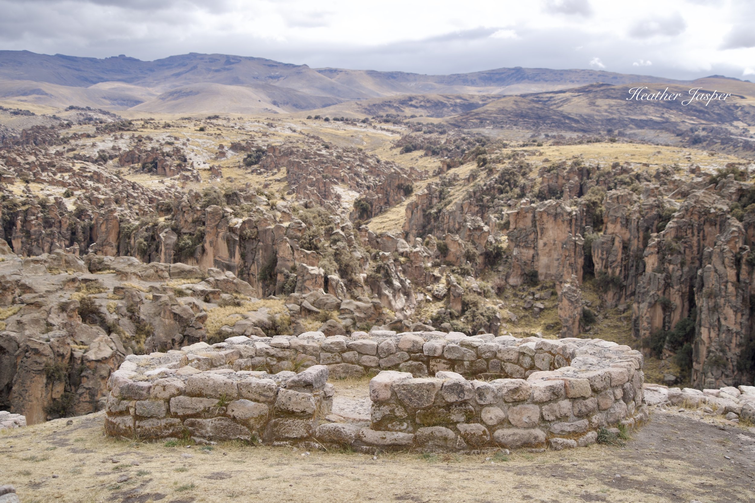
Wind howled around the round structures on top of the mesa and they don’t appear to have had windows.
What is so unique about Taqrachullo?
Taqrachullo is built on top of a mesa with 300 foot high sheer cliffs around most sides. There is only one access in and out of the city and the path has several guard towers to keep watch. It’s a beautiful location that will take your breath away – partly because it’s at 4,100m/13,390ft above sea level.
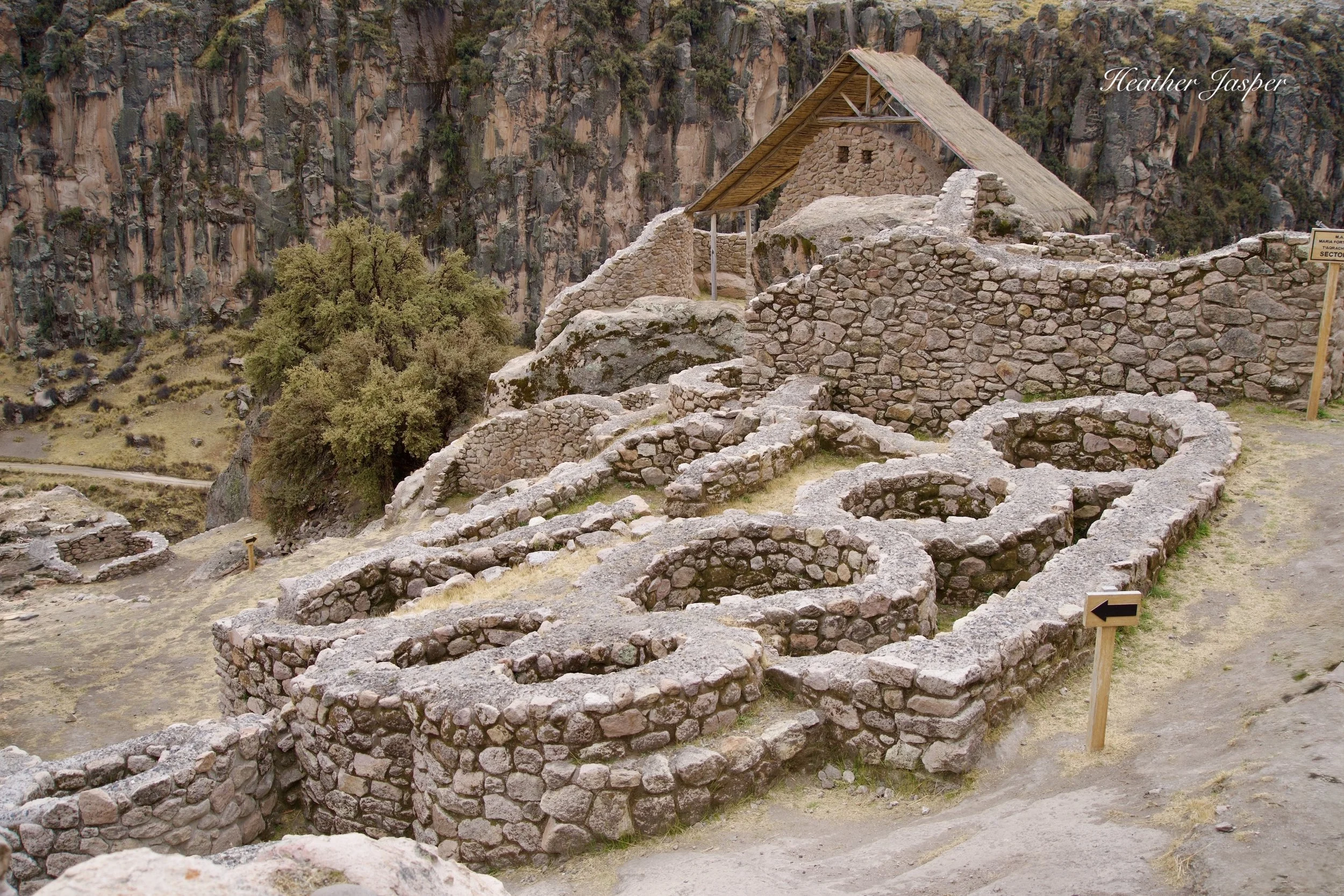
The small, round structures are a group of tombs built in an area that’s mostly homes.
Unlike cities built by the Inca, Taqrachullo does not have separate residential, agricultural and religious sectors. Like cities built by older cultures like the Kanas and Wari, there are temples and tombs mixed in the residential areas. Taqrachullo does not have agricultural terraces or significant sources of water in the city, as most Inca cities did. That last detail may be what led to its defeat.
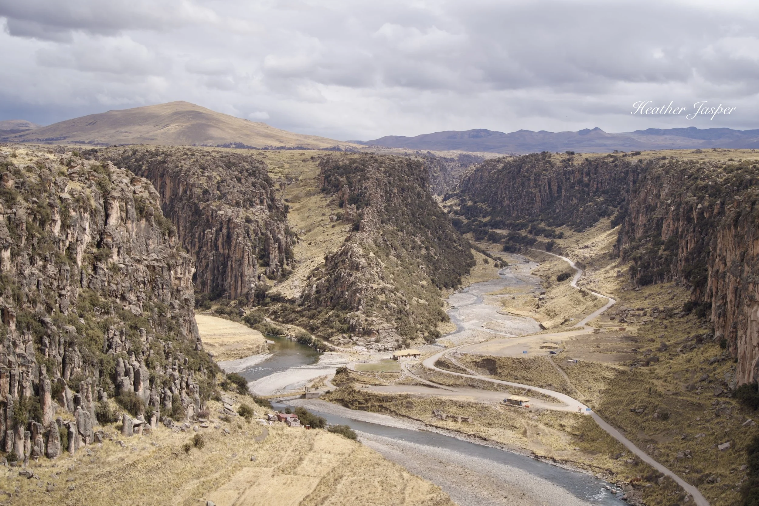
Looking down from the llaqta, the Apurímac River and tributaries look tame in the dry season but are raging rivers from January through April.
Where is Taqrachullo?
Taqrachullo is in southern Peru, at the confluence of the Apurímac River with two smaller tributaries. The Apurímac is the farthest source of the Amazon, making it the beginning of the largest river in the world, by water volume.
For Andean cultures, especially the Inca, it was a key point on the road from Puno to Cusco, controlling who approached the Inca’s capital from the south.
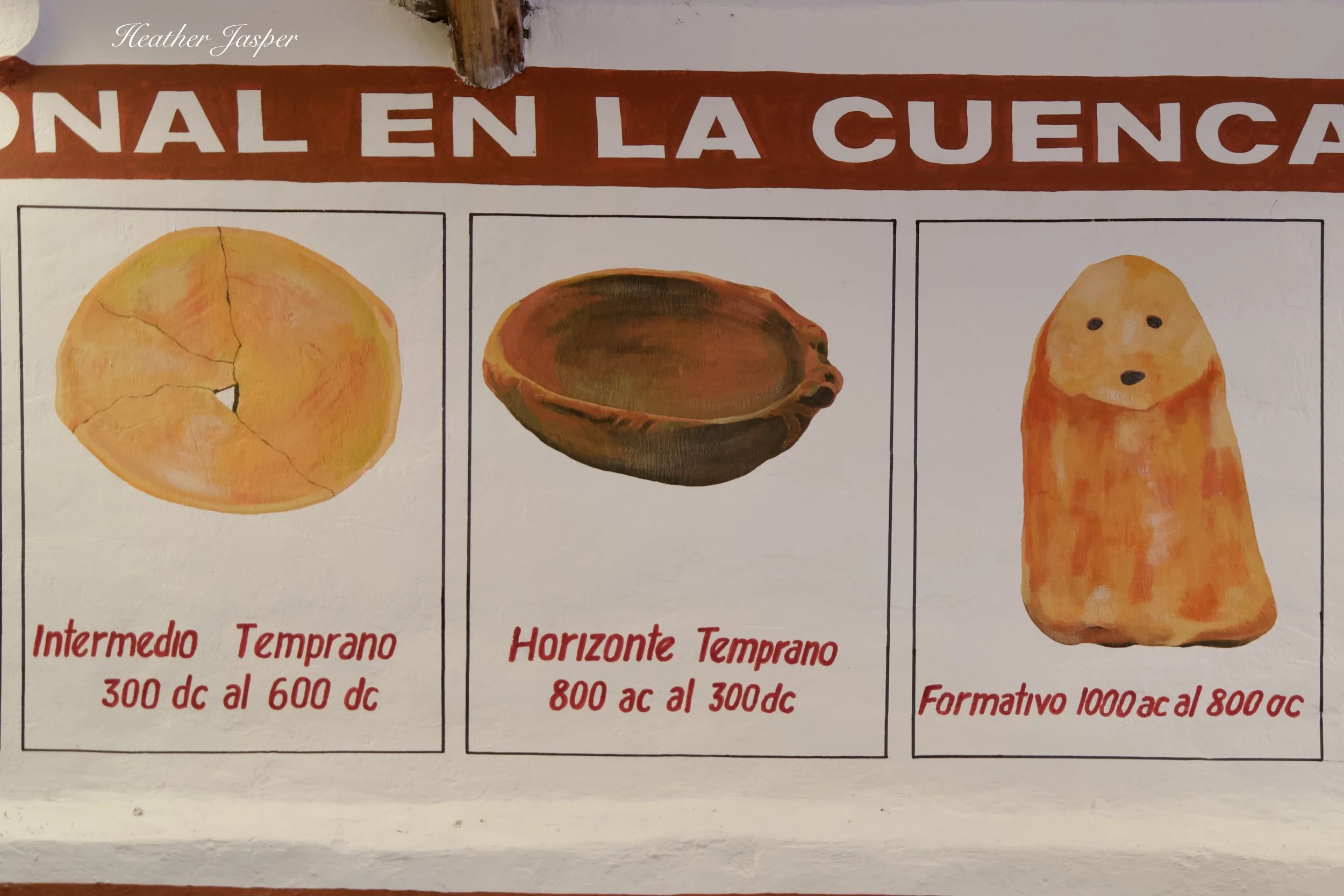
Artifacts found at Taqrachullo show that it was inhabited as far back as 1000 BCE.
When was Taqrachullo built?
Artifacts going back to 1000BCE show that the site was inhabited long before a city was built there. The city continually evolved and gained more buildings over thousands of years, up to the 1530s, when the Spanish killed or captured the surviving residents. It was then abandoned as there is no evidence it was inhabited during the colonial period.
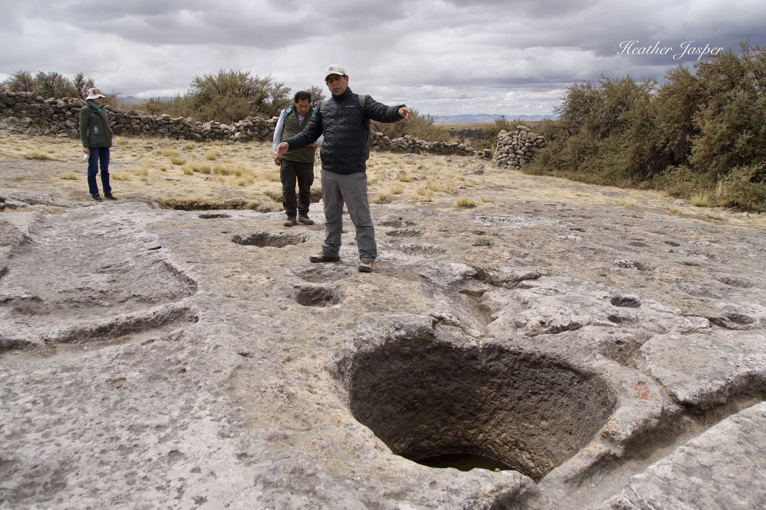
One of the oldest parts of Taqrachullo is this section of bedrock carved with holes that archeologists believe were used as reflecting ponds for stargazing. Filled with water, they would act like mirrors at night.
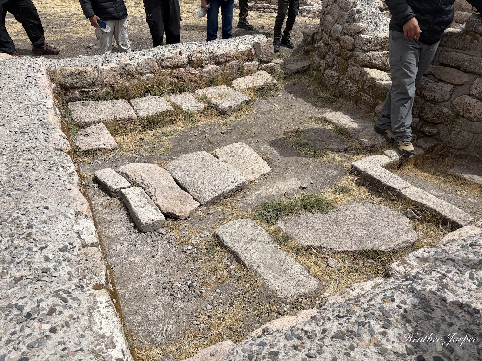
Emerson shows us three Wari graves that archeologists excavated, showing that Taqrachullo was inhabited long before the Inca.
Who built Taqrachullo?
Numerous cultures inhabited the area, going back about 3,000 years. However, archeological evidence suggests that the first to build a city were the Kana.
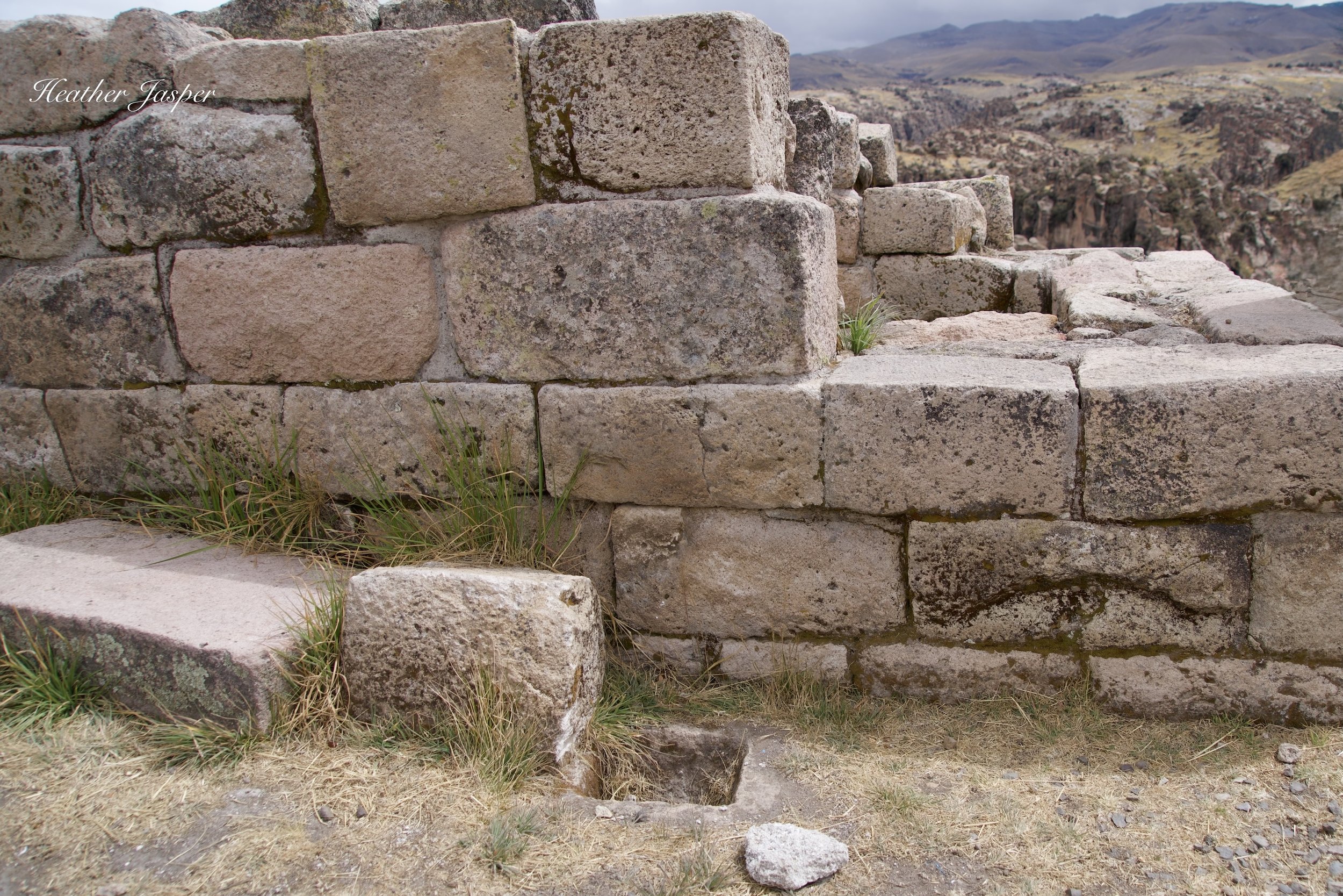
This tomb is the only one at Taqrachullo with a square hole outside that could be used to pour in liquids. Archeologists believe it was used to give chicha to the person buried there without opening the tomb. I’ve never seen anything like it anywhere else in Peru, or in the world.
What did they eat at Taqrachullo?
Archeologists have found that residents of Taqrachullo ate lots of corn, which they would have had to trade for since the area is too high of altitude to grow corn. Lots of the corn was probably used to make chicha, a fermented drink like beer. They grew high altitude crops like potatoes, quinoa, cañihua and tarwi, a domesticated variety of lupine.
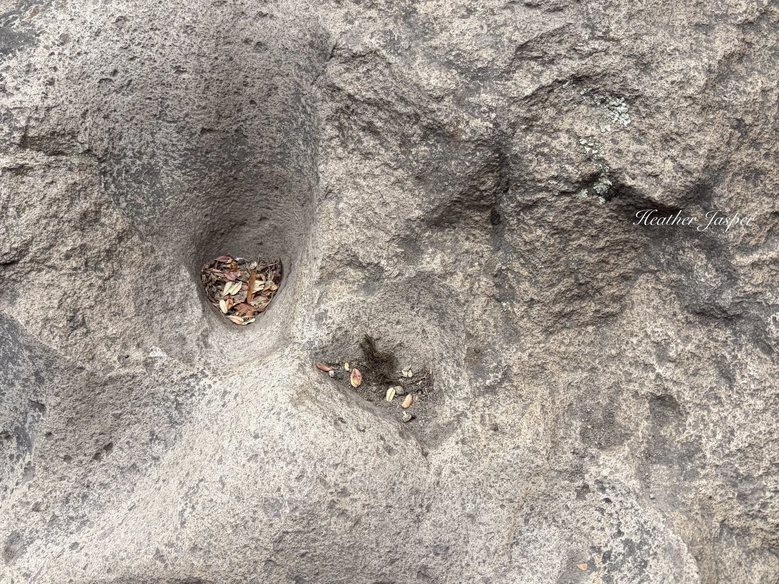
The heart-shaped hole full of leaves is a llama footprint, one of a long trail showing where for hundreds of years llamas walked up to the llaqta. Llamas have soft pads on their feet so for them to wear such deep depressions into solid stone they were probably carrying heavy loads, likely giant ceramic jars of water up from the river. No matter how much weight they carried, it would take hundreds of llamas every day for hundreds of years to wear footprints into the bedrock like this.
However, their main activity was not agriculture but raising livestock.
They lived mostly from llamas, which were both beasts of burden and food. If you want to compare llamas to European animals, they provided wool like sheep, meat like cows (but not milk) and carrying power like horses or donkeys.
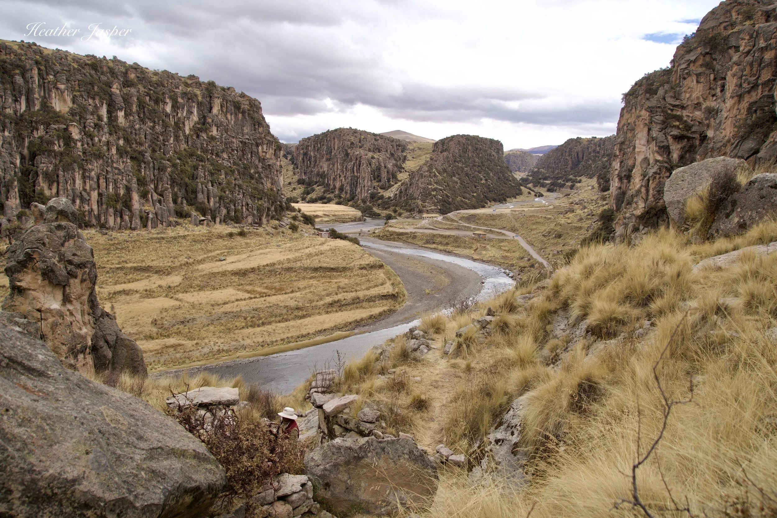
Because of seasonal floods, it would have been impossible to grow crops down in the canyon. Anything grown nearby would be up on the windswept top of the plateau.
The people also mined silver nearby, which was the way they paid tribute, like taxes, to the Inca in Cusco. The name Taqrachullo was probably given by the Inca since taqra was the sound made by silver and chullo means “origin of water,” clearly referencing the location at the confluence of three rivers.
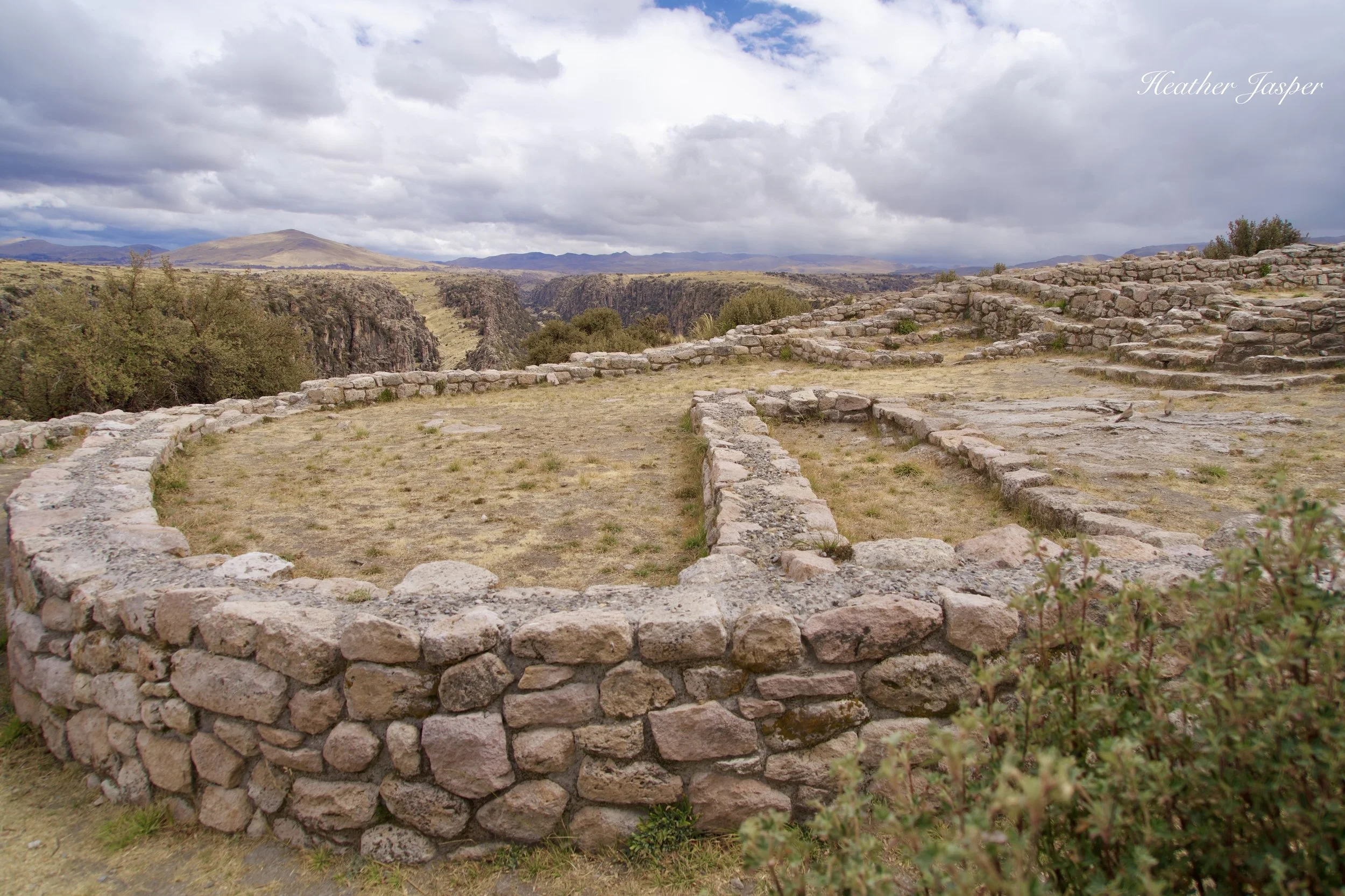
This temple structure is one of most interesting buildings, with layers and additions built by several successive cultures over centuries.
What were religious practices at Taqrachullo?
Archeologists found lots of artifacts that were clearly sacrificial objects, like spondylus shells from what is today Ecuador and Panama. Young women were sacrificed at Taqrachullo, and objects were brought as offerings from across South America. Some offerings were distinctly Wari, the civilization based in Ayacucho from about 600-1000CE.
Even today archeologists are careful to respect local customs and during the most recent study began each season by hiring a local shaman who sacrificed a llama. During the ceremony, the shaman would pull out the heart and count how many times it beat to foretell how the year would go.
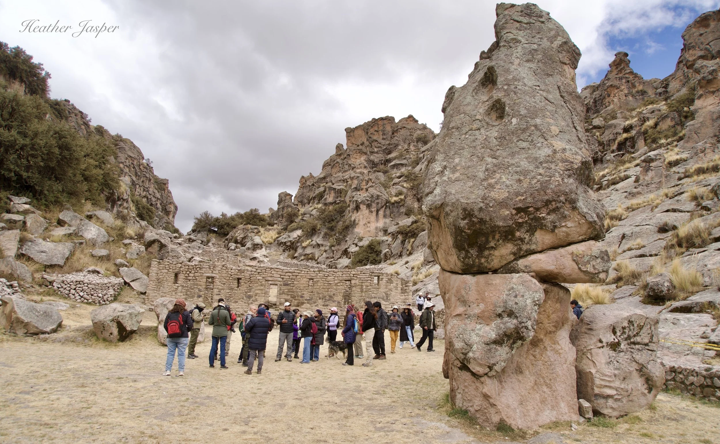
You have to walk through here, past several guard towers, to get to the entrance in the two photos below.
What happened to Taqrachullo?
Sadly, in the Spanish campaign to erase Incan power and culture, the people who carried their oral history were killed and many key artifacts destroyed. The history we have was written by the Spanish and it begins with the Spanish invasion of South America and a key battle between Spanish and Incan forces.
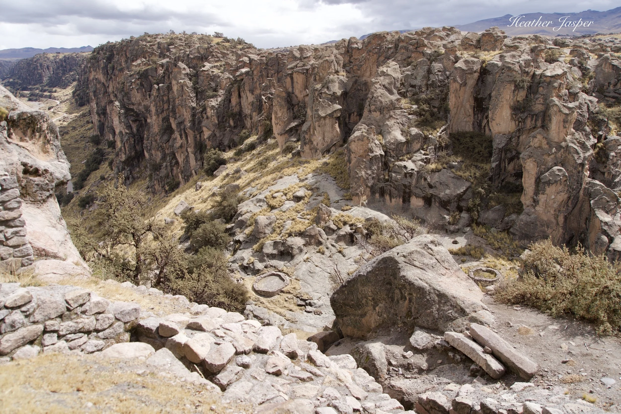
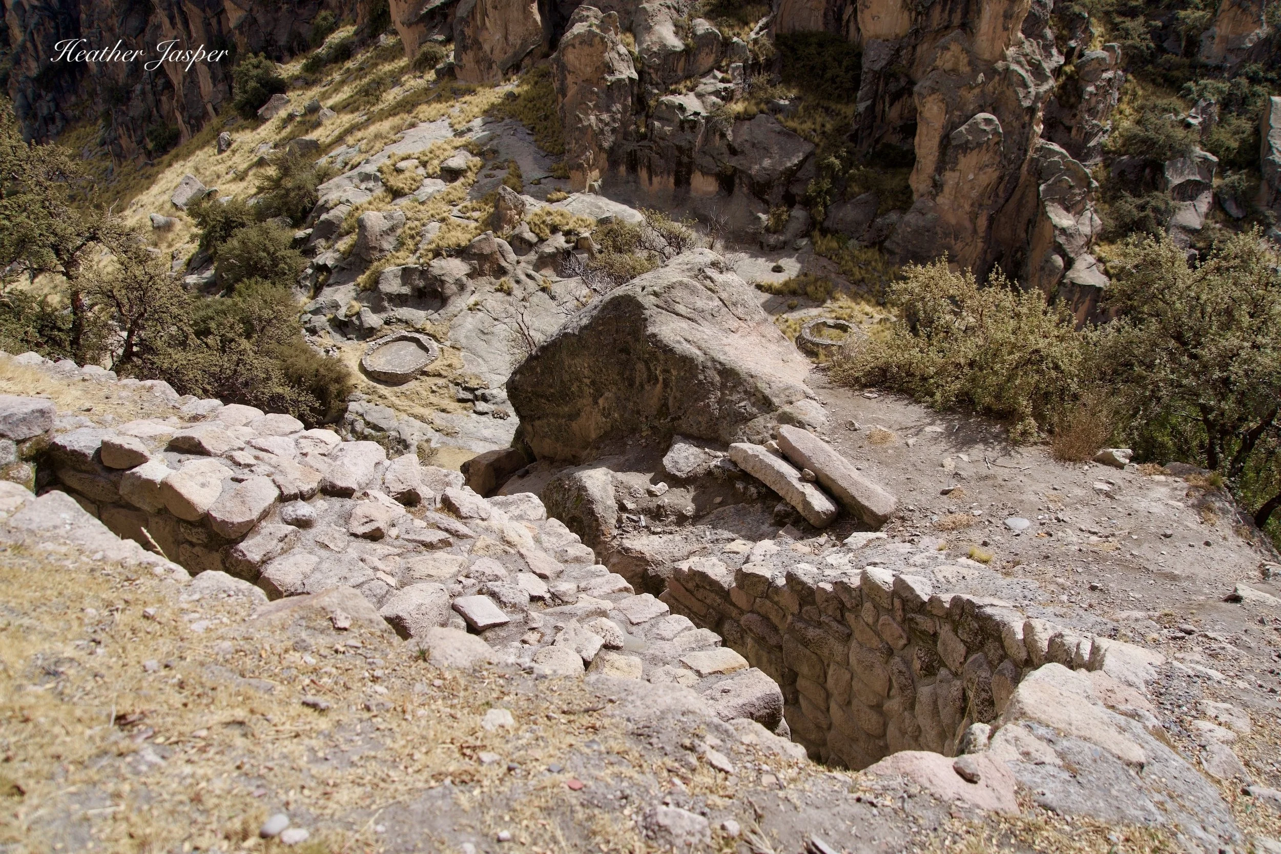
In the battle, city residents, as loyal subjects of the Inca, resisted Spanish rule. They did not have an army or weapons to match the Europeans, but they lived in a highly defensible city and resisted as long as they could. They filled in the only entrance up to the city, including the narrow switchback above, with rubble to make it entire impassible, preventing the Spanish from entering and themselves from escaping.
However, the city does not have enough water to support the number of people who lived there and most water was brought in giant clay jars from the river below. Under siege, the city ran out of water, and perhaps food. They burned the upper section of the city and many, if not most, jumped off the cliffs to their death rather than be captured by the Spanish.
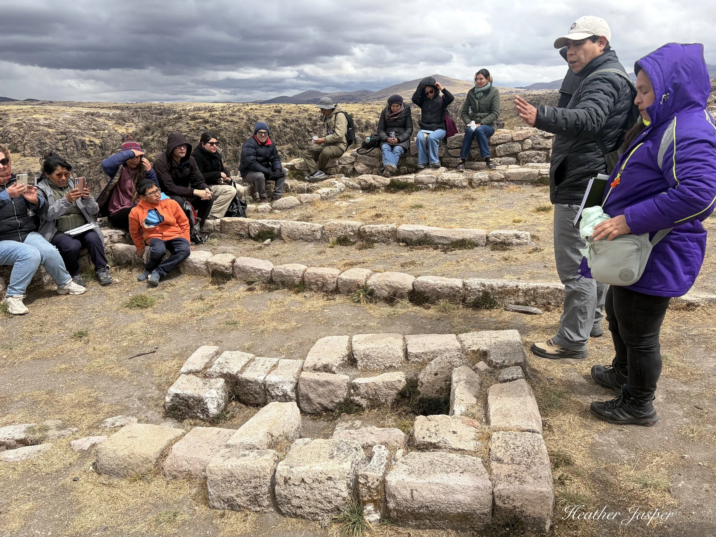
I was lucky to get to attend this training session for tour guides led by an archeologist and a historian.
How do we know about Taqrachullo?
The most recent archeological study lasted from 2019 to 2024. During that time, archeologists uncovered more artifacts at Taqrachullo than have ever been uncovered at Machu Picchu. There is an enormous pile of tangible evidence that this place was inhabited for thousands of years, though the buildings are mostly only about 1,200-600 years old.
Two Spanish chroniclers wrote about Ancocagua, which many historians and archeologists today agree is Taqrachullo. Ancocagua was mentioned by Pedro Cieza de León in Crónica del Perú in 1553, but the description is vague. Colonist Juan de Betanzos gave a much more accurate description, with information about the battle between Pizarro’s forces and the city’s residents, including the detail that many threw themselves off the cliffs when defeat became evident.
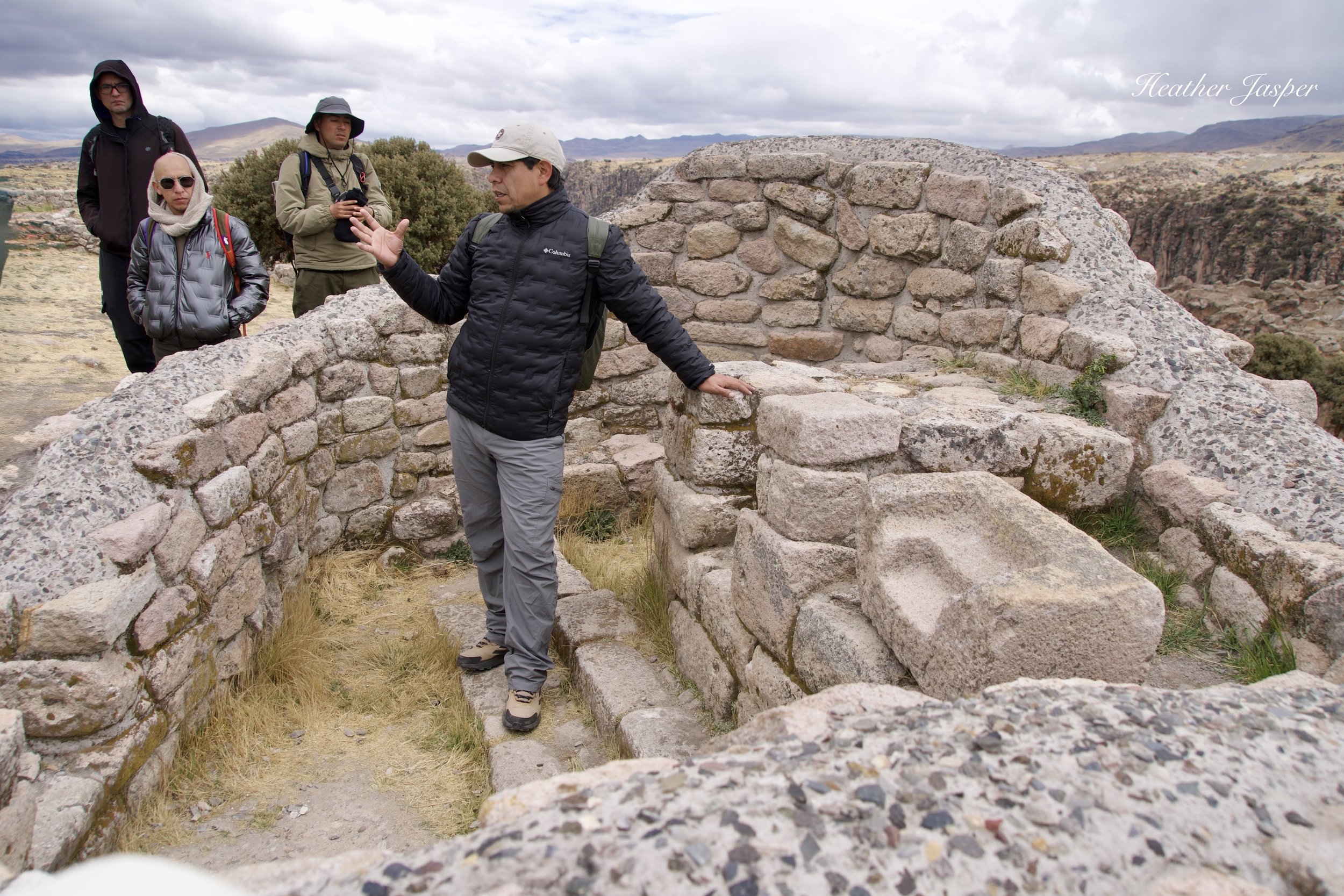
Emerson Pereyra Pacheco was quoted throughout the National Geographic article regarding his work at Taqrachullo.
Why is Taqrachullo in the news now?
Taqrachullo made the cover of National Geographic UK in June 2026. The article was written by Alejandro Muñoz and includes lots of information from lead archeologist Emerson Pereyra. Muñoz also interviewed archeologist Alicia Quirita and anthropologist and National Geographic Explorer Johan Reinhard, who published a paper about the site in 1998.
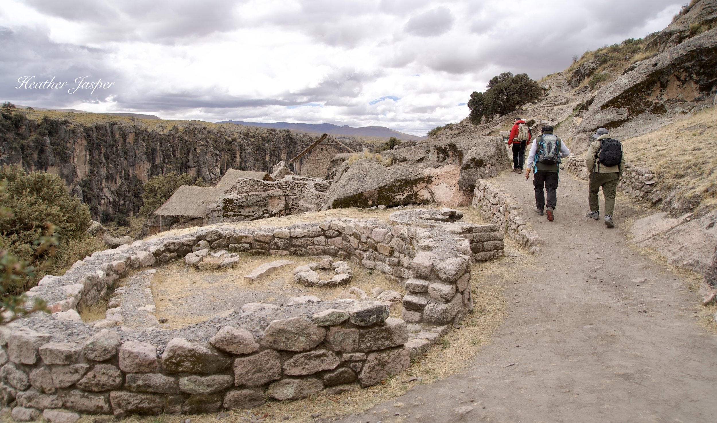
The nicest homes, clearly where the elite lived, are in an area of the llaqta that’s a bit lower in the canyon and protected from the wind.
How to get to Taqrachullo?
Taqrachullo is an hour south of the Peruvian city of Espinar, about six hours south of Cusco, if you drive without stopping along the way. The nearest airport is in Juliaca, about five hours away. You can also get there by driving seven hours from Arequipa. Basically, you have a long drive ahead of you, no matter where you start.
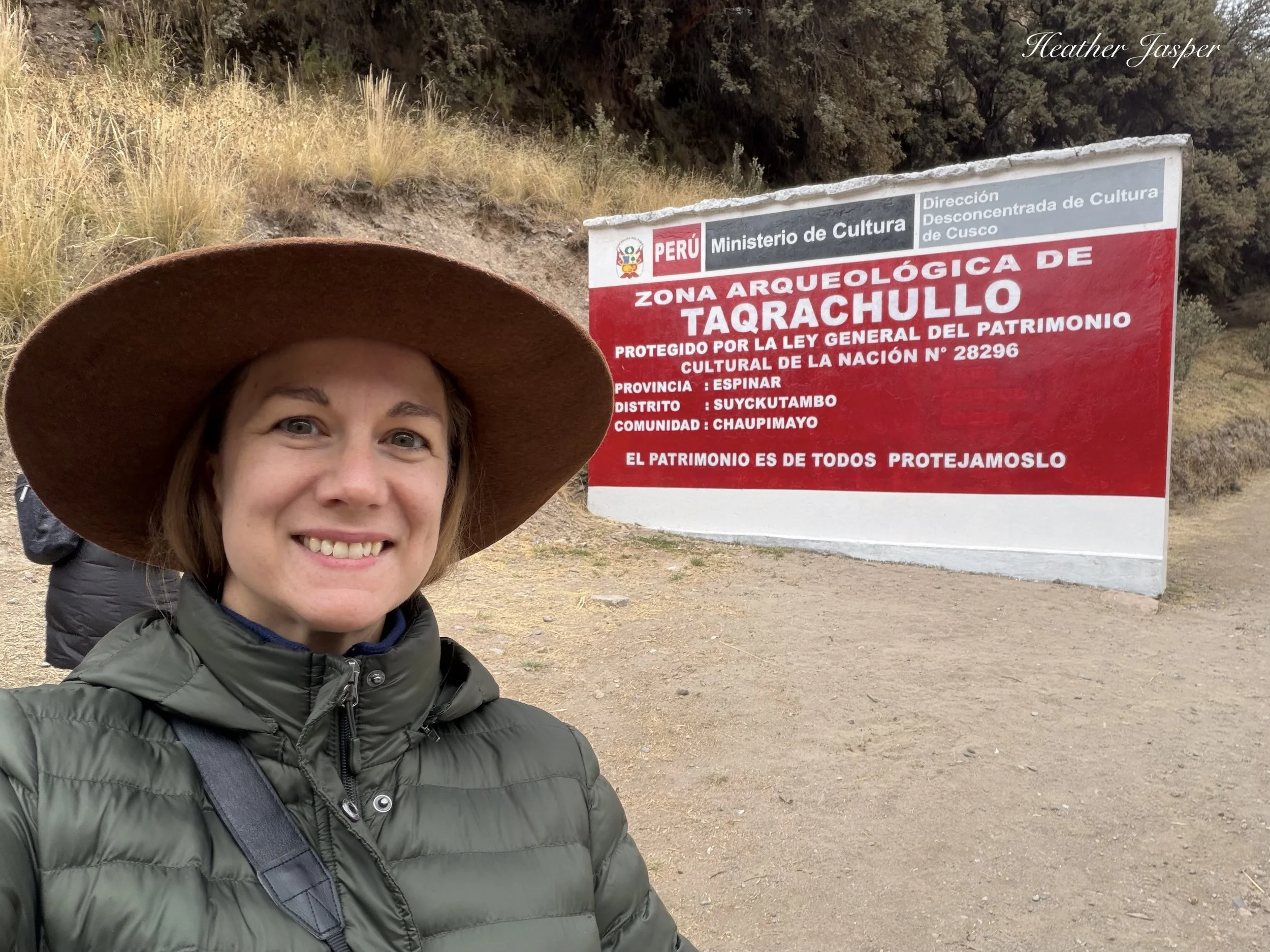
The archeological site has trails and some signs for visitors but there are no guides at Taqrachullo.
How to visit Taqrachullo?
Getting there is still tricky because it’s so far from any major city or airport and there is no public transportation. You need your own vehicle and I recommend hiring a guide in Cusco if you need somebody who speaks English.
So far, about 200 people have visited Taqrachullo with Inkari to learn about the site. Most of them are tour guides from Cusco but some are people like me who don’t lead tours. If you want a tour guide for Taqrachullo, so far, my best advice is to ask me, and I’ll reach out to people I know who have been trained to lead tours there. Hopefully, soon I’ll be able to recommend tour agencies who have guides that can lead tours of Taqrachullo.
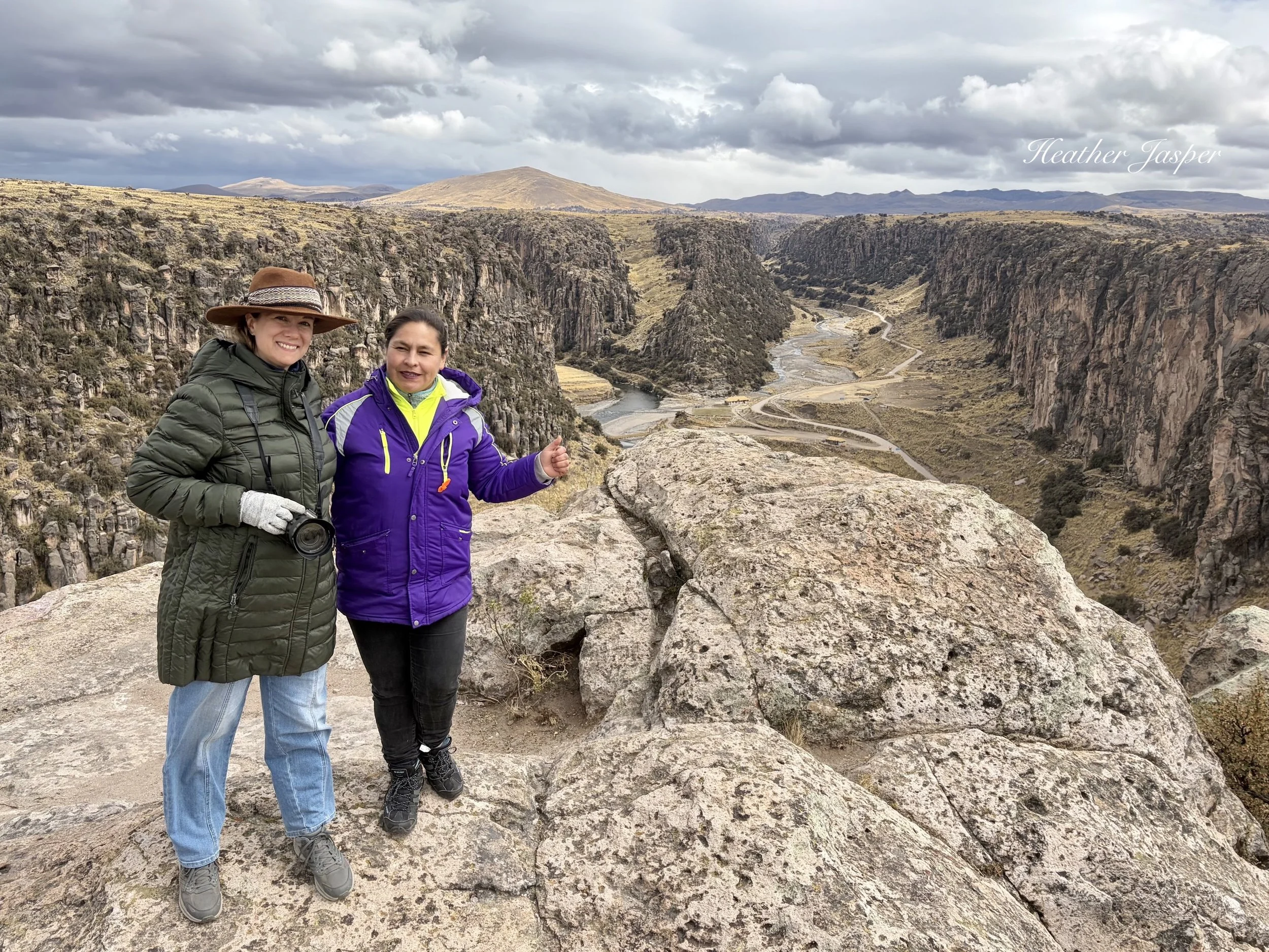
Me with historian Lilia Vargas León at Taqrachullo in August, 2026 - right before my hat blew off again.
Note: If you use any information from this article, please cite me, Heather Jasper, as the source, along with my sources: archeologist Emerson Pereyra Pacheco, historian Lilia Vargas León and the National Geographic issue from June 2026, written by Alejandro Muñoz.
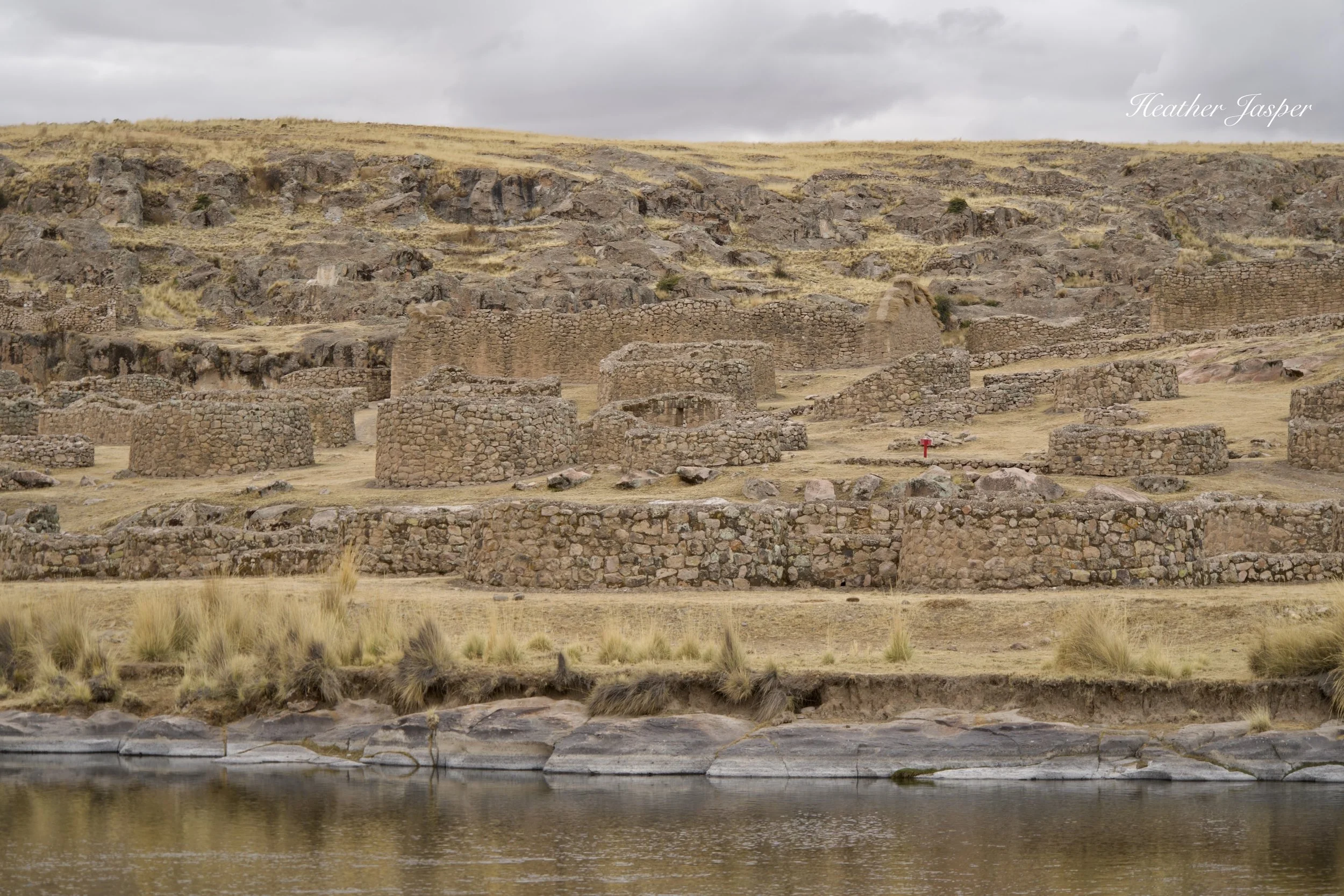
There are several areas of ruins near Taqrachullo, like this one called Maukallaqta, that I plan to visit on my next trip there. Check back for more information from my next trip.