Cusco Day Hikes
You can start all my favorite hikes from the Plaza de Armas, even ones as far away as Huchuy Qosqo.
Why go on a day hike from Cusco?
If you’re in Peru for a trek like Lares, Salkantay or Choquequirao, you need to do a little hiking at altitude before the big trek. If you want to do the Inca Trail, read this first. If you’re in Cusco during the rainy season, especially January through March, it rains so much at night you’ll enjoy day hikes more than overnight camping trips or treks.
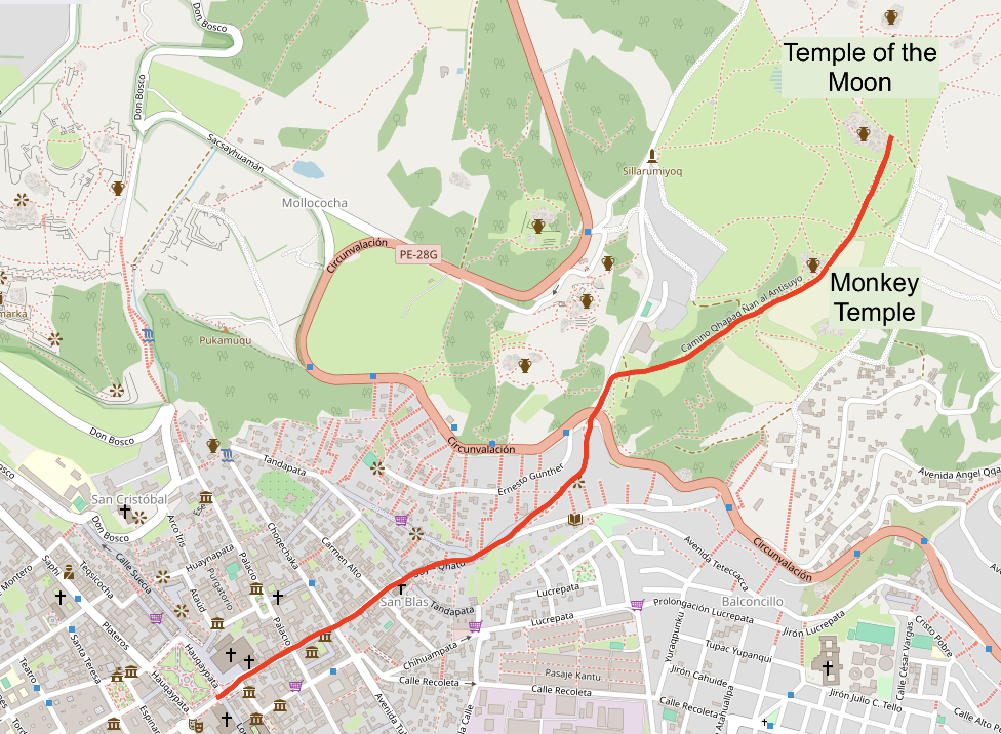
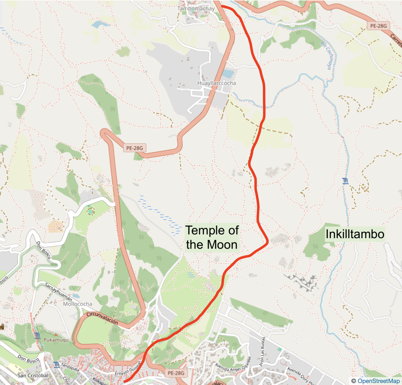
This is near the Temple of the Moon, only an hour walking from Cusco’s Plaza de Armas aka Haukaypata.
The best day hikes in Cusco
Here’s my favorite day hikes that start in Cusco’s Plaza de Armas.
Cusco is in a bowl, surrounded by hilltops on three sides. The fourth side slopes down towards the airport and from there to Lake Titicaca, Bolivia and Chile. Any other direction you go from the center is up, so these hikes aren’t for your first day at altitude – unless you do them very slowly!
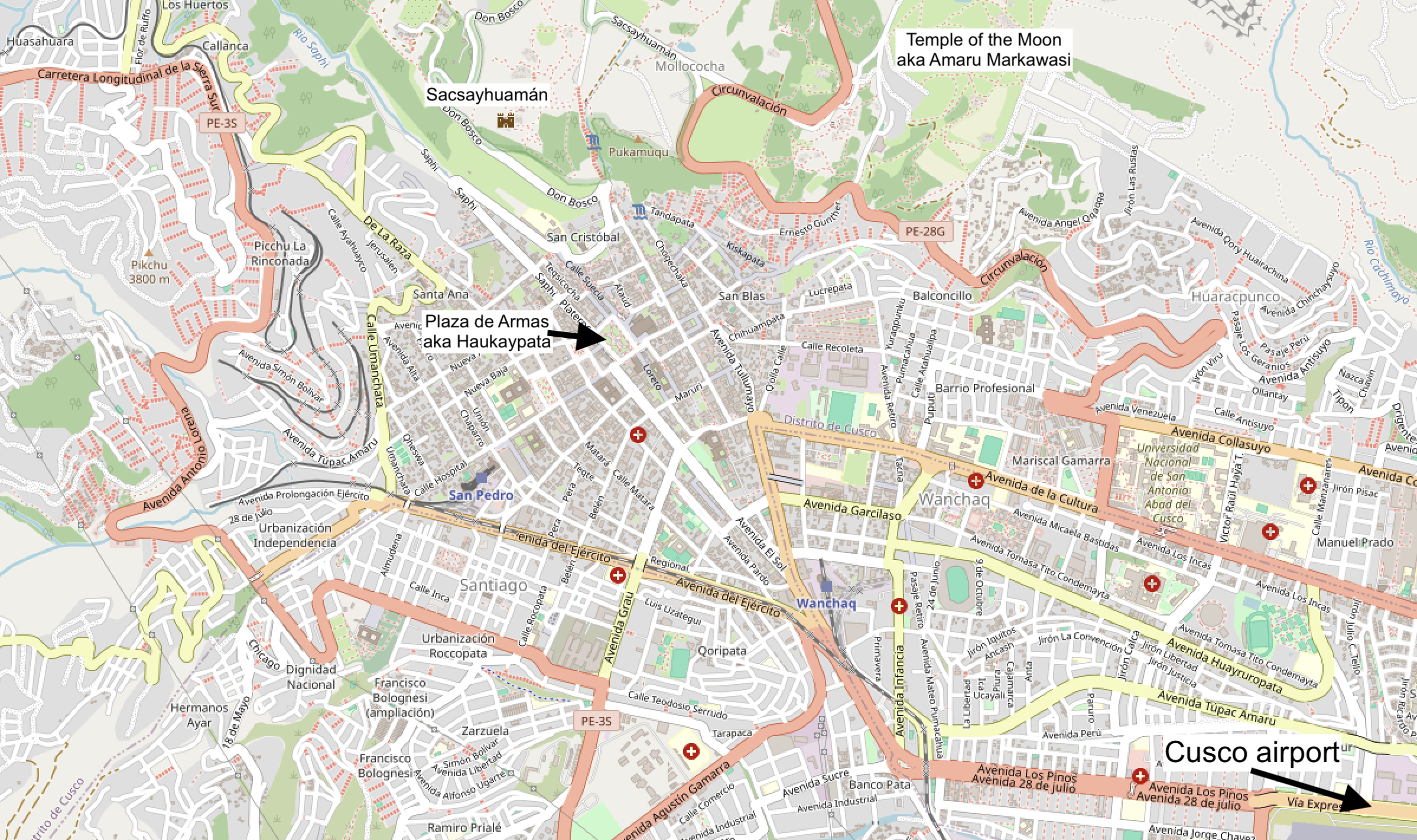
The top, left and bottom sides of the map are all uphill from the center. Only the airport is downhill.
How to orient yourself in Cusco?
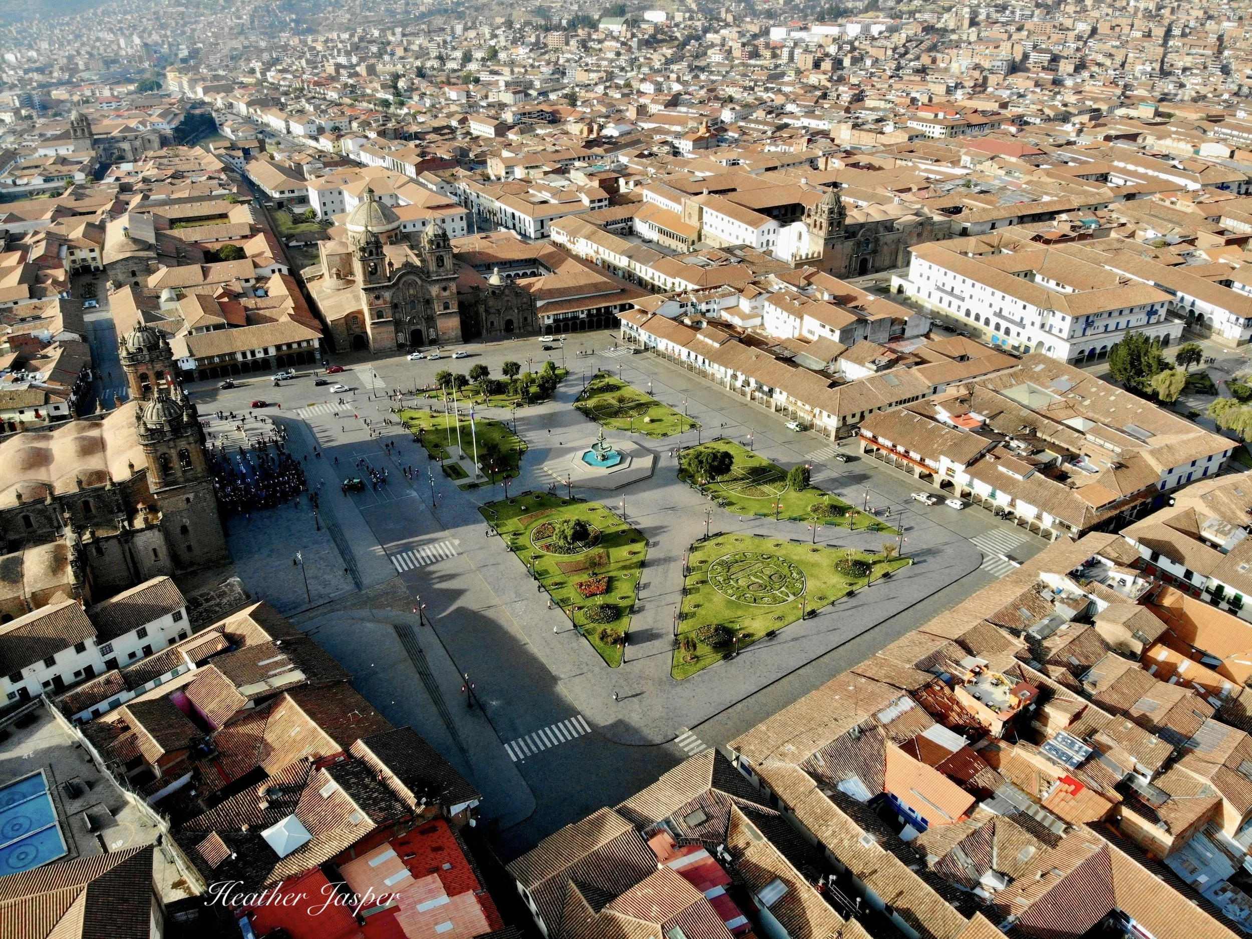
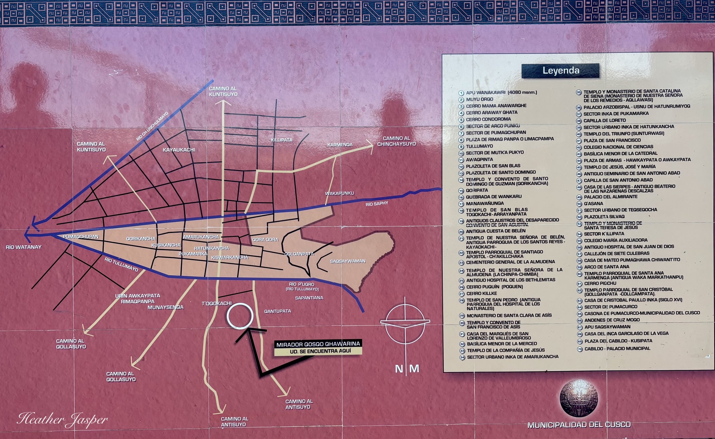
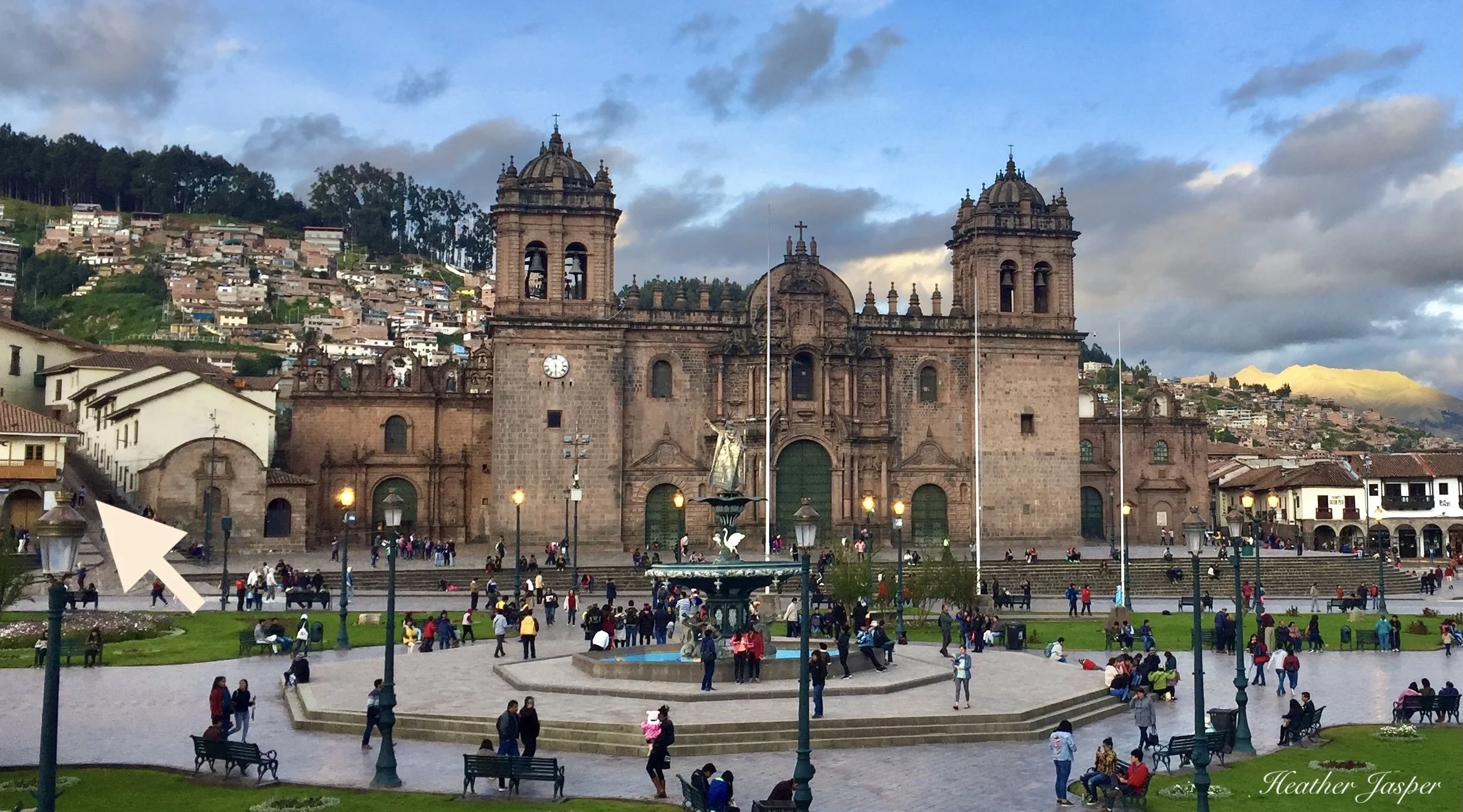
Before you start on any hike, you need to orient yourself. Start in the historic center, in the main plaza. What today is the Plaza de Armas, the center of central Cusco, was called Haukaypata before the Spanish invaded.
Start in Cusco’s main plaza
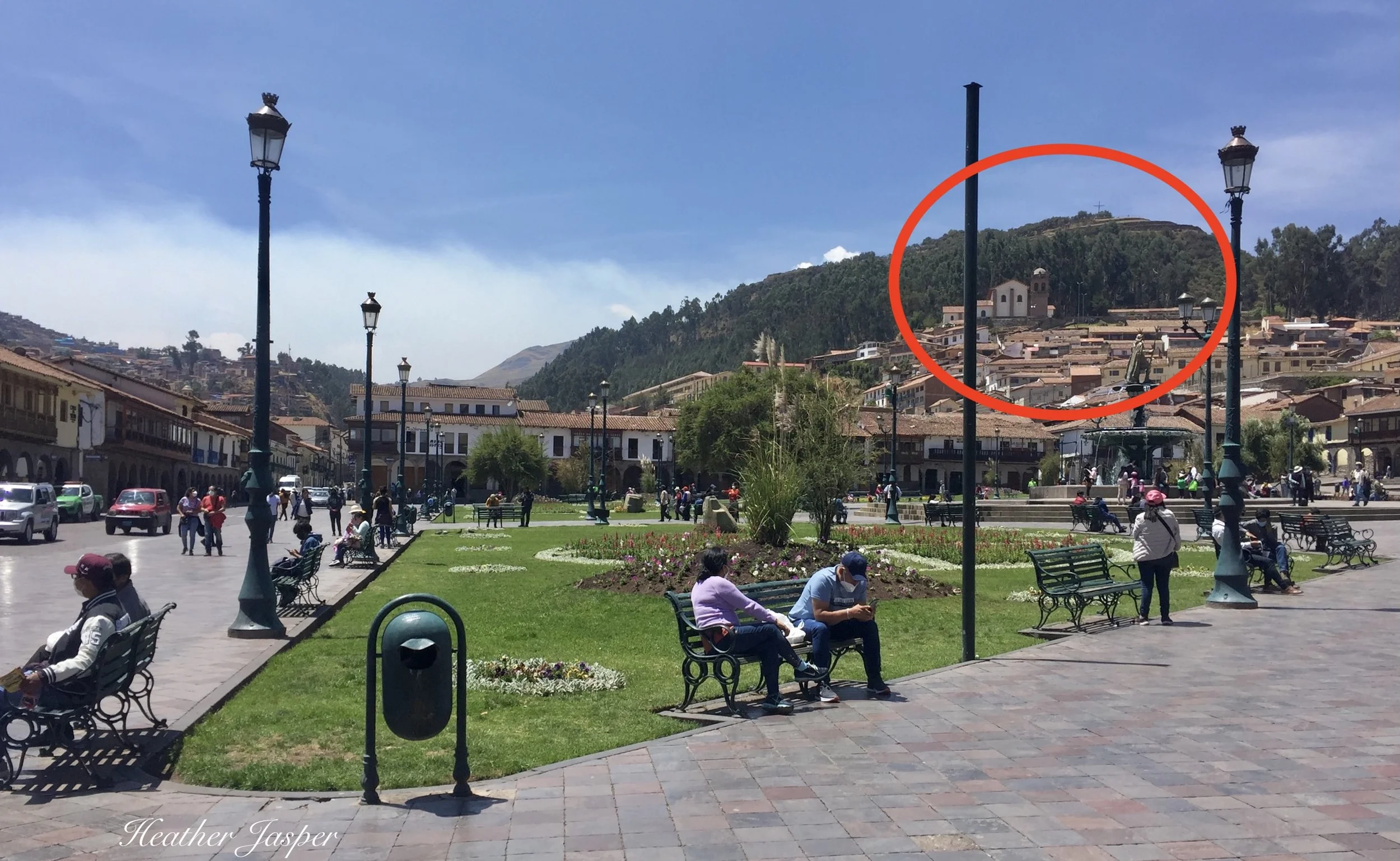
This is the south, downhill corner of the Plaza de Armas. The terraces and cross at the top right are Sacsayhuamán. (Pronounced sack-sigh-wah-mon)
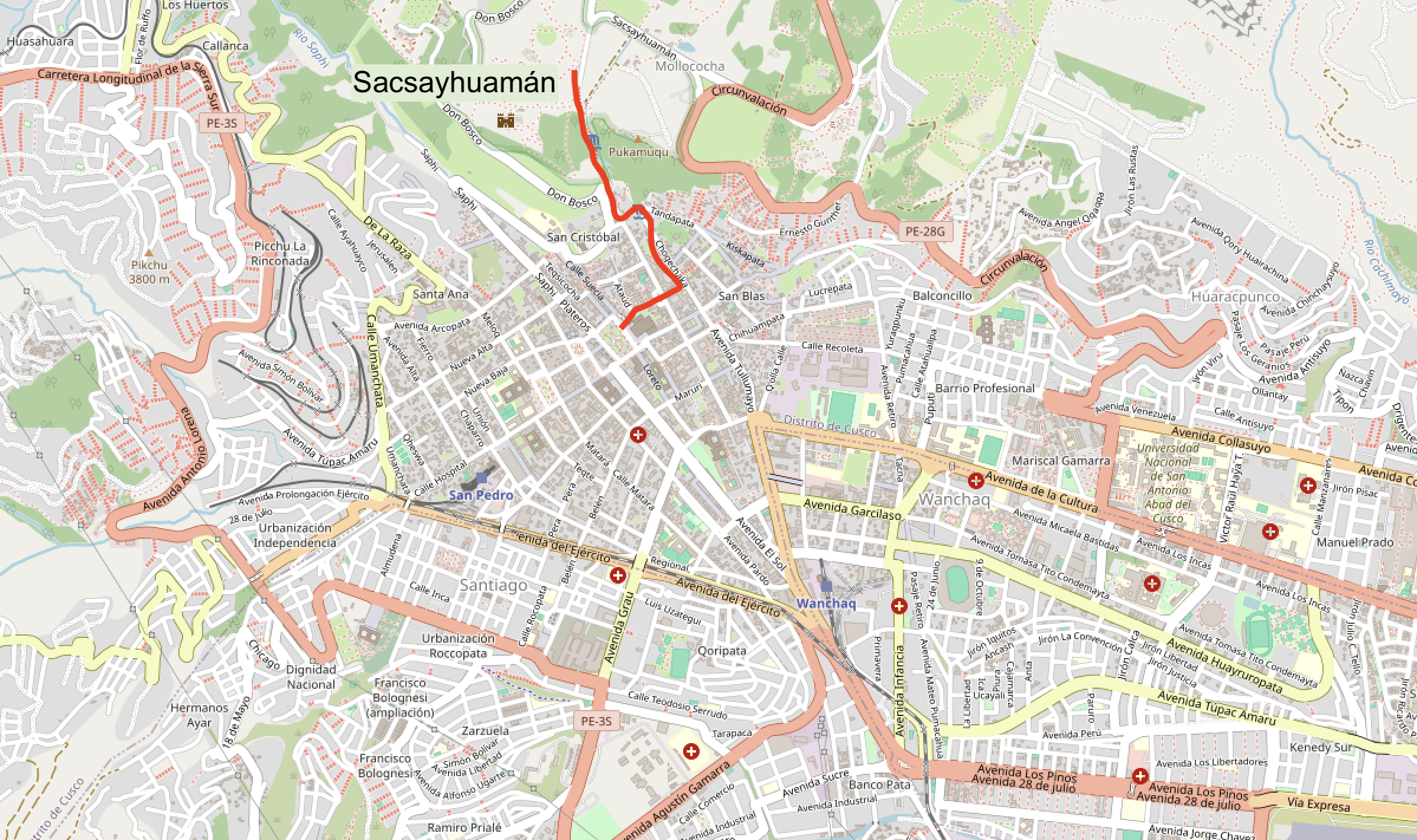
The hike up to Sacsayhuamán is one of my favorites and you can stop by San Cristobal on the way.
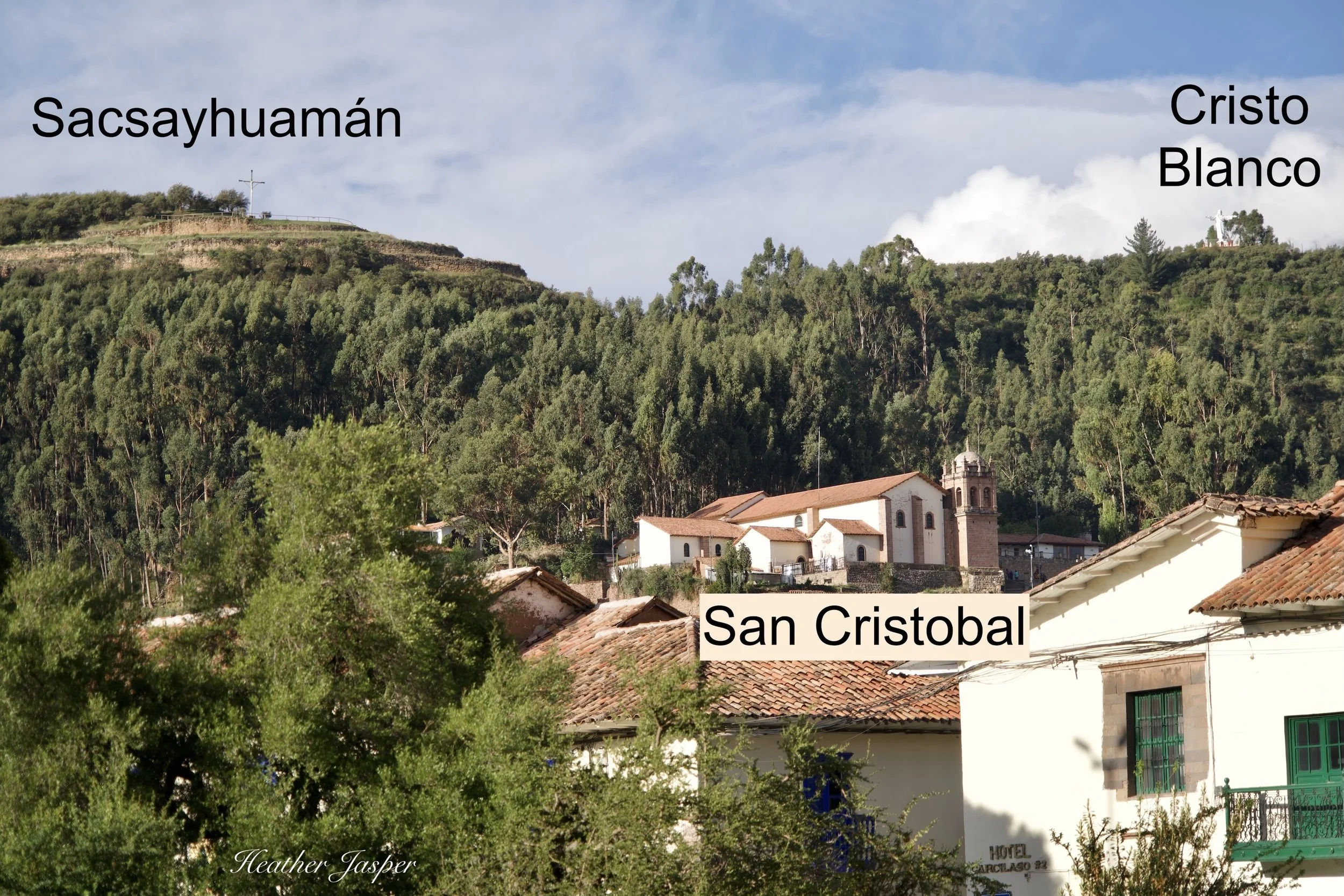
Stand on the downhill (southern) corner of the plaza, facing uphill towards the closest hills. The highest church is San Cristobal, the terraces with a cross are Sacsayhuamán (pronounced sack-sigh-wah-mon) and the white Jesus statue is Cristo Blanco. One of the two city busses that go up there is named Cristo Blanco, the other is Huerto. More on how to make hikes easier with taxis and busses is below, keep reading!
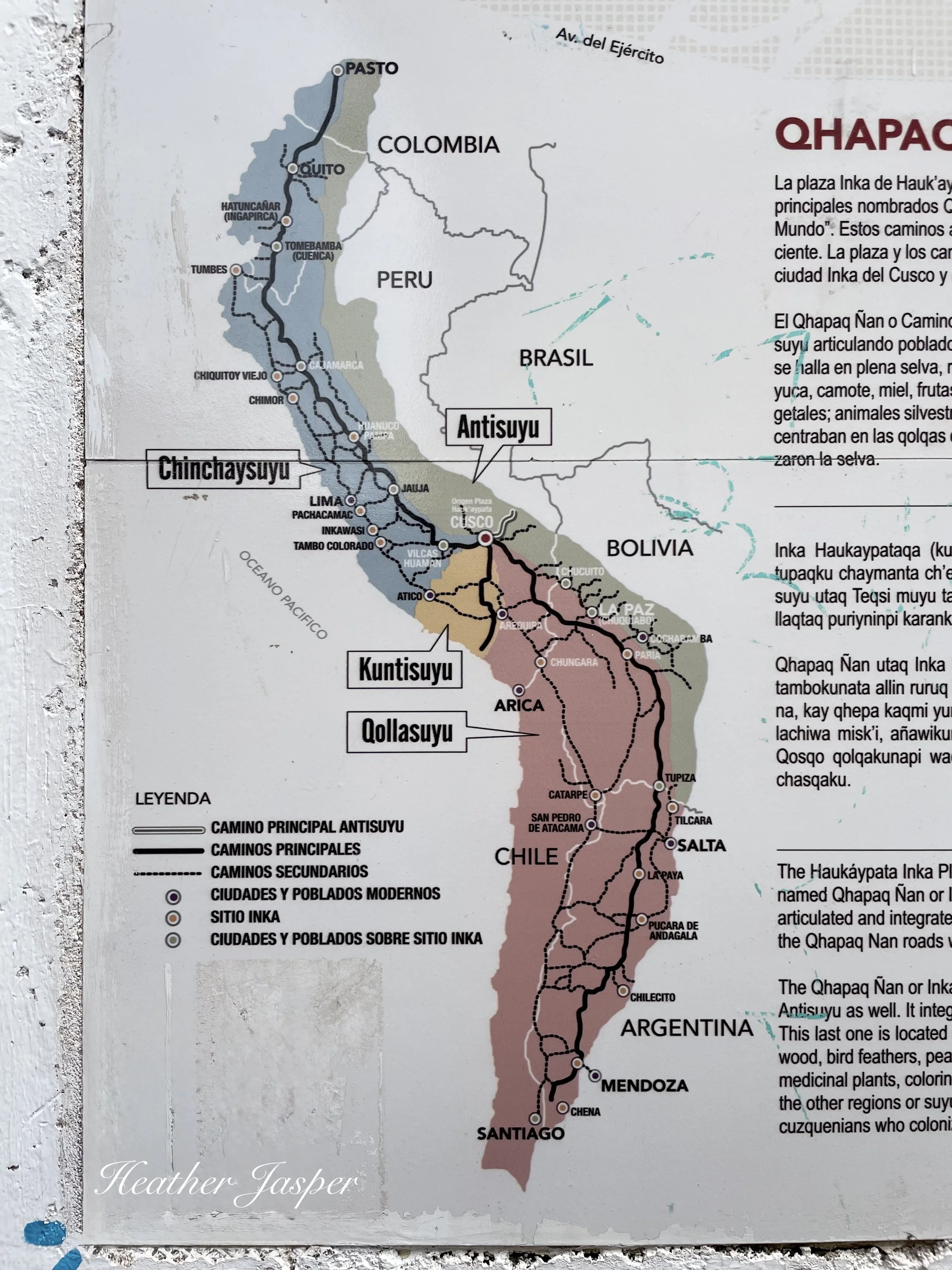
The Map of Incan South America
Cusco was the center of Tahuantinsuyu, the four corners of the world ruled by the Inca. Look for these maps on walls throughout Cusco. They mark the four roads that leave from the plaza to the four suyus.
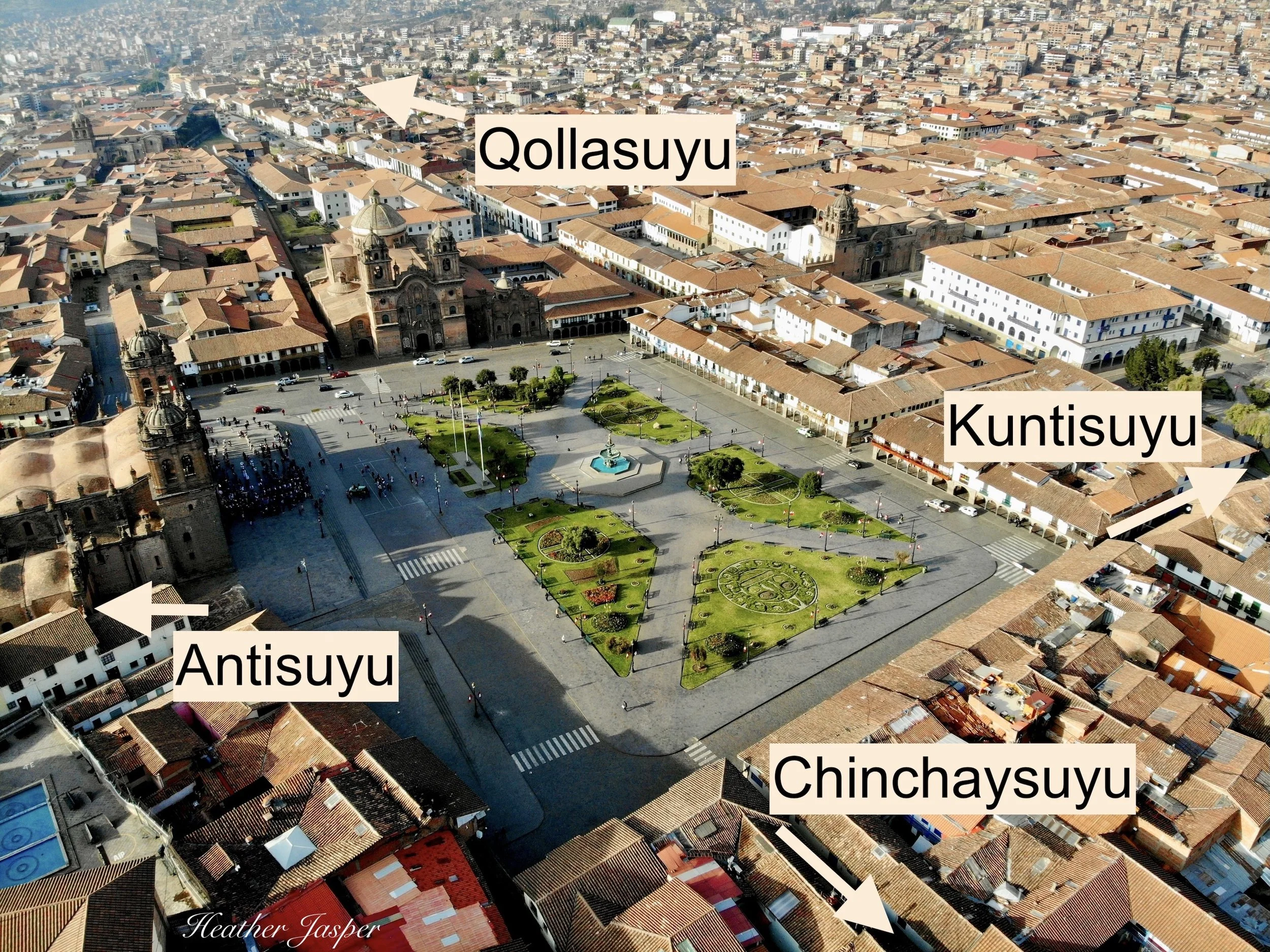
Roads to the four suyus lead from Haukaypata, so, all roads lead to Cusco.
Tahuantinsuyu (the Inca Empire)
The four parts of Tahuantinsuyu were Antisuyu (the jungles to the north and east), Qollasuyu (the deserts and coast to the south as far as Santiago de Chile), Kuntisuyu (the Pacific coast to the southwest) and Chinchaysuyu (the coastal north as far as Colombia).
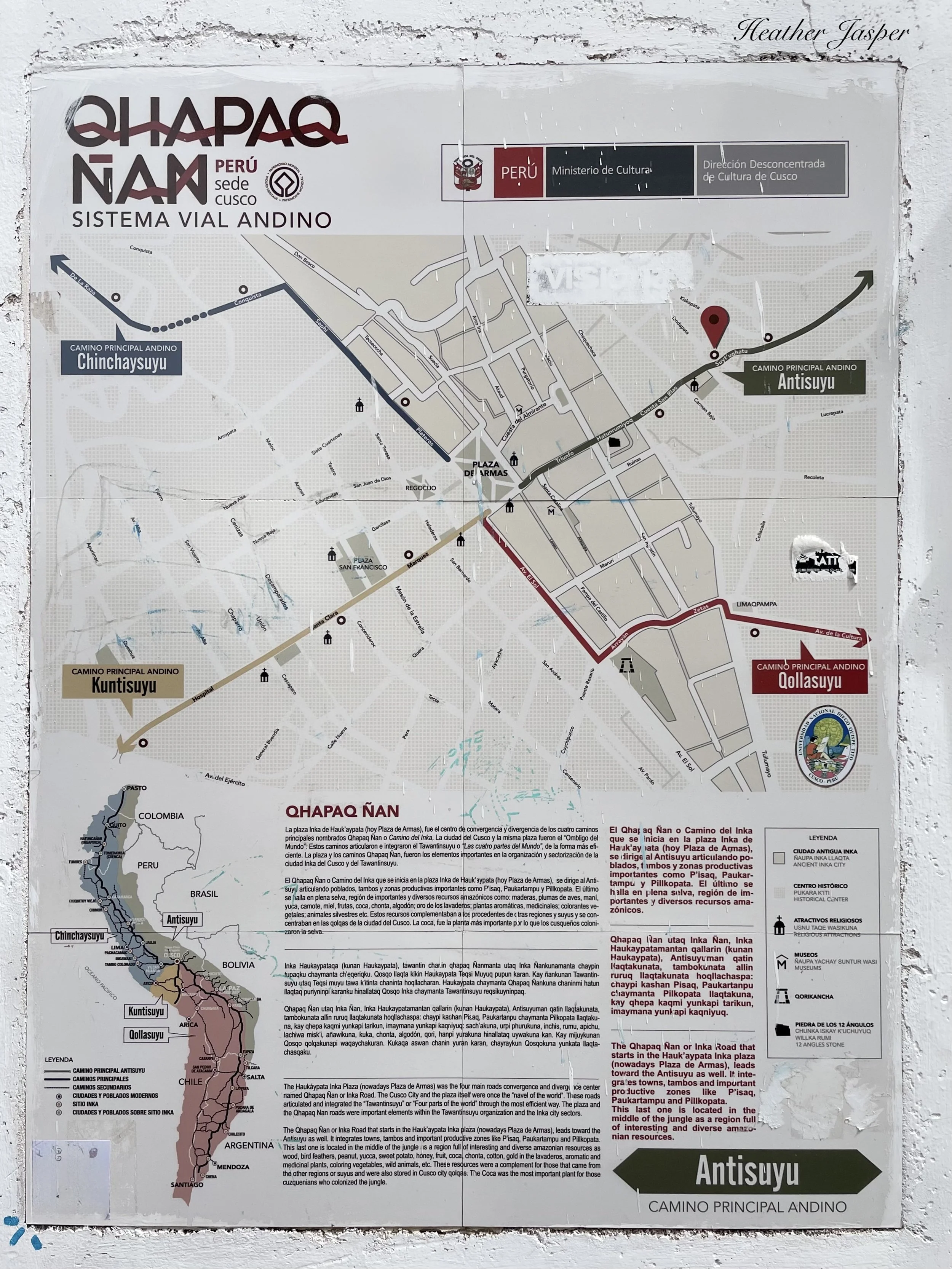
Antisuyu, the Amazon
All my favorite hikes are in Antisuyu, the part of Cusco that’s above San Blas. Chinchaysuyu also has some great hikes near the city but the ones in this blog are mostly Antisuyu.
The Qhapaq Ñan
The roads that lead from Haukaypata to each of the four suyus are part of the Qhapaq Ñan. This is a network of Inca trails that used to lead from Pasto, Colombia in the north all the way to Santiago de Chile in the south. The trails crisscross Peru everywhere, but they mostly lead out from Cusco. Think of Haukaypata as Km.0 like Notre Dame in Paris is for France. (The bar Km.0 in San Blas is at the beginning of the Qhapaq Ñan to Antisuyu and a great place to see live music every night).
Some maps show Cusco shaped like a puma, with Sacsayhuamán as the head. Some archeologists say this is a modern interpretation.
Actually, there were several trail systems built by the Inca or adapted from previous civilizations and only the roads used by royalty were Qhapaq Ñan. The other roads were for messenger runners called chaskis or merchants or military troops on the march. Today, people use the term Qhapaq Ñan for all trails part of this network, royal or not.
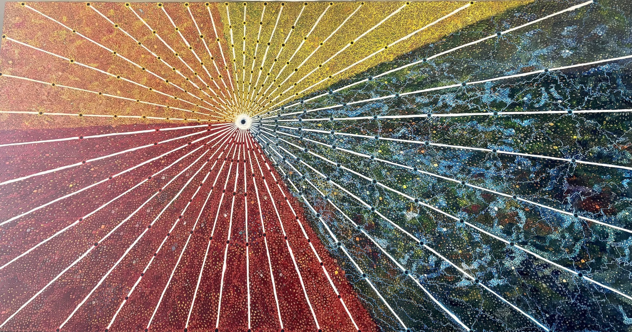
In this painting, Cusco is the center and lines called seqes radiate out, each dot represents a huaca, a sacred site.
Cusco is the center of the world.
Some historians and linguists say that the Inca considered Cusco the navel of the world, since the navel is the center of the body. Others say Cusco was the placenta, the first giver of life. Until all the historians I know come to a consensus, you get to pick the metaphor you like best.
A note on Quechua spelling:
The European alphabet doesn’t do a great job with Quechua sounds and there is more than one correct spelling of many Quechua words. Tahuantinsuyu and Tahuantinsuyo and both correct. Qollasuyu and Collasuyo are both correct. Haukaypata and Hauqaypata are both correct. Huaca and waka are both correct. You get the idea.
Here’s a few of my favorite hikes in Cusco!
Even on your first day at altitude, you should be able to get to Sapantiana. Walk as slowly as you want.
Huaca Sapantiana
From Haukaypata 15-30 minutes up, 700 meters (less than half a mile)
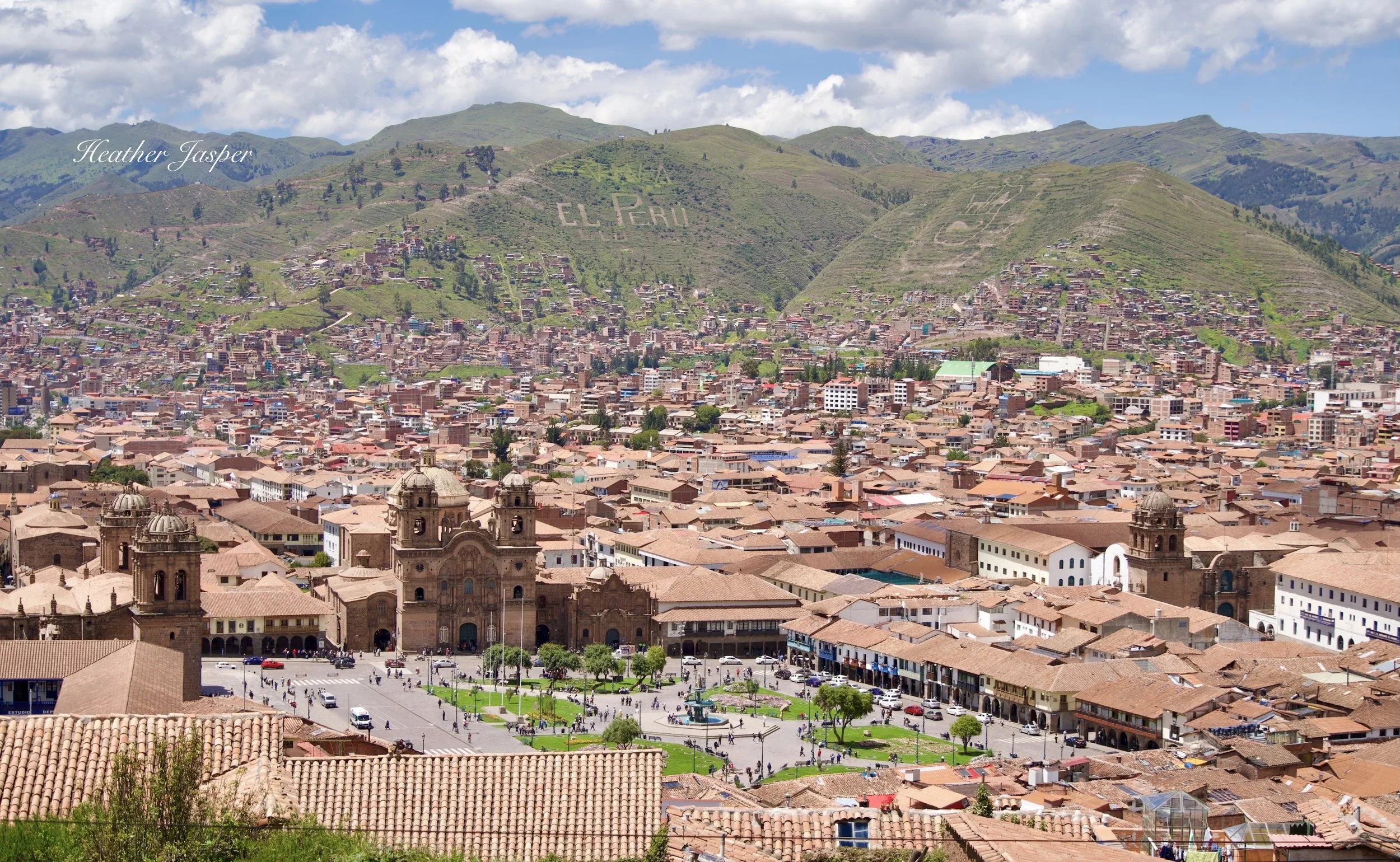
This is more of a walk than a hike, but it should be your first, especially if you’ve recently arrived at altitude. Cusco is at about 3,400 meters above sea level (11,150ft) and will leave you breathless if you try to do too much too soon.
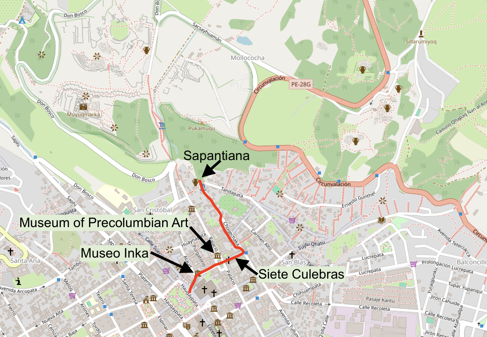
Follow the arrow up the left side of the cathedral to walk up to the Huaca Sapantiana.
Start in Haukaypata and walk up the narrow street on the left of the cathedral (above). It’ll take you to the Plaza Tricentenario, which has a great view of Haukaypata. Go by the door of the Museo Inka, which has the best collection of Inca artifacts in Cusco but not the best explanations of what you’re looking at.
Photogenic Cusco
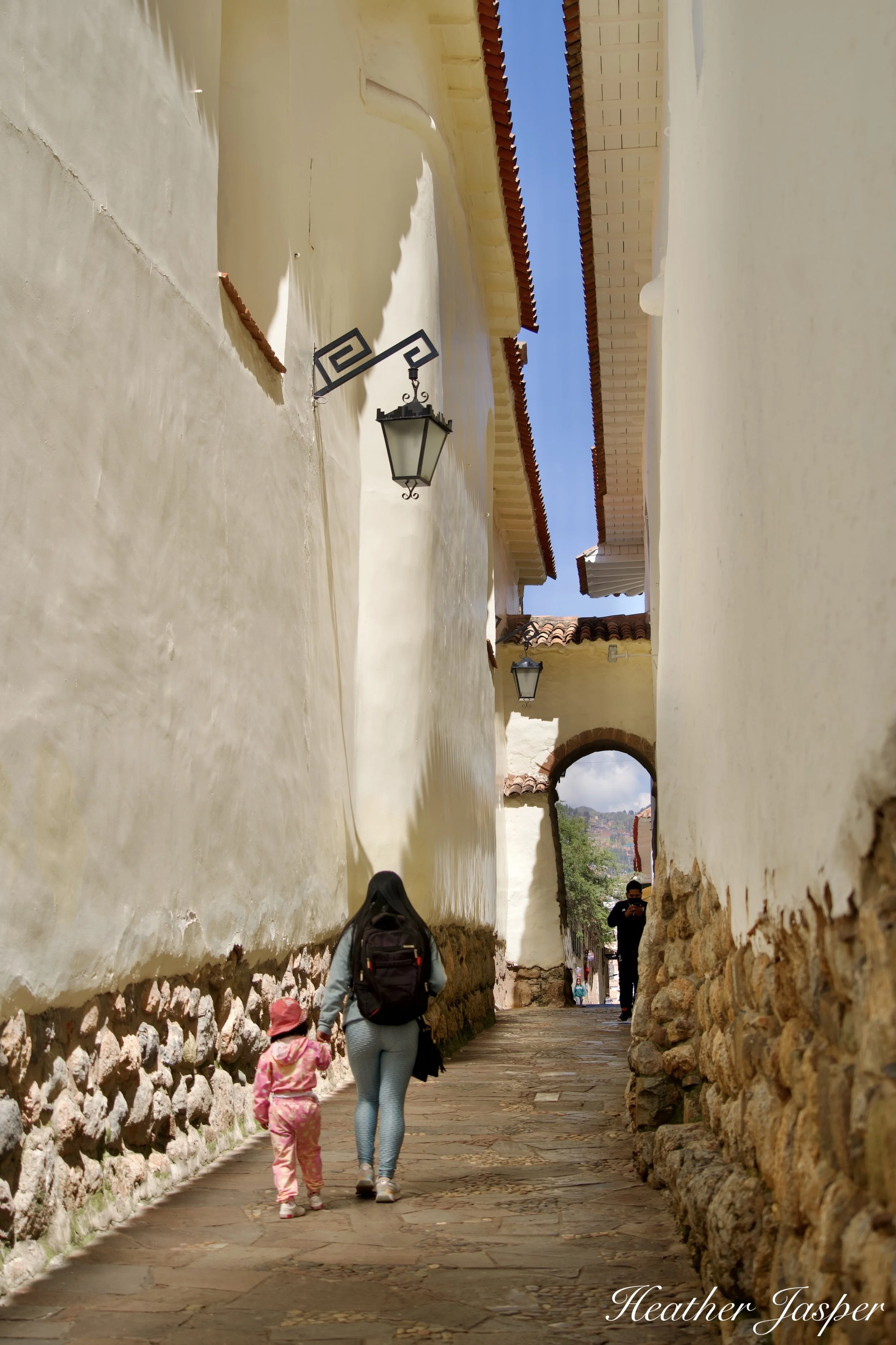
Siete Culebras not only has seven snakes carved into an original Inca section of the wall (just on the other side of the arch), it’s also one of the most photogenic passages in Cusco. The oldest parts of the city were built centuries before cars were invented and were designed for pedestrians and llamas.
Keep going up to Plaza Nazarenas, which has my favorite museum, the Museum of Pre-Columbian Art. Go across the plaza and through the narrow Siete Culebras – see if you can spot all seven snakes carved into the stones of this Inca wall. On the other side of Siete Culebras you’re in Calle Choquechaka.
Go left, uphill to the top of Choquechaka. If you get tired along the way, stop in Inkari Centro Cultural for a cup of coffee or tea. This is my favorite bookshop in Cusco and they have books in English about Cusco and Inca culture.
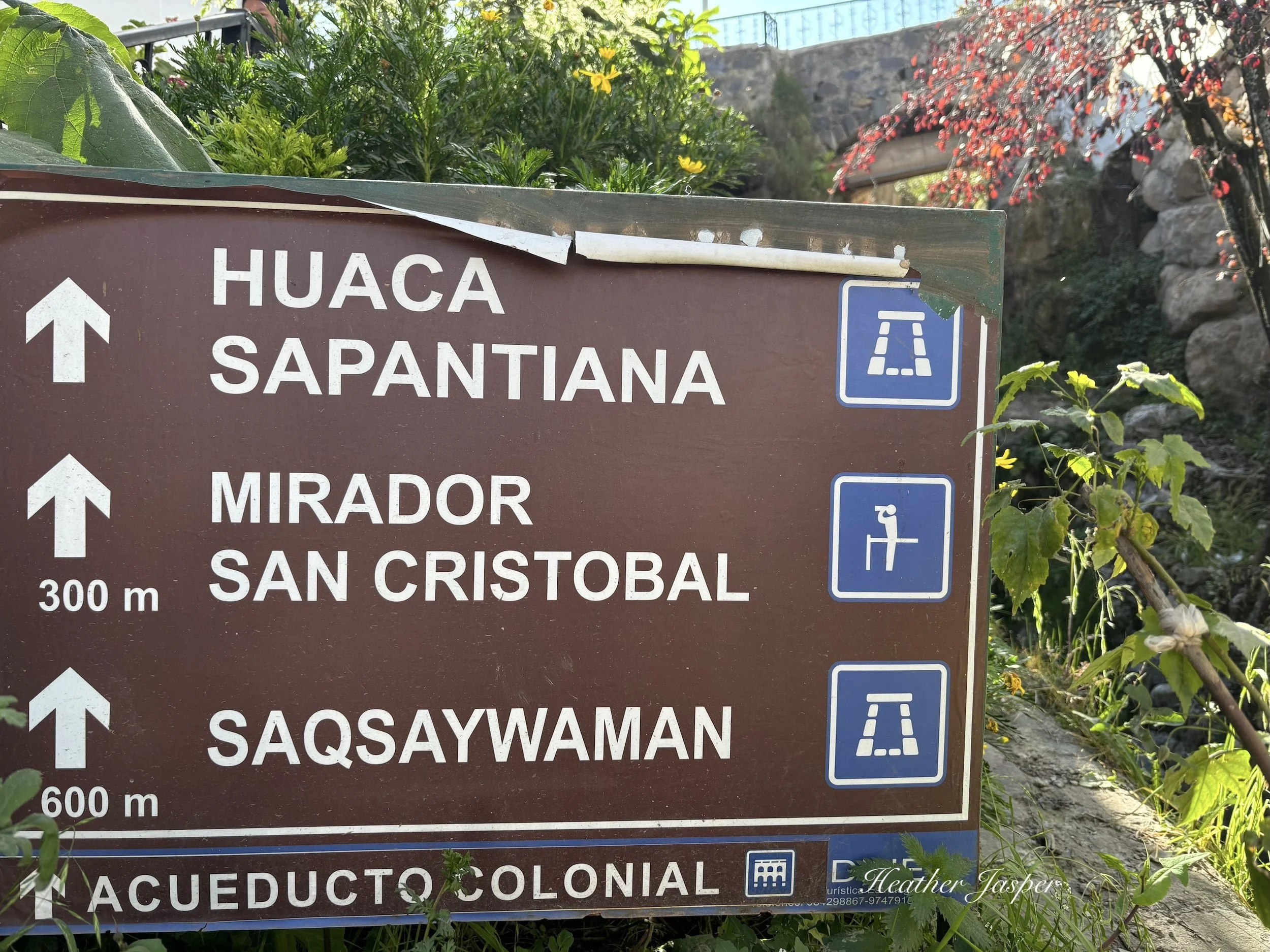
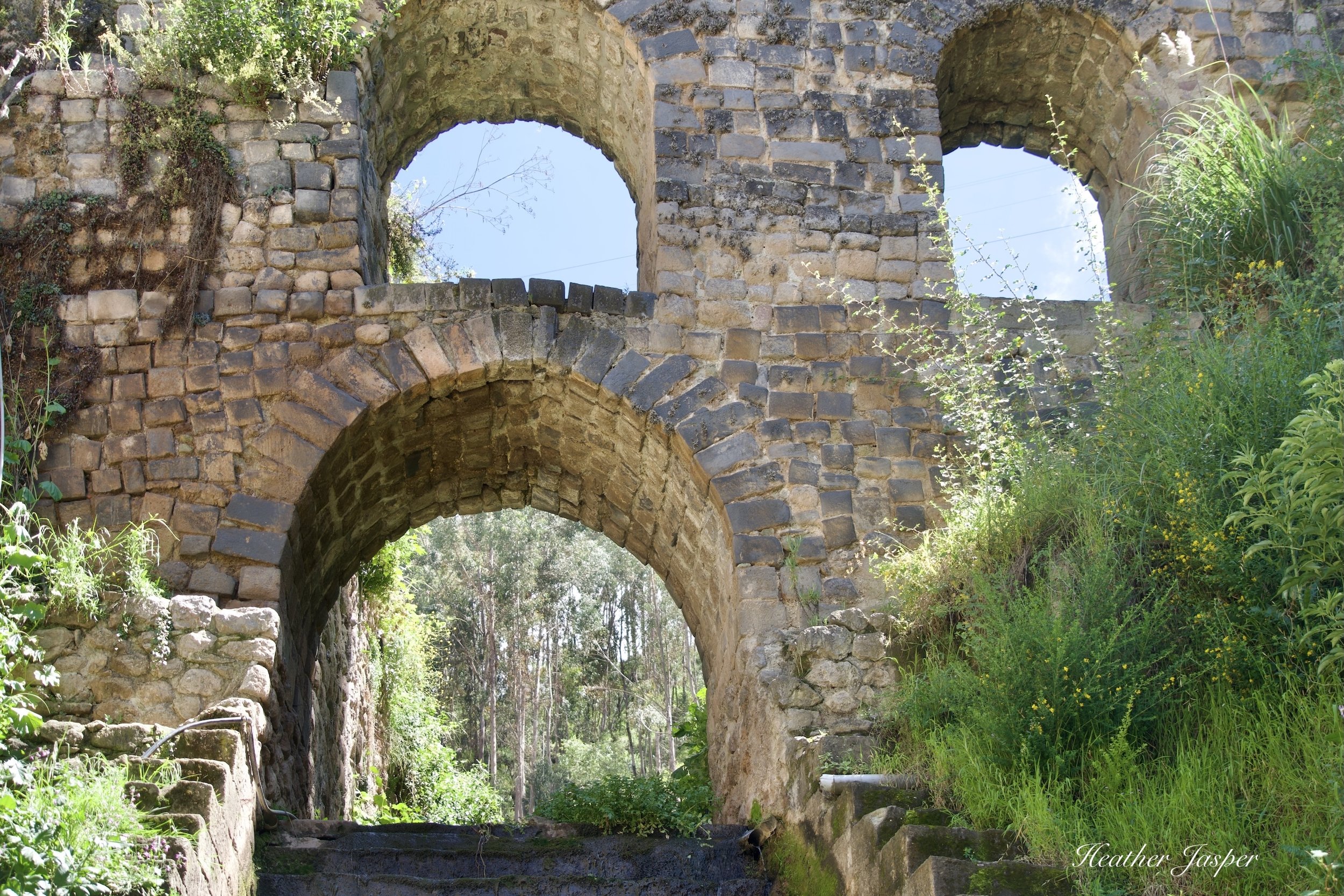
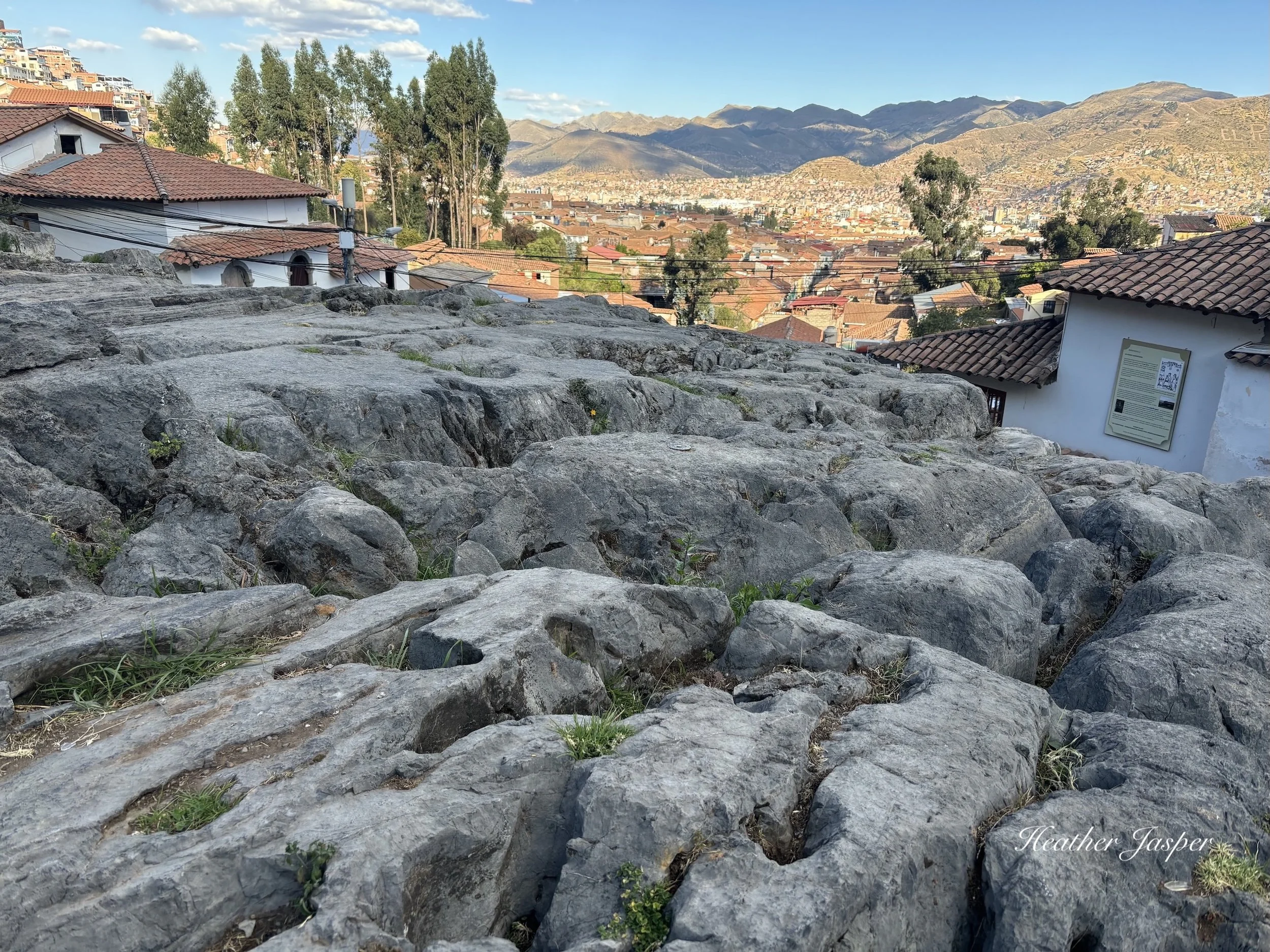
Once you make it to the top of Choquechaka, and climb the stairs, you’ll see a big piece of limestone bedrock, with weathered carvings all over it. This is the Huaca Sapantiana. A huaca is a sacred site, usually something natural like bedrock, but often with carvings all over it. Climb up the stairs on the left to the top of the huaca where there’s a sign with information about the huaca. You can also walk up the canal that’s on the right side of the huaca to a beautiful Spanish aqueduct called, of course, the Acueducto Sapantiana.
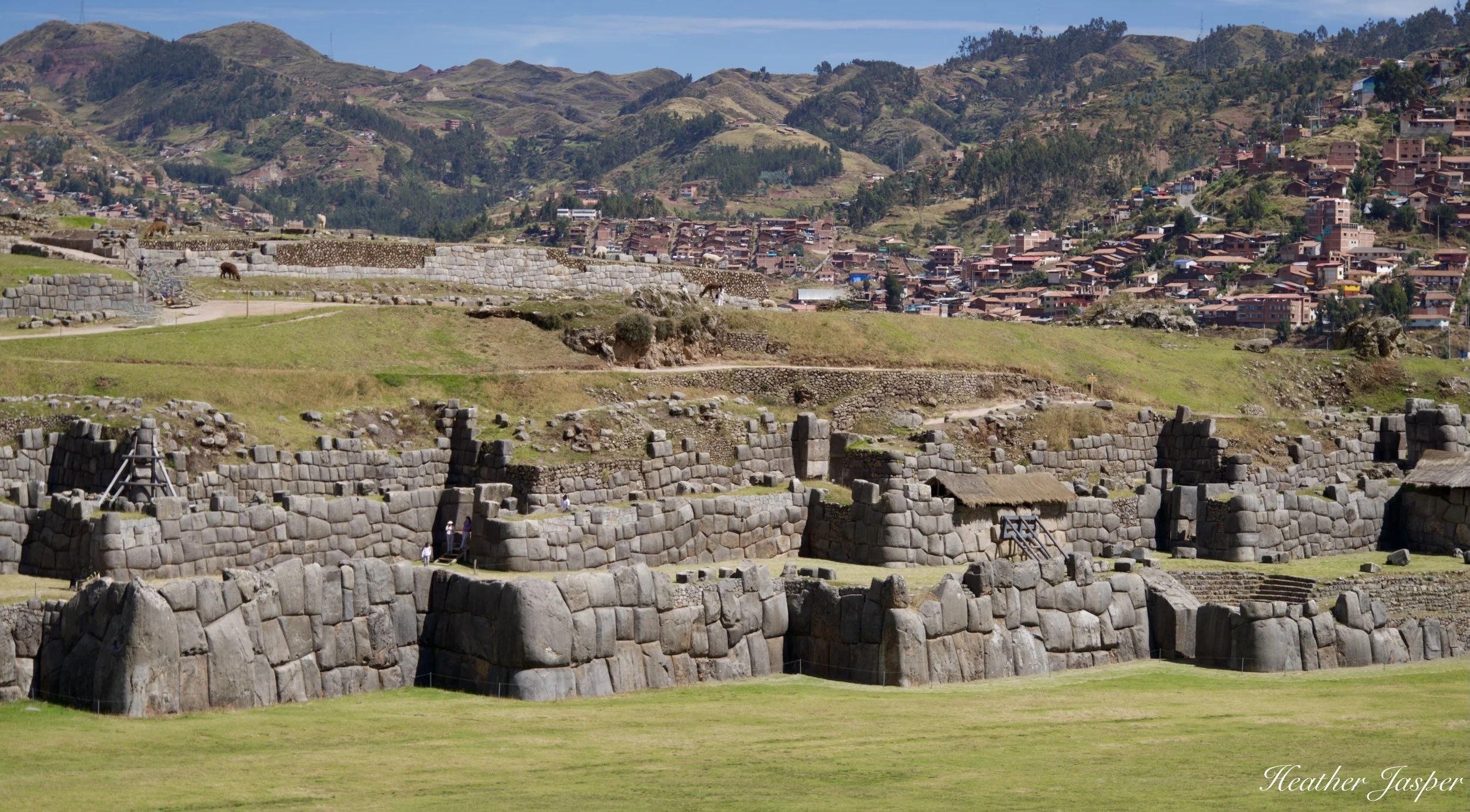
Whether you walk or drive, you must visit the Sacsayhuamán archeological site when you’re in Cusco.
Sacsayhuamán
From Sapantiana 30-45 min up, 640m/0.4mi
If you’ve made it to Sapantiana and want more of a hike, head up the flower-covered stairs called Siete Borreguitos (seven lambs) and turn right at the top to go up the stairs to Sacsayhuamán. There’s plenty to see on the way up, so don’t hurry, even if you’re already acclimatized to the altitude. Guides are available at the entrance and if you don’t have a ticket you can buy one here. First, read my blog about the different options for the Cusco Tourist Ticket, the Boleto Turístico del Cusco.
You can see there are roads to Sacsayhuamán on both sides, but the scenic route is to walk up from the plaza.
Plan at least two hours to walk around Sacsayhuamán if you want to see it all. Guides hang out by the entrance but always interview a guide before hiring them and make sure their guiding license looks real. Fake guides not only tend to make up random stuff about the Inca, their language skills are often lacking. Download my app Peru’s Best for recommended guides in Cusco.
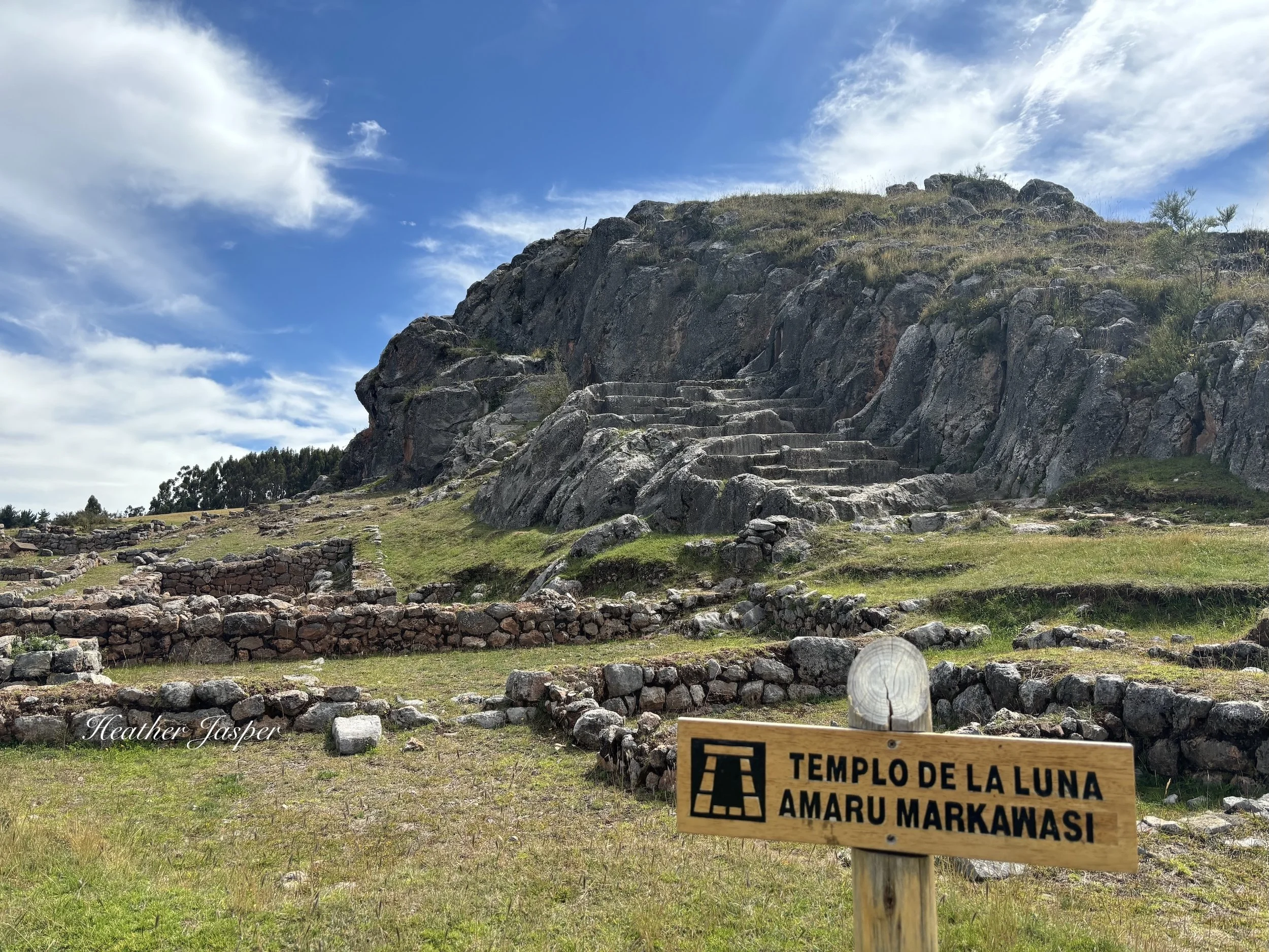
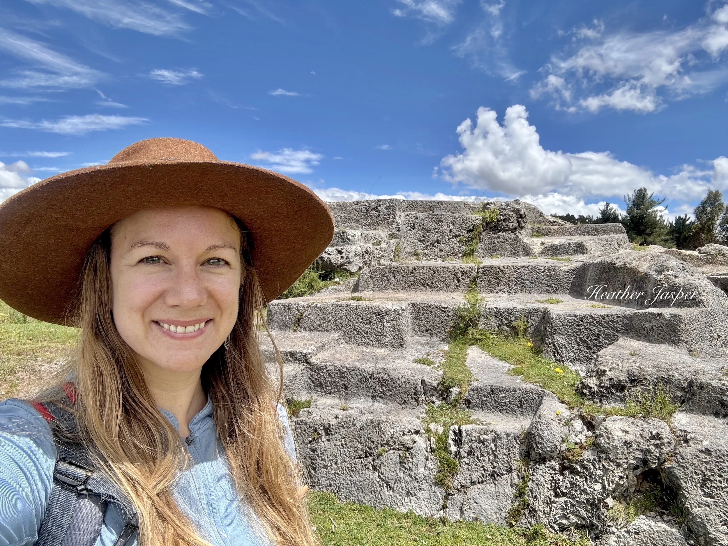
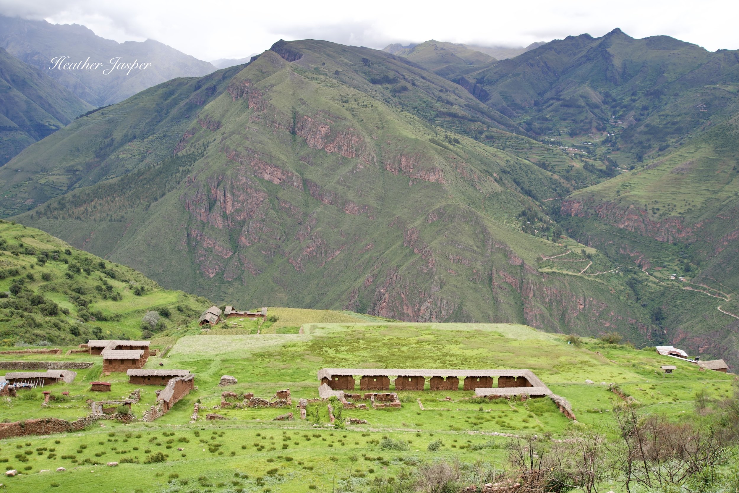
The Temple of the Moon is pre-Inca but certainly used by the Inca for ceremonies and rituals.
Temple of the Moon
From Haukaypata 1-2 hours up, 30min-1 hour down, 2.2km/1.4mi each way
This hike is by far my favorite of all the hikes in Cusco. Start in Haukaypata and walk up the right side of the cathedral, on the road that leads to Antisuyu. Look for signs about Antisuyu on the walls and brass arrows underfoot that point the way.
From Haukaypata, walk up Calle Triunfo to Hatunrumiyoc, the famous 12-angle stone. At the end of the Hatunrumiyoc passage, you’re at the bottom of Choquechaka and the Cuesta de San Blas. Go up the Cuesta de San Blas till you get to the Iglesia and Plazoleta San Blas. Pause here if you need to catch your breath. Xapiri Ground is an art gallery on the plazoleta with excellent coffee, tea and hot chocolate.
If you just keep walking, you can do this in under an hour. I recommend planning two hours to stop along the way and enjoy everything.
Keep going up from San Blas, up Calle Suytuccato, which is spelled at least four ways – all correct. You’ll get to a dry fountain and on the wall is a map of Tahuantinsuyu and the Qhapaq Ñan. The flat street in front of you is Jardines del Inka, but you’re going up the trail on the left side of the road. In another ten to fifteen minutes, you’ll cross a major road. Be careful here because pedestrians do not have the right of way in Peru. Do not expect vehicles to stop for you.
Once you cross the road, there’s a very steep street that heads uphill. Go as far as the bridge on the right, next to a row of cypress trees, about 140m/460ft. Cross the bridge, pass the trees and then you’re back on the Qhapaq Ñan.
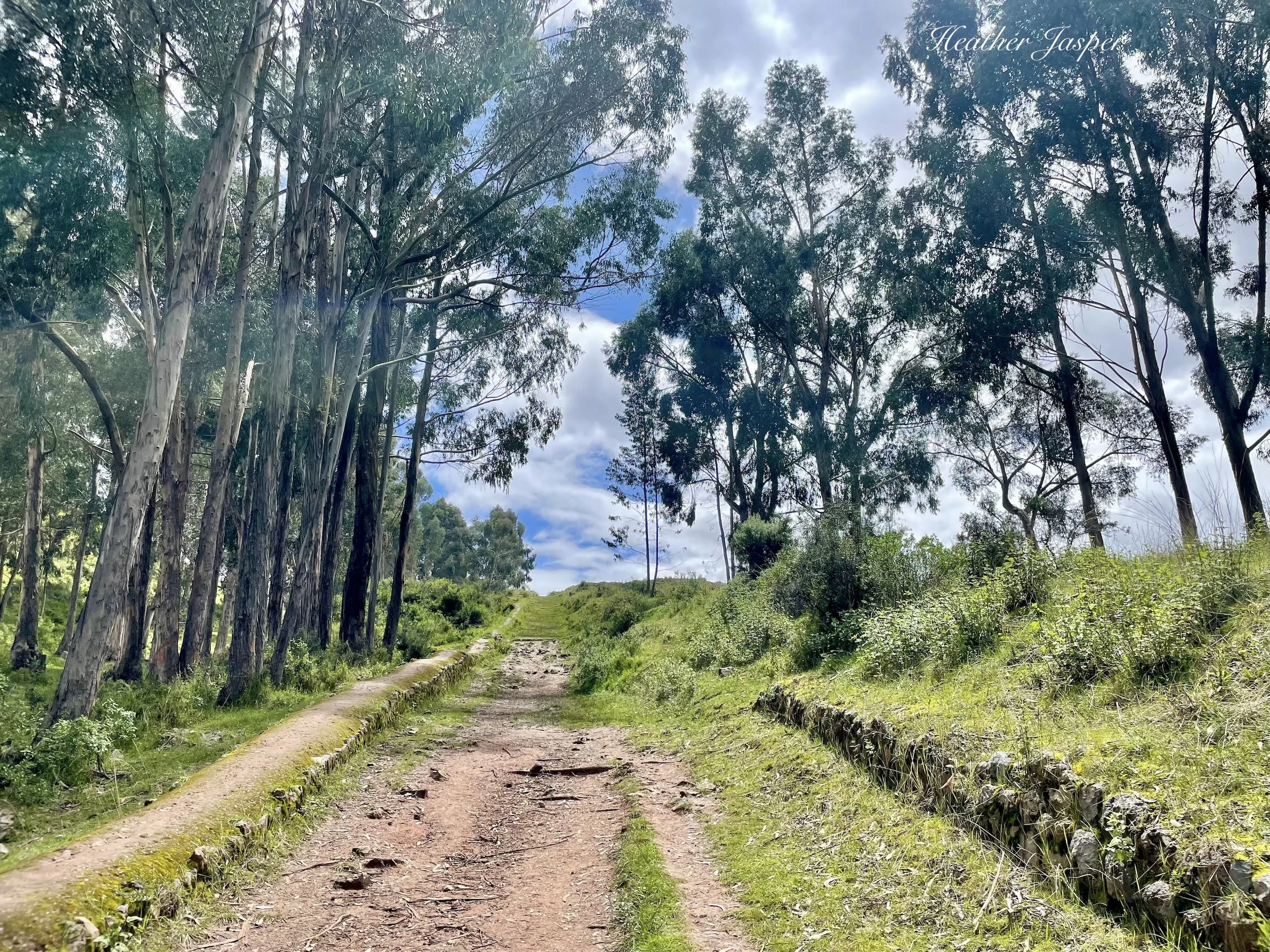
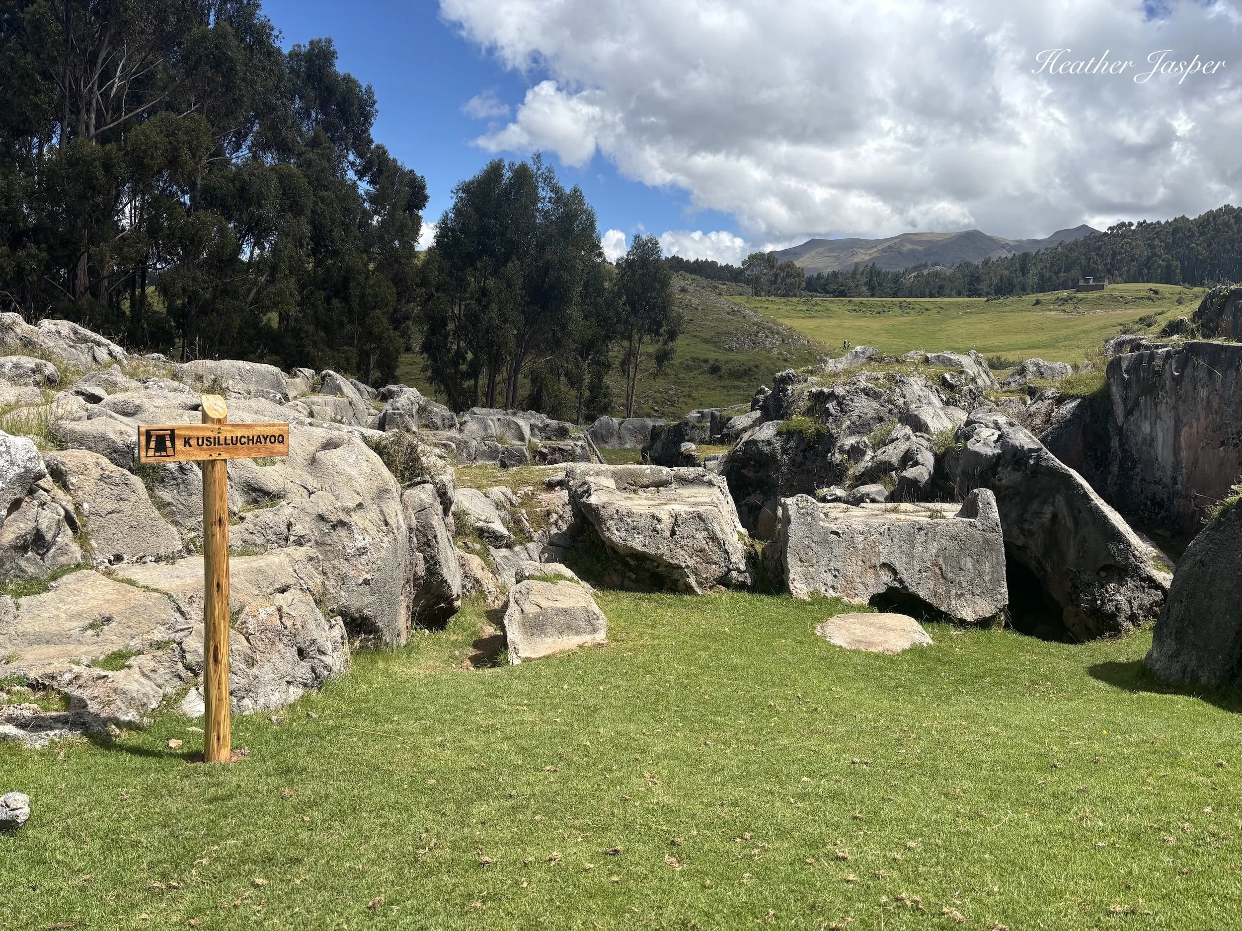
Once you get up past the groves of eucalyptus, you’ll see the Monkey Temple.
The most convincing story I’ve heard about the name is that parents used to yell at their kids from jumping around on the rocks here, telling them to stop acting like monkeys. When you’re there, you’ll see how tempting that would be. There are no carvings of monkeys but there is the remains of what was probably a feline and there is a rock either carved like a heart, or naturally heart-shaped – the heart organ, not the card suit.
Pass the Monkey Temple and you can already see the Temple of the Moon up ahead. Read my blog about the Temple of the Moon to learn why I love this place so much.
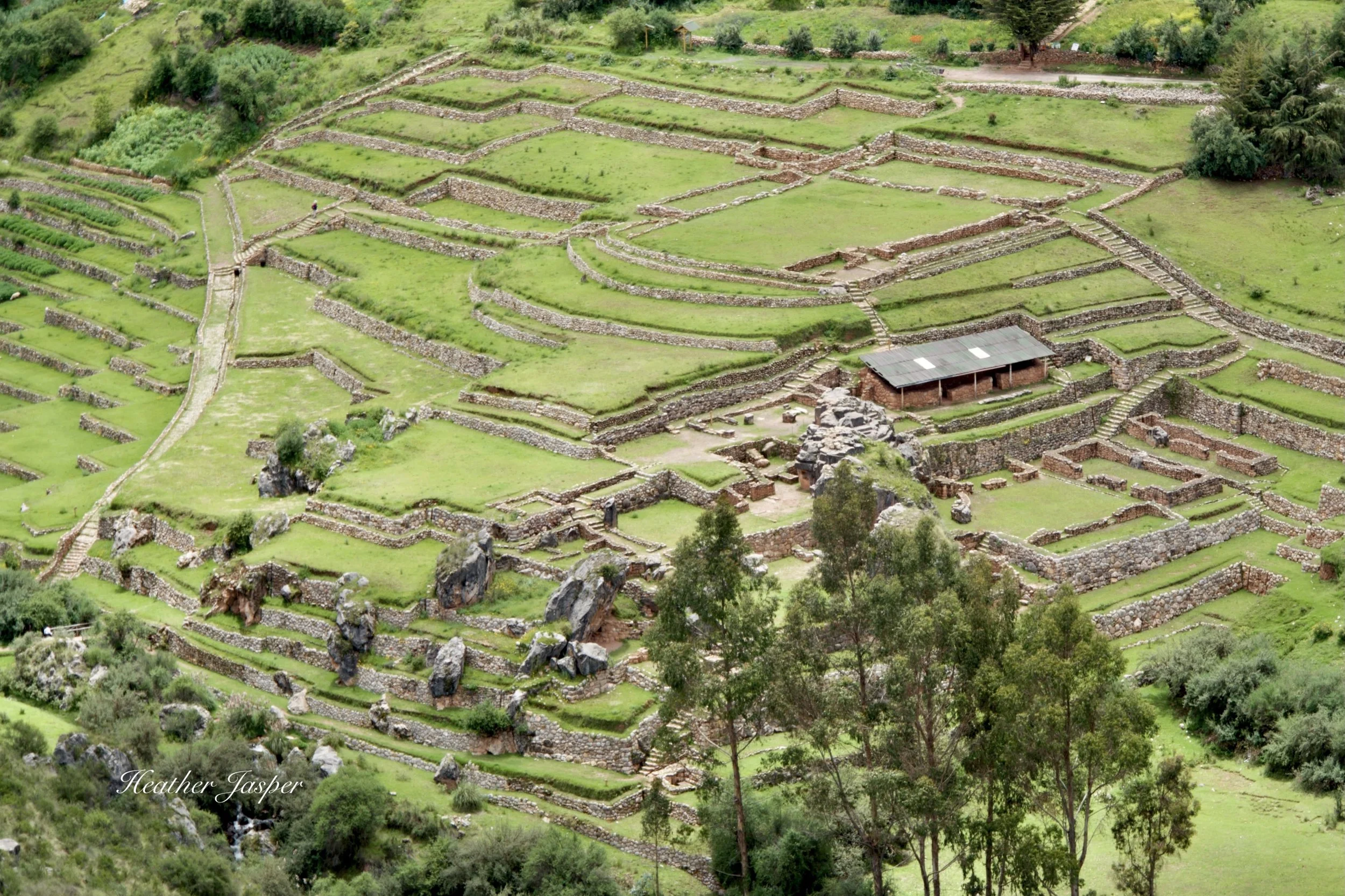
This is your view of Inkilltambo from the trail above, before you go down through the eucalyptus groves.
Inkilltambo (from above)
From Haukaypata 2 hours, 3.6km/2.2 miles
If you make it to the Temple of the Moon and want more, keep going to Inkilltambo. This is the most complete Inca city that’s near Cusco and free to visit. I started coming here for afternoon picnics in 2020 when restaurants were closed and there was almost nowhere else to go.
From the Temple of the Moon, go down to the stream below, where there’s carved boulders that clearly had some ceremonial purpose in centuries past. Today, they’re often used for picnics and afternoon drinking.
From there, two trails head uphill, take the lower one for Inkilltambo. The higher one goes to the bouldering area Los Techos, which is where you should go if you want to meet Cusco’s rock climbing community.
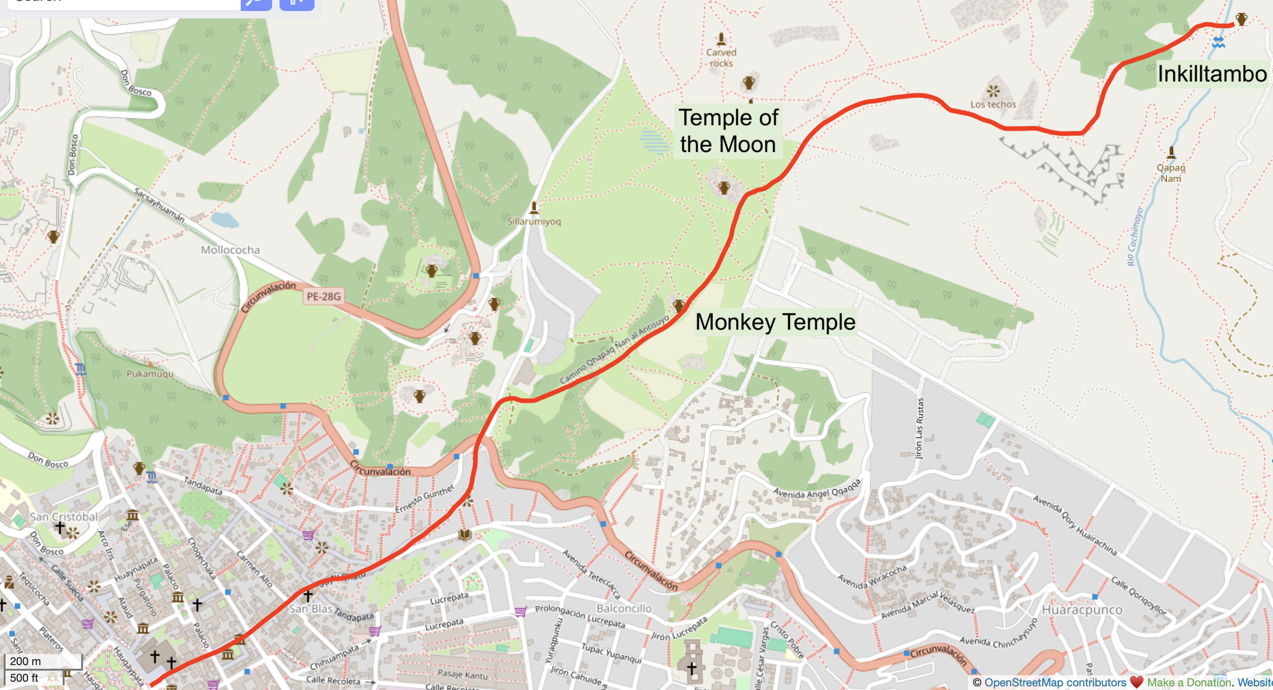
You can hike down the way you came up, or you can take a bus or taxi down - keep reading for the bus info!
The trail skirts an area of steep rocks, where you have an excellent view south from Cusco to Mt Ausangate, a sacred mountain called an apu. Read about my four-day trek around Ausangate here.
Past the area with steep rocky cliffs on your right, you’ll see Inkilltambo below you and another eucalyptus forest sloping down towards it. There are dozens of trails down through that forest because people graze herds of sheep here and the sheep make trails every which way. Some are more of a scramble than others, but I suggest either the trails on the near side of the forest, or keep going to the other side of the forest because right in the middle is another rocky area with some steep drop offs.
To read more about Inkilltambo and why I love it so much, read my Inkilltambo blog.
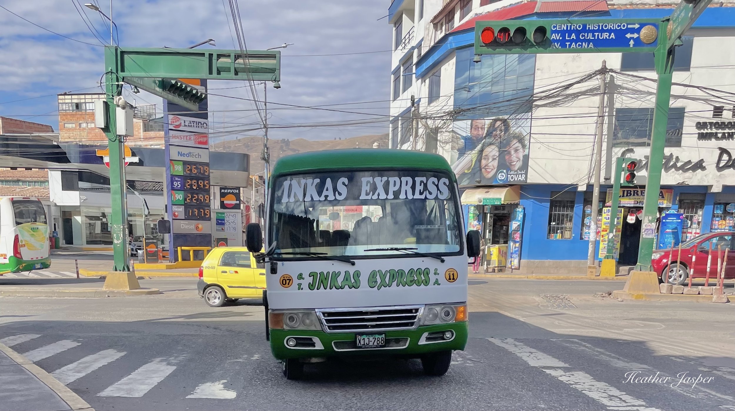
You can catch the bus along Avenida de la Cultura, but make sure you’re going uphill. Ask if they’re going to Inkilltambo to be sure.
Day hikes that include a bus or taxi
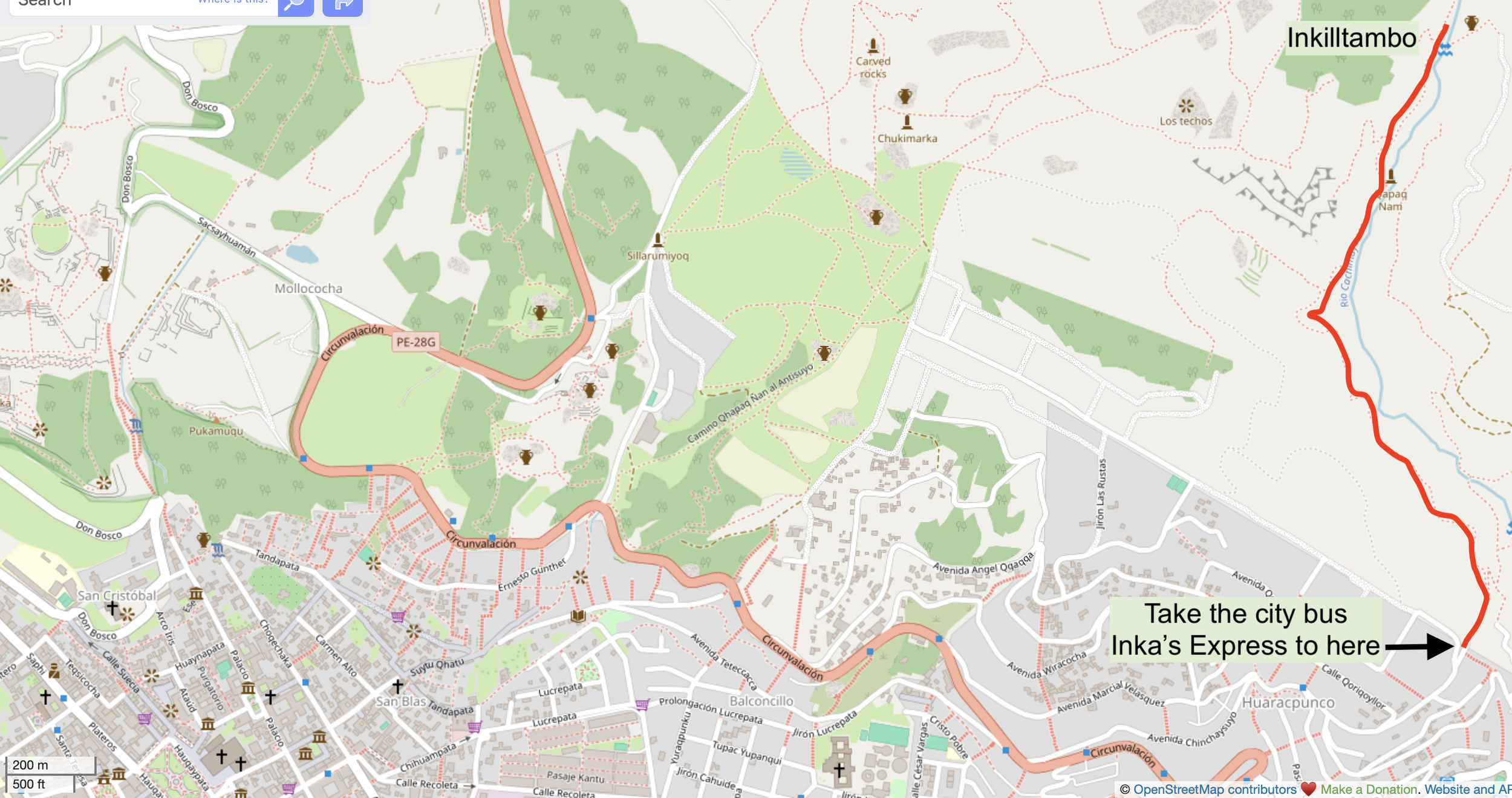
The Inkas Express bus drivers are used to dropping people off at the trailhead. Just tell them you’re going to Inkilltambo.
Inkilltambo (from below)
From the trailhead up to Inkilltambo 45 min, 2km/1.2mi
You can take a taxi to the other trailhead for Inkilltambo or take the city bus Inkas Express. Hike up the trail, which isn’t as steep as the other route. This is my favorite way of leaving Inkilltambo, rather than hiking back up to the Temple of the Moon and down to San Blas again.
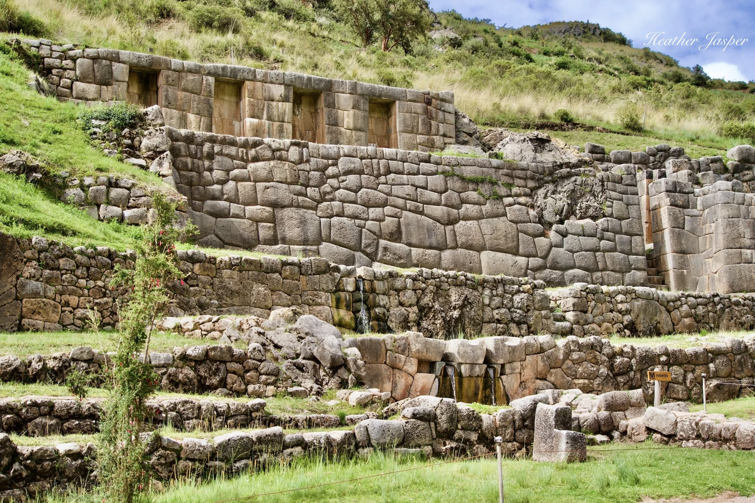
Tambomachay is a sprawling place with lots of fountains, used by the Inca for ceremonies and rituals.
Tambomachay
To the plaza 3 hours down, 6km/3.7mi
Tambomachay is one of the Inca ruins included on the Boleto Turístico and on most city tours – through it’s not actually in the city. It’s on the road to Pisac and if you want a long hike without any uphill, take the bus to Tambomachay and walk back down to town. It’s a meandering 6km and there’s plenty to see along the way, which is why I recommend planning three hours just for the hike down. After Tambomachay, you’ll pass Puka Pukará, several unnamed Inca and pre-Inca ruins before the Temple of the Moon, then you’ll go by the Monkey Temple and back through San Blas to the plaza aka Haukaypata.
Hike down from Tambomachay
You can hike both up and down, but it’s a long and scenic hike that I think is best done one way, with the other way by the Huerto city bus.
A note on maps: I’m using screenshots of Open Street Maps because they don’t get mad at bloggers like Google Maps does.
Three trails lead down to Huchuy Qosqo, and a fourth leads from Huchuy Qosqo down to Lamay in the Sacred Valley.
Huchuy Qosqo
Time and distance depends on which of the four trails you do.
This is the longest day hike and the farthest one from Cusco, but I’ve done it three times and will definitely go back. Each time, I’ve done a different trail and the only trail left that I haven’t hiked yet is the longest – from Tambomachay all the way to Huchuy Qosqo.
Read my Huchuy Qosqo trails blog to choose the trail that’s best for you. Except for the one from Tambomachay, they all involve a taxi or bus to somewhere outside the city of Cusco: Chinchero or the Sacred Valley.